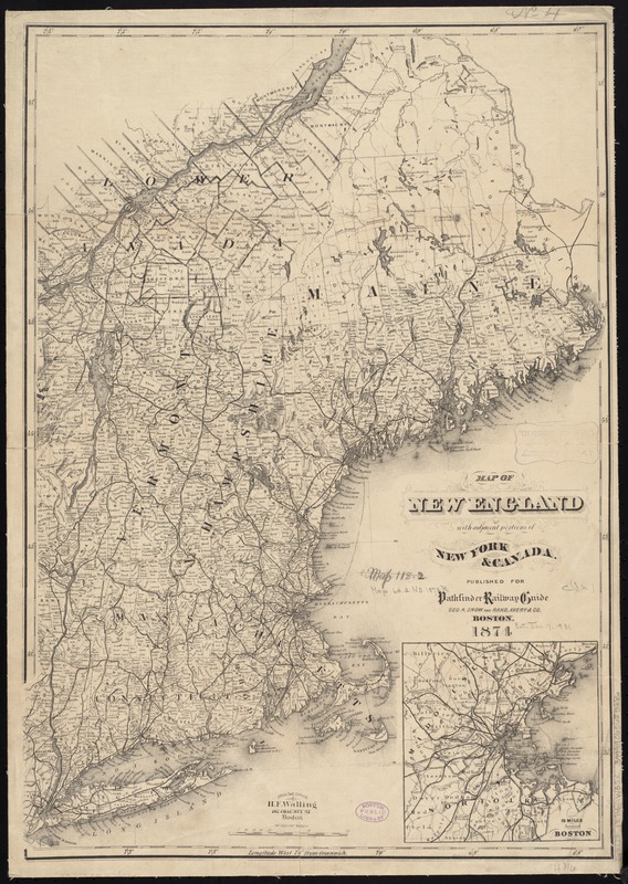
Map of New England with adjacent portions of New York & Canada
Item Information
- Title:
- Map of New England with adjacent portions of New York & Canada
- Creator:
- Walling, Henry Francis, 1825-1888
- Name on Item:
-
from the office of H. F. Walling.
- Date:
-
1874
- Format:
-
Maps/Atlases
- Location:
-
Boston Public Library
Norman B. Leventhal Map & Education Center - Collection (local):
-
Norman B. Leventhal Map & Education Center Collection
- Subjects:
-
Railroads--New England--Maps
New England--Maps
- Places:
-
New England (area)
- Extent:
- 1 map ; 54 x 39 cm.
- Terms of Use:
-
No known copyright restrictions.
No known restrictions on use.
- Publisher:
-
Boston :
H.F. Walling
- Scale:
-
Scale [ca. 1:1,537,500]
- Language:
-
English
- Notes:
-
Shows railroads, townships, counties, and populated places.
Relief shown by hachures.
Inset: 15 miles around Boston.
"Published for Pathfinder Railway Guide, Geo. K. Snow and Rand, Avery & Co."
- Identifier:
-
06_01_008658
- Call #:
-
G3720 1874 .W35x
- Barcode:
-
39999065655886


