Toggle navigation
LMEC Home
Exhibitions
Georeferencing
Tools for Teachers
Collections
My Favorites
Sign Up / Log In
Search
Search the map portal
Map Collection
Map Collection
Map Sets
Search
Search
Search for
Search In
All Fields
Creator
Title
Subject
Place
Search All Digital Collections
Advanced Search
494 Results
My Search
Start Over
More Like
commonwealth:z603vv06x
Remove constraint More Like: commonwealth:z603vv06x
Filter your Search
Place
North and Central America
263
United States
190
North America
176
South America
49
Canada
43
New York
34
Suffolk (county)
31
Boston
29
more
Place
»
Topic
North America--Maps--Early works to 1800
180
South America--Maps--Early works to 1800
46
United States--Maps--Early works to 1800
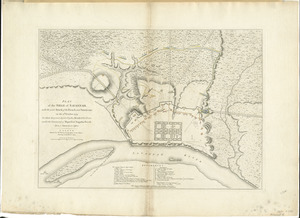
20
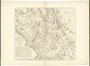
Boston (Mass.)--History--Revolution, 1775-1783--Maps--Early works to 1800
16
Great Britain--Colonies--America--Maps--Early works to 1800
15
Canada--Maps--Early works to 1800
14
New England--Maps--Early works to 1800
11
United States--History--French and Indian War, 1754-1763--Maps--Early works to 1800
11
more
Topic
»
Date
Date range begin
–
Date range end
Current results range from
1528
to
1850
View distribution
Creator
Jefferys, Thomas, -1771
40
Faden, William, 1749-1836
34
Sayer, Robert, 1725-1794
29
Le Rouge, Georges-Louis
24
Des Barres, Joseph F. W. (Joseph Frederick Wallet), 1722-1824
21
Moll, Herman, d. 1732
18
Mitchell, John, 1711-1768
14
Korn, Christoph Heinrich, 1726-1783
11
more
Creator
»
Format
Maps/Atlases
451
Prints
32
Manuscripts
25
Drawings/Illustrations
9
Books
2
Georeferenced
Yes
17
No
477
Collection
American Revolutionary War-Era Maps
392
Richard H. Brown Revolutionary War Map Collection at Mount Vernon
293
Norman B. Leventhal Map Center Collection
150
New York Public Library Collection
32
Mapping Boston Collection
9
Sidney R. Knafel Map Collection at Phillips Academy
8
Boston and New England Maps
6
Maritime Charts and Atlases
4
more
Collection
»
Available to use
Creative Commons license
339
No known restrictions
144
Search Constraints
Sort by date (desc)
relevance
title
date (asc)
date (desc)
Number of results to display per page
100 per page
10
per page
20
per page
50
per page
100
per page
View results as:
grid view
map view
Search Results
1.
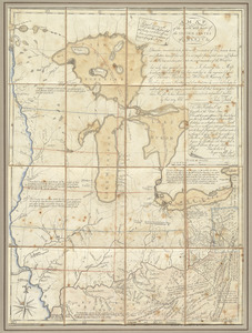
Copy of a map presented to the Congres [sic]
2.
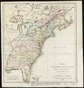
North America
3.
British colonies in North America : drawn from the best authorities
4.
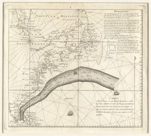
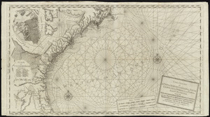
[Chart of the Gulf Stream]
5.
North America, drawn from the best authorities
6.
South America
7.
Mapa geográfico de la mayor parte de la América Meridional que contiene los paises por donde debe trazarse la línia...
8.
South America
9.
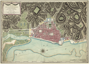
To the citizens of Philadelphia this plan of the city and its environs : is respectfully dedicated by the editors
10.
Map of the northern, or, New England states of America, comprehending Vermont, New Hampshire, District of Main, Massachusetts,...
11.
Map of the northern, or, New England states of America, comprehending Vermont, New Hampshire, District of Main, Massachusetts,...
12.
A New and correct map of the British colonies in North America comprehending eastern Canada with the province of Quebec, New...
13.
A New map of North America with the West India Islands : divided according to the preliminary articles of peace, signed at...
14.
A new map of the United States of North America with the British dominions on that continent &c
15.
Carte d'un partie de l'Amerique Septentrionale : ou est tracée notre route d'Halifax à New York, par Quebec, Montreal, le Lac...
16.
Amerique septentrionale divisée en ses principales parties
17.
LʼAmérique Septentrionale et Méridionale divisée suivant ses différens pays
18.
Plan of the city of Washington in the territory of Columbia, ceded by the states of Virginia and Maryland to the United States...
19.
A map of the northern and middle states : comprehending the western territory & the British dominions in North America : from...
20.
North America
21.
L'Amerique divisée en ses principaux États
22.
Generalkarte von Nord America samt den Westindischen inseln
23.
Action at Spencer's ordinary : June 26th. 1781
24.
Affair at Quintin's Bridge : 18th March 1778
25.
Ambuscade of the Indians at Kingsbridge : August 31st. 1778
26.
The landing at Burrell's, April 17th. 1781
27.
March of the Queens Rangers : Emmericks Corps, the Cavalry of the Legion under Lt. Col. Tarleton, and a detachment of the...
28.
New & accurate map of North America : with the new discovered islands on the north east coast of Asia
29.
North America drawn from the latest and best authorities
30.
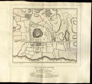
Plan of Oyster Bay, as fortified by the Queen's Rangers
31.
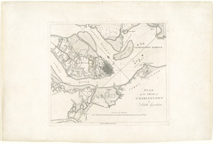
Plan of the siege of Charlestown in South Carolina
32.
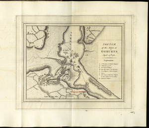
Sketch of the action at Osburns, April 27th. 1781
33.
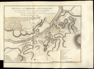
Sketch of the skirmish at Petersburg, between the Royal Army under the command of Major Genl. Phillips, and the American Army...
34.
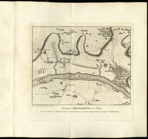
Skirmish at Richmond Jan. 5th. 1781
35.
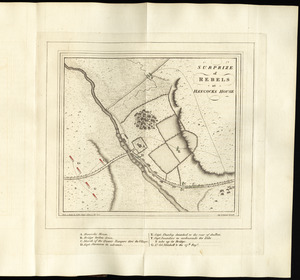
Surprize of rebels at Hancock's House
36.
Amérique Septentrionale dressée sur les relations les plus modernes des voyageurs et navigateurs, ou se remarquent les Etats...
37.
Plan de la ville du Cap Francois et de ses environs dans l'Isle St. Domingue
38.
America settentrionale divisa ne' suoi principali stati
39.
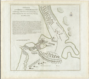
Attack of the rebels upon Fort Penobscot in the province of New England in which their fleet was totally destroyed and their...
40.
Bowles's new and accurate map of Europe, divided into it's [sic] empires, kingdoms, states, republicks and principalities :...
41.
A map of the north west parts of the United States of America
42.
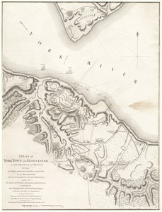
A plan of York Town and Gloucester, in the province of Virginia, shewing the works constructed for the defence of those posts...
43.
Remarques sur la navigation de terre-neuve à New-York afin d'eviter les courrants et les bas-fonds au sud de Nantuckett et du...
44.
Bowles's new and accurate map of North America and the West Indies : exhibiting the extent and boundaries of the United States,...
45.
Carte des Etats-Unis de l'Amerique suivant le Traité de Paix de 1783
46.
The coast of a part of New England, New York, New Jersey, Pensilvania, Maryland, Virginia, and part of North Carolina &c. with...
47.
The coast of a part of North Carolina, South Carolina, Georgia and part of East Florida, with the bays, soundings, banks, roks,...
48.
A map of the United States of N. America
49.
A new and correct chart of the coast of East Florida, and part of West Florida and Gulf of Mexico, Gulf of Florida or Cannel of...
50.
A new and correct map of North America, with the West India Islands : divided according to the last Treaty of Peace, concluded...
51.
A new and correct map of North America, with the West India Islands : divided according to the last Treaty of Peace, concluded...
52.
A new chart of the coast of New England, Nova Scotia, and the islands of St. John, Cape Breton, Sable, the banks of St. Peters,...
53.
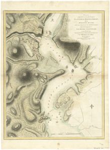
Plan of the attack of the Forts Clinton & Montgomery, upon Hudsons River which were stormed by His Majestys forces under the...
54.
Plan of the siege of Savannah : with the joint attack of the French and Americans on the 9th October 1779 : in which they were...
55.
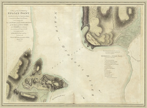
A plan of the surprise of Stoney Point, by a detachment of the American army commanded by Brigr. Genl. Wayne, on the 15th July...
56.
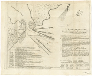
A representation, of the sea fight, on the 5th of Sepr. 1781, between Rear Admiral Graves and the Count de Grasse
57.
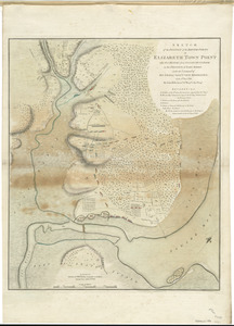
Sketch of the position of the British forces at Elizabeth Town Point after their return from Connecticut Farm, in the province...
58.
Sketch of the surprise of German Town by the American forces commanded by General Washington October 4th 1777
59.
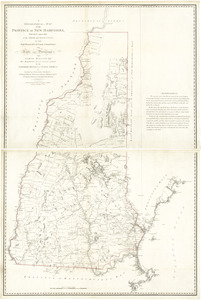
A topographical map of the Province of New Hampshire
60.
Amerique Septentrionale divisée en ses principales parties, ou sont distingués les vns des autres les estats suivant qu'il...
61.
L'Amerique Septentrionale, ou se remarquent les Etats Unis
62.
BOWLES'S NEW POCKET MAP OF THE UNITED STATES OF AMERICA : WITH THE BRITISH POSSESSIONS OF CANADA, NOVA SCOTIA, AND OF...
63.
Carte des Etats-Unis d'Amérique, et du cours du Mississippi : rédigée d'après différentes cartes et relations Anglaises et...
64.
Carte generale des colonies angloises dans l'Amerique Septentrionale pour l'intelligence de la guerre presente : d'apres des...
65.
Chart of the Banks of Newfoundland, drawn from a great number of hydrographical surveys, these charts are followed, according...
66.
The coast of New Schotland, New England, the gulph and river of St. Laurence : the islands of New Foundland, Cape Breton, St....
67.
A new and correct map of North America, with the West India islands, divided according to the preliminary articles of peace,...
68.
A New map of North America with the West India Islands : divided according to the preliminary articles of peace, signed at...
69.
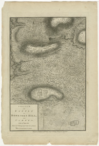
Sketch of the battle of Hobkirks Hill, near Camden, on the 25th April 1781
70.
The United States of America laid down from the best authorities, agreeable to the Peace of 1783
71.
The United States of America with the British possessions of Canada, Nova Scotia, & of Newfoundland, divided with the French :...
72.
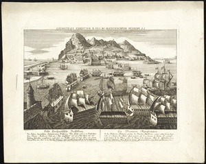
Abriss der stadt Gibraltar und der darinn befindlichen festen platze, nebst dem meerbusen von Algesiras
73.
Carte de l'Amérique septentrionale, depuis la baye d'Hudson jusqu'au Mississipi : pour servir aux essais historiques et...
74.
Carte du theatre de la guerre presente en Amerique
75.
Carte generale des treize Etats Unis, de l'Amerique septentrionale = Kaart van de dertien Verénigde Staaten, in Noord Amerika
76.
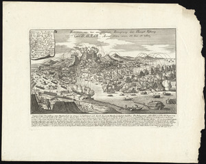
Plan de Gibraltar
77.
Plan de la position de l'armée française au tour de Newport dans Rhode Island et du mouillage de l'escadre dans la rade de...
78.
Plan de la ville et des forts de Gibraltar, avec la Baye d'Algesiras
79.
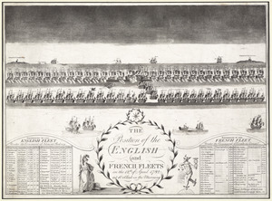
The position of the English and French fleets on the 12th of April 1782 at 10 oclock in the morning
80.
La premiere representation de les X batteries flottantes
81.
Prospect von Gibraltar mit seinen werken, umliegenden gegenden und iezigen neuern belagerungs anstalten : gezeichnet vor...
82.
Province de New-Jersey divisée en est et ouest nomée vulgairement les Jerseys
83.
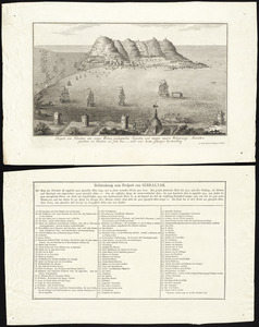
Relation von der vergeblichen belagrung der haupt vestung Gibraltar : anno 1782 von 13 bis 17 sbre
84.
Suite du theatre de la guerre dans l'Amérique Septentrionale y compris le Golfe du Méxique
85.
To His Excellency Genl. Washington, Commander in Chief of the armies of the United States of America : this plan of the...
86.
Carte de la partie de la Virginie ou l'armée combinée de France & des États-Unis de l'Amérique a fait prisonnière l'armée...
87.
Carte des environs du Fort Pitt et de la nouvelle province Indiana : dediée a M. Franklin
88.
A new map of the British colonies in North America, shewing the seat of the present war, taken from the best surveys, compared...
89.
Partie occidentale de la Virginie, Pensylvanie, Maryland, et Caroline septle. la Rivière d'Ohio, et toutes celles qui s'y...
90.
Plan de l'armée de Cornwallis attaquée et faitte prisoniere dans York Town : le 19 8bre par l'armée combinée Francaise et...
91.
Plan der belagerung der stadt Gibraltar im jahr 1779, 1780, 1781
92.
Plan des environs de New York (manuscrit) - Position du camp de l'armée combinée à Philippsburg du 6 juillet au 19 août -...
93.
Plan des villages de la contrée des Illinois et partie de la Riviere de Mississipi ; plan des Rapides de la Riviere d'Ohio
94.
A plan of the entrance of Chesapeak Bay, with James and York rivers : wherein are shewn the respective positions (in the...
95.
Reddition de l'armée Angloises commandée par Mylord Comte de Cornwallis aux armees combinées des Etats Unis de l'Amerique et...
96.
Sketch of part of the island of Ste. Lucie : computed at about 2500 feet to 1 inch
97.
Théatre de la guerre en Amerique, avec les Isles Antilles : projetté et assujettie aux observations
98.
Amérique septentrionale
99.
Castle William : A view of New Castle with the Fort and light house on the entrance of the Pisquataqua River
100.
Charlestown
‹ Prev
Next ›
1
2
3
4
5
![Copy of a map presented to the Congres [sic]](https://bpldcassets.blob.core.windows.net/derivatives/images/commonwealth:z603vn16x/image_thumbnail_300.jpg)


![[Chart of the Gulf Stream]](https://bpldcassets.blob.core.windows.net/derivatives/images/commonwealth:z603vr47j/image_thumbnail_300.jpg)


![Bowles's new and accurate map of Europe, divided into it's [sic] empires, kingdoms, states, republicks and principalities](https://bpldcassets.blob.core.windows.net/derivatives/images/commonwealth:q524mt678/image_thumbnail_300.jpg)