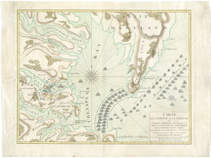
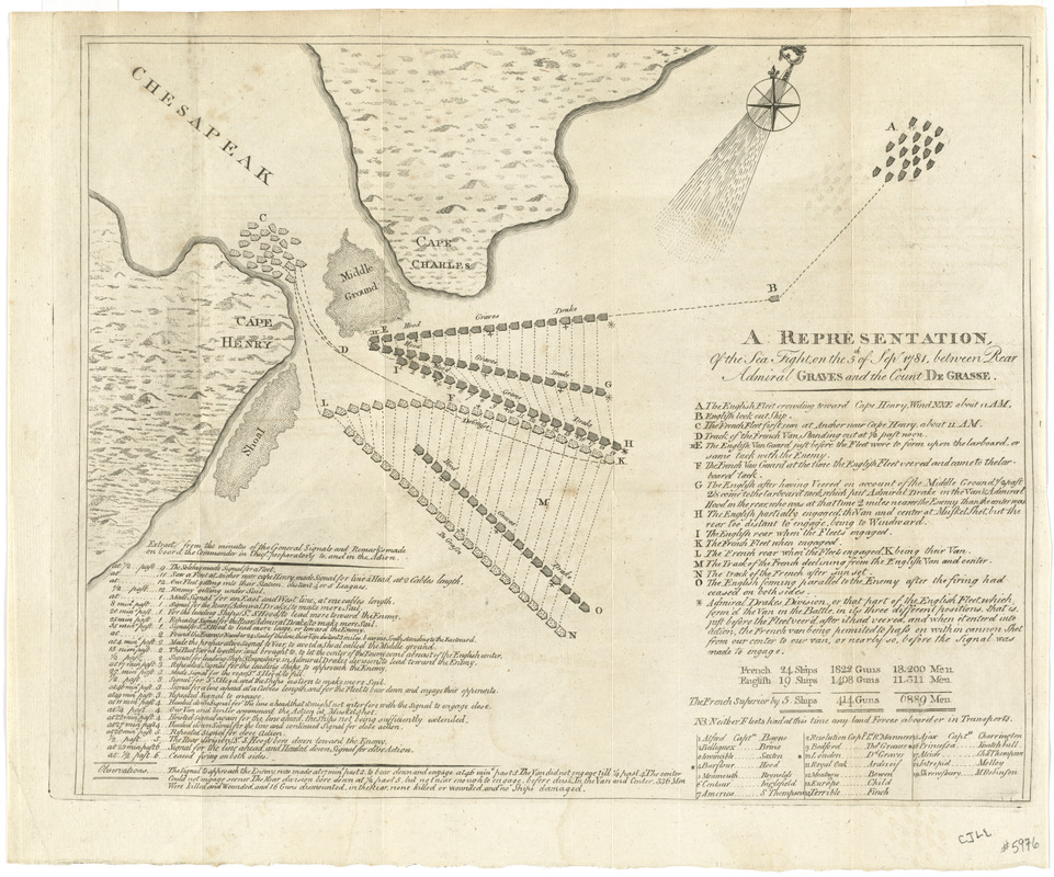
A representation, of the sea fight, on the 5th of Sepr. 1781, between Rear Admiral Graves and the Count de Grasse
This map is also available in American Revolutionary Geographies Online (ARGO), a collections portal especially built for material relating to the American Revolutionary War Era. Visit ARGO to learn more about this item and explore the historical geography of North America in the late eighteenth century.
Item Information
- Title:
- A representation, of the sea fight, on the 5th of Sepr. 1781, between Rear Admiral Graves and the Count de Grasse
- Title (alt.):
-
Political magazine and parliamentary, naval, military, and literary journal
- Creator:
- Grasse, François Joseph Paul de Grasse, comte de, 1722-1788
- Contributor:
- Graves, Thomas Graves, 1725?-1802
- Date:
-
[1784]
- Format:
-
Maps/Atlases
- Location:
- George Washington's Mount Vernon
- Collection (local):
-
Richard H. Brown Revolutionary War Map Collection at Mount Vernon
- Subjects:
-
Yorktown (Va.)--History--Siege, 1781--Maps--Early works to 1800
Chesapeake Bay (Md. and Va.)--History--18th century--Maps--Early works to 1800
- Places:
-
Chesapeake Bay
York (county)Yorktown
- Extent:
- 1 map : 31 x 38 cm.
- Terms of Use:
-
No known copyright restrictions.
This work is licensed for use under a Creative Commons Attribution Non-Commercial Share Alike License (CC BY-NC-SA).

- Publisher:
-
London :
[s.n.]
- Scale:
-
Scale [ca. 1:400,000]
- Language:
-
English
- Catalog Record:
-
MVLA record
- Notes:
-
Shows engagement at entrance to Chesapeake Bay between Capes Henry and Charles.
Includes "extract from the minutes of the general signals," observations, and references.
Table: [Number of ships, guns, and men] -- [English captains and ships].
From "Political magazine" 6 (1784).
- Notes (date):
-
This date is inferred.
- Identifier:
-
06_01_008225