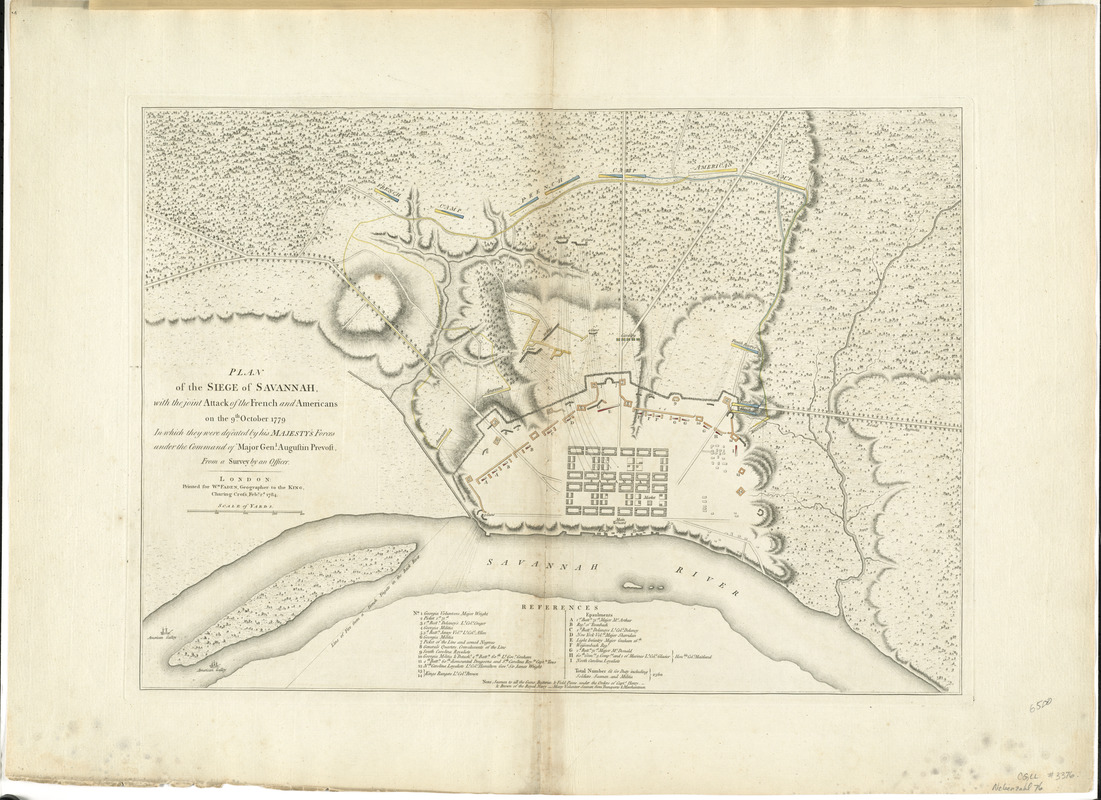
Plan of the siege of Savannah : with the joint attack of the French and Americans on the 9th October 1779 : in which they were defeated by his Majesty's forces under the command of Major Genl. Augustin Prevost, from a survey by an officer
This map is also available in American Revolutionary Geographies Online (ARGO), a collections portal especially built for material relating to the American Revolutionary War Era. Visit ARGO to learn more about this item and explore the historical geography of North America in the late eighteenth century.
Item Information
- Title:
- Plan of the siege of Savannah : with the joint attack of the French and Americans on the 9th October 1779 : in which they were defeated by his Majesty's forces under the command of Major Genl. Augustin Prevost, from a survey by an officer
- Creator:
- Faden, William, 1749-1836
- Date:
-
1784
- Format:
-
Maps/Atlases
- Location:
- George Washington's Mount Vernon
- Collection (local):
-
Richard H. Brown Revolutionary War Map Collection at Mount Vernon
- Subjects:
-
Savannah (Ga.)--History--18th century--Maps--Early works to 1800
- Places:
-
Chatham (county)Savannah
- Extent:
- 1 map : hand col. ; 41 x 58 cm.
- Terms of Use:
-
No known copyright restrictions.
This work is licensed for use under a Creative Commons Attribution Non-Commercial Share Alike License (CC BY-NC-SA).

- Publisher:
-
London :
Printed for Wm. Faden
- Scale:
-
Scale [ca. 1:4,500]
- Language:
-
English
- Catalog Record:
-
MVLA record
- Notes:
-
Oriented with north to the bottom.
Relief shown by hachures.
Includes references to troops.
- Identifier:
-
06_01_008144

![[A map of part of Pennsylvania & Maryland intended to shew, at one view, the several places proposed for opening a communication between the waters of the Delaware & Chesopeak Bays]](https://bpldcassets.blob.core.windows.net/derivatives/images/commonwealth:z603vt12v/image_thumbnail_300.jpg)


