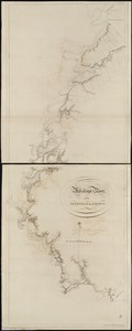
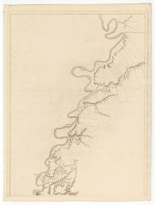
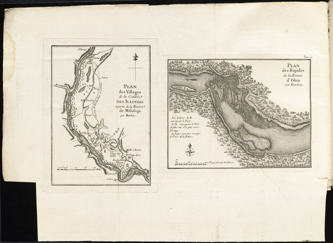
Plan des villages de la contrée des Illinois et partie de la Riviere de Mississipi ; plan des Rapides de la Riviere d'Ohio
This map is also available in American Revolutionary Geographies Online (ARGO), a collections portal especially built for material relating to the American Revolutionary War Era. Visit ARGO to learn more about this item and explore the historical geography of North America in the late eighteenth century.
Item Information
- Title:
- Plan des villages de la contrée des Illinois et partie de la Riviere de Mississipi ; plan des Rapides de la Riviere d'Ohio
- Title (alt.):
-
Plan des Rapides de la Riviere d'Ohio
- Creator:
- Hutchins, Thomas, 1730-1789
- Name on Item:
-
par Hutchins
- Date:
-
[1781]
- Format:
-
Maps/Atlases
- Location:
- George Washington's Mount Vernon
- Collection (local):
-
Richard H. Brown Revolutionary War Map Collection at Mount Vernon
- Subjects:
-
Falls of the Ohio (Ky. and Ind.)--Maps--Early works to 1800
Mississippi River--Maps--Early works to 1800
- Places:
-
Randolph (county)
Monroe (county)
Falls of the Ohio
- Extent:
- 2 maps on 1 sheet ; 18 x 13 cm. and 14 x 19 cm., on sheet 31 x 43 cm.
- Terms of Use:
-
No known copyright restrictions.
This work is licensed for use under a Creative Commons Attribution Non-Commercial Share Alike License (CC BY-NC-SA).

- Publisher:
-
Paris :
Chez Le Rouge
- Scale:
-
Scale [ca. 1:32,000]
Scale [ca. 1:660,000]
- Language:
-
French
- Catalog Record:
-
MVLA record
- Notes:
-
In Description topographique de la Virginie, de la Pensylvanie, du Maryland et de la Caroline Septentrionale (Paris : Le Rouge, 1781); Le Rouge's translation of Hutchin's A topographical description of Virginia, Pennsylvania, Maryland, and North Carolina (London : Hutchins, 1778).
Relief shown by hachures.
In upper right: page 17.
Le Rouge's French translation of Hutchin's maps.
- Notes (date):
-
This date is inferred.
- Notes (citation):
-
Sabin, 34055
- Identifier:
-
06_01_011755
- Barcode:
-
30000004224770