Charlestown
This map is also available in American Revolutionary Geographies Online (ARGO), a collections portal especially built for material relating to the American Revolutionary War Era. Visit ARGO to learn more about this item and explore the historical geography of North America in the late eighteenth century.
Item Information
- Title:
- Charlestown
- Description:
-
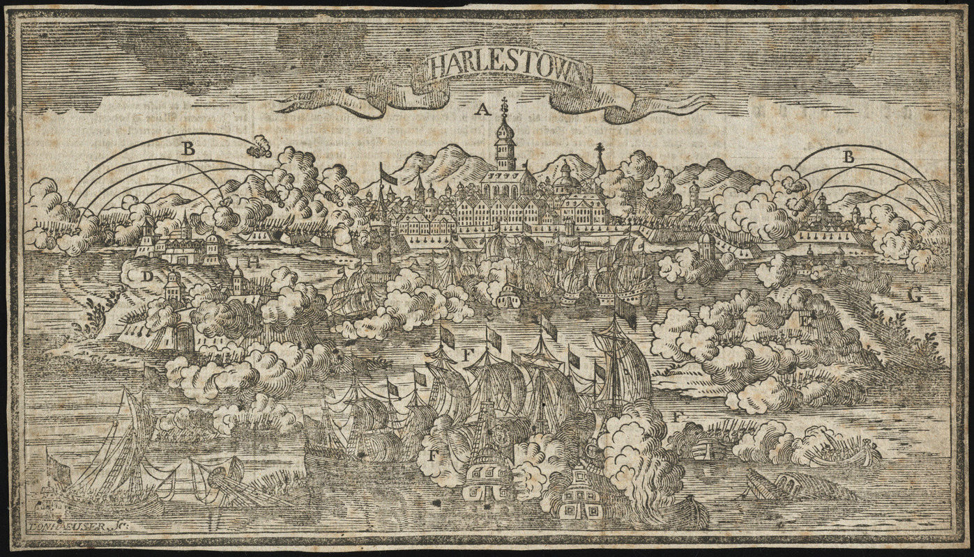
German woodcut of the siege of Charleston, South Carolina in May 1780. The depiction of Charleston is imaginary. Donnhaeuser lacked a view of Charleston so he modified a pre-existing view of an unidentified German city to show the siege.
- Creator:
- Donnhaeuser, Johann David, 1752-1789
- Name on Item:
-
Donhaeuser, sc.
- Date:
-
1780
- Format:
-
Prints
- Genre:
-
Views
- Location:
- George Washington's Mount Vernon
- Collection (local):
-
Richard H. Brown Revolutionary War Map Collection at Mount Vernon
- Subjects:
-
Charleston (S.C)--History--Revolution, 1775-1783--Aerial views--Early works to 1800
Charleston (S.C)--History--Revolution, 1775-1783--Pictorial works--Early works to 1800
Charleston (S.C)--History--Siege, 1780--Aerial views--Early works to 1800
Charleston (S.C)--History--Siege, 1780--Pictorial works--Early works to 1800
- Places:
-
Charleston (county)Charleston
- Extent:
- 1 view ; 17 x 31 cm
- Terms of Use:
-
No known copyright restrictions.
This work is licensed for use under a Creative Commons Attribution Non-Commercial Share Alike License (CC BY-NC-SA).

- Publisher:
-
[Frankfurt am Main] :
s.n.
- Scale:
-
Not drawn to scale
- Language:
-
English
- Catalog Record:
-
MVLA record
- Notes:
-
Relief shown pictorially.
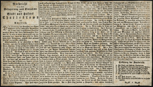
Text describing the siege on verso, titled Nachricht von der belagerung und einnahme der stadt und hafens Charlestown in America.
References to marked locations on verso.
- Identifier:
-
06_01_014551

![[A map of part of Pennsylvania & Maryland intended to shew, at one view, the several places proposed for opening a communication between the waters of the Delaware & Chesopeak Bays]](https://bpldcassets.blob.core.windows.net/derivatives/images/commonwealth:z603vt12v/image_thumbnail_300.jpg)


