Toggle navigation
LMEC Home
Exhibitions
Georeferencing
Tools for Teachers
Collections
My Favorites
Sign Up / Log In
Search
Search the map portal
Map Collection
Map Collection
Map Sets
Search
Search
Search for
Search In
All Fields
Creator
Title
Subject
Place
Search All Digital Collections
Advanced Search
461 Results
My Search
Start Over
More Like
commonwealth:z603vg87v
Remove constraint More Like: commonwealth:z603vg87v
Filter your Search
Place
North and Central America
421
United States
330
New York
93
New Jersey
53
Canada
36
Virginia
33
South Carolina
31
Suffolk (county)
31
more
Place
»
Topic
United States--History--Revolution, 1775-1783--Maps
328
Newport (R.I.)--Maps
24
United States--Maps
21
Charleston (S.C.)--Maps
18
New Jersey--Maps
17
North America--Maps
17
West Indies--Maps
17
Hudson River (N.Y. and N.J.)--Maps
16
more
Topic
»
Date
Date range begin
–
Date range end
Current results range from
1750
to
1881
View distribution
Creator
Clinton, Henry, Sir, 1738?-1795
17
Hills, John, active 1777-1819
13
André, John, 1751-1780
11
Reid, John, 1764?-1828
11
Kitchin, Thomas, 1718-1784
10
Montrésor, John, 1736-1799
10
Farwell, John Whittemore, 1843-1929
9
Bellin, Jacques Nicolas, 1703-1772
8
more
Creator
»
Format
Maps/Atlases
456
Manuscripts
16
Drawings/Illustrations
5
Georeferenced
Yes
12
No
449
Collection
American Revolutionary War-Era Maps
454
William L. Clements Library Collection
305
American Antiquarian Society Collection
138
Norman B. Leventhal Map Center Collection
8
Boston and New England Maps
6
Newberry Library Collection
3
Urban Maps
3
New York Public Library Collection
2
more
Collection
»
Available to use
No known restrictions
10
Creative Commons license
6
Search Constraints
Sort by relevance
relevance
title
date (asc)
date (desc)
Number of results to display per page
100 per page
10
per page
20
per page
50
per page
100
per page
View results as:
grid view
map view
Search Results
1.
Boston its environs and harbour, : with the rebels works raised against that town in 1775, from the observations of Lieut. Page...
2.
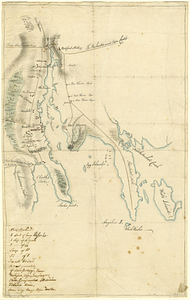
[Chart of Boston Harbor and the surrounding areas]
3.
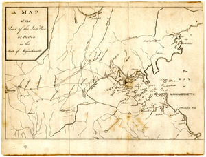
A Map of the seat of the late war at Boston in the state of Massachusetts
4.
A Plan of Charles Town the capitol of South Carolina, : with the harbour, islands, and forts; the attack on Fort Sulivan, by...
5.
A plan of the town and harbour of Boston. : And the country adjacent with the road from Boston to Concord shewing the place of...
6.
Plan of the town and harbour of St. Augustin, in East Florida
7.
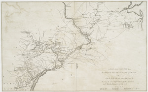
A map of the country from Rariton River in East Jersey to Elk Head in Maryland : shewing the several operations of the American...
8.
An accurate map of the United States of America : according to the Treaty of Peace of 1783
9.
Affaire de Monmouth ce 28me Juin 1778
10.
American camp at Valley Forge
11.
Amérique Septentrionale, Yorck : reconnoissance des ouvrages de cette ville ave le tracé des attaques dirigées contre eux
12.
Atlas to Marshall's life of Washington
13.
The attack and defeat of the American fleet under Benedict Arnold, by the kings fleet commanded by Captn. Thos. Pringle, upon...
14.
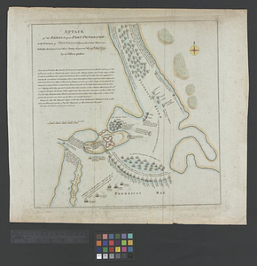
Attack of the rebels upon Fort Penobscot in the province of New England in which their fleet was totally destroyed and their...
15.
Attaque de la ville d'York en Virginie prise le 19 8bre 1781 par les armées combinées de France et d'Amérique
16.
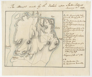
The attempt made by the rebels upon Staten Island January 15th 1780
17.
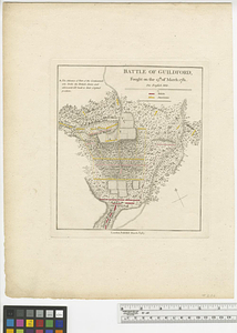
Battle of Guildford : fought on the 15th of March 1781
18.
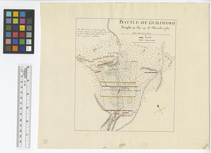
Battle of Guildford fought on the 15 of March 1781
19.
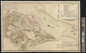
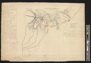
Battle of Monmouth, 28th June 1778
20.
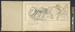
Battle of Monmouth, 28th June 1778
21.
Bedford
22.
Bedford &c.
23.
Blackwell's Island
24.
Boston
25.
Boston Harbor
26.
Boston Harbor, 1778
27.
Boston with its environs
28.
Bridge from Staten Island to the Jersies, by Cn. Laird's description
29.
British capture of Savannah
30.
British troop dispositions in and near New York City
31.
British troop dispositions in and near New York City, July and August 1781
32.
British troop dispositions in and near New York City, Sept. 2d 1781
33.
The British works at Yorktown and Gloucester
34.
Burlington, New Jersey, and Bristol, Pennsylvania
35.
Cambridge to Prospect Hill
36.
Carte de la prise de la Grenade par Mr. Cmte. d'Estaing, le 5 juillet 1779
37.
Carte de l'affaire de Montmouth, ou le Général Washington commandon l'armée Americaine, et le Général Clinton l'armée...
38.
Carte des environs de York en Virginie avec les attaques et la position des armées Françoise et Américaine, devant cette place...
39.
Carte des environs de York en Virginie avec les attaques et la position des armées Françoise et Américaine devant cette place...
40.
Centennial map of Concord, 1775-1875
41.
Charles Town, South Carolina, with a chart of the bars & harbour
42.
Charleston and its approaches from the sea
43.
Charleston and the British attack of June 1776
44.
A chart of the harbour of Rhode Island and Narraganset Bay surveyed in pursuance of directions from the Lords of Trade to His...
45.
A chorographical map of the country round Philadelphia = Carte particuliere des environs de Philadelphia
46.
A compleat plan of part of the province of Pennsylvania East and West Jersey shewing the transactions of the royal army under...
47.
Confluence of the James River, York River, and Chesapeake Bay
48.
Delaware Bay and Chesapeake Bay
49.
Delaware Bay and Chesapeake Bay
50.
Disposition of the British forces before Charleston 1780
51.
Disposition of the British forces on Long Island, Staten Island, and Manhattan Island, under Cornwallis and Knyphausen
52.
Distances North River
53.
Distribution & strength of corps 1780
54.
A draft of the Nerernanset shore from the entrance to the mouth of Potewomet River northward and from the Nererganset Bay to...
55.
Draught of part of the province of South Carolina shewing the march & encampments of the British troops under the command of...
56.
A draught of Rhode Island, 1777
57.
A draught of the towns of Boston & Charles Town & the circumjacent country, shewing the works thrown up by the kings troops, &...
58.
Draught of the watering place & redouts constructed to defend it, 15th: July 1776
59.
Exact plan of General Gage's lines on Boston Neck in America
60.
Flatbush
61.
Fort Germain and neighboring posts
62.
Fort Independence to Slaughter's Landing
63.
Fort Lafayette and Verplank Point
64.
Fort Lee
65.
Forts of the Highlands, ca. 1777
66.
Fragment of map showing two small fortifications
67.
From Fishkill Creek to the Croton River
68.
From Freehold toward Trenton
69.
A front view of Fort George Majabigwaduce June 1780
70.
Gen. Washington's Revolutionary campaign war map : after a survey ordered by him showing the position of his army in defence of...
71.
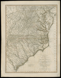
A general map of the southern British colonies in America comprehending North and South Carolina, Georgia, East and West...
72.
George's Island in Halifax harbor, Nova Scotia
73.
Goat Island
74.
Halifax
75.
Haverstraw Bay and vicinity
76.
Hudson River from Anthony's Nose to Stony Point
77.
Hudson River from Peekskill to Slaughters Landing
78.
Hudson River from Stony Point to West Point
79.
Hudson River from West Point to Dobbs Ferry
80.
Hudson's River from Stony Pt. to Fort Montgomery
81.
Isle de Newyork : reconnaissance des ouvrages du nord de lisle de Newyork faite en presence des Généraux, Wasington et...
82.
Kings Bridge
83.
Lent's Creek and Baillies Creek
84.
Lines of Charleston
85.
Long Island
86.
Map of American camp in New Jersey and surrounding countryside
87.
Map of New York I. with the adjacent rocks and other remarkable parts of Hell-Gate
88.
A map of that part of Pensylvania now the principle seat of war in America wherein may be seen the situation of Philadelphia,...
89.
A map of the country adjacent to Kingsbridge, surveyed by order of his excellency General Sir Henry Clinton K.B., commander in...
90.
A map of the environs of Boston
91.
A map of the environs of Brooklyn : surveyed by order of his excellency General Sir Henry Clinton K.B., commander in chief of...
92.
A map of the pass at Jamaica, Long Island : surveyed by order of his excellency General Sir Henry Clinton K:B: commander in...
93.
Map of the powers at war with Great Britain, 1783
94.
Map of the seat of the late war at Boston in the state of Massachusetts
95.
Map of the vicinity of Yorktown, Virginia, 1881
96.
The marches of Lord Cornwallis in the Southern Provinces, now states of North America : comprehending the two Carolinas, with...
97.
Monmouth County, New Jersey
98.
Moore's sketch of the navigation of the Highlands
99.
Narragansett Bay and Rhode Island
100.
A new and correct plan of the town of Boston
‹ Prev
Next ›
1
2
3
4
5

![[Chart of Boston Harbor and the surrounding areas]](https://bpldcassets.blob.core.windows.net/derivatives/images/commonwealth:6108vs71d/image_thumbnail_300.jpg)