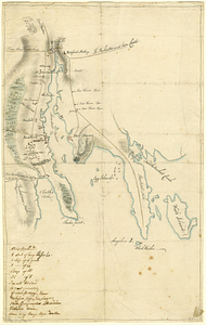
Bedford
This map is also available in American Revolutionary Geographies Online (ARGO), a collections portal especially built for material relating to the American Revolutionary War Era. Visit ARGO to learn more about this item and explore the historical geography of North America in the late eighteenth century.
Item Information
- Title:
- Bedford
- Contributor:
- André, John, 1751-1780
- Date:
-
[1770–1779]
- Format:
-
Maps/Atlases
- Genre:
-
Manuscript maps
- Location:
- William L. Clements Library
- Collection (local):
-
William L. Clements Library Collection
- Subjects:
-
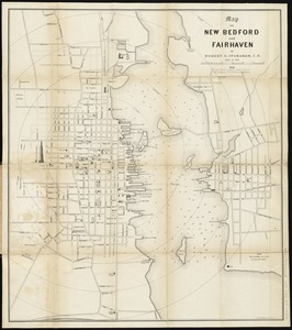
New Bedford (Mass.)--Maps
Fairhaven (Mass.)--Maps
United States--History--Revolution, 1775-1783--Maps
- Places:
-
MassachusettsBristol (county)New Bedford
MassachusettsBristol (county)Fairhaven
- Extent:
- 1 ms. map : col. ; 37.3 x 24 cm
- Terms of Use:
-
The University of Michigan Library provides access to these materials for educational and research purposes. These materials may be under copyright. If you decide to use any of these materials, you are responsible for making your own legal assessment and securing any necessary permission. If you have questions about the collection, please contact the William L. Clements Library.
Contact host institution for more information.
- Scale:
-
Scale indeterminable.
- Language:
-
English
- Catalog Record:
-
Catalog record
- Notes:
-
Finished, colored topographical map showing individual houses with names of owners.
Notes on shipping and goods in the hand of John André.
Title from verso of map.
Clinton Maps 57.
- Notes (date):
-
This date is inferred.
- Identifier:
-
198
- Barcode:
-
B1936361