Toggle navigation
LMEC Home
Exhibitions
Georeferencing
Tools for Teachers
Collections
My Favorites
Sign Up / Log In
Search
Search the map portal
Map Collection
Map Collection
Map Sets
Search
Search
Search for
Search In
All Fields
Creator
Title
Subject
Place
Search All Digital Collections
Advanced Search
8518 Results
My Search
Start Over
More Like
commonwealth:tq57r795j
Remove constraint More Like: commonwealth:tq57r795j
Filter your Search
Place
North and Central America
5,267
United States
3,957
Suffolk (county)
1,381
Boston
1,354
Europe
963
Canada
427
Massachusetts
297
France
269
more
Place
»
Topic
Boston (Mass.)--Maps
665
City planning--Massachusetts--Boston--Maps
417
United States--Maps
270
Urban renewal--Massachusetts--Boston--Maps
253
Real property--Massachusetts--Boston--Maps
215
Massachusetts--Maps
160
Landowners--Massachusetts--Boston--Maps
134
North America--Maps--Early works to 1800
103
more
Topic
»
Date
Date range begin
–
Date range end
Current results range from
1482
to
2023
View distribution
Creator
Boston Redevelopment Authority
390
United States. Hydrographic Office
357
O.H. Bailey & Co
148
Des Barres, Joseph F. W. (Joseph Frederick Wallet), 1722-1824
123
United States. Post Office Dept
120
Ptolemy, 2nd cent
100
Walling, Henry Francis, 1825-1888
94
Jefferys, Thomas, -1771
84
more
Creator
»
Format
Maps/Atlases
8,459
Manuscripts
215
Prints
51
Books
36
Objects/Artifacts
10
Drawings/Illustrations
8
Posters
4
Georeferenced
Yes
869
No
7,649
Collection
Norman B. Leventhal Map Center Collection
8,165
Boston and New England Maps
2,539
Urban Maps
2,277
Maritime Charts and Atlases
750
American Revolutionary War-Era Maps
616
Boston Redevelopment Authority Collection
438
Available to use
No known restrictions
8,377
Creative Commons license
46
Search Constraints
Sort by relevance
relevance
title
date (asc)
date (desc)
Number of results to display per page
100 per page
10
per page
20
per page
50
per page
100
per page
View results as:
grid view
map view
Search Results
1.
James Hayes Park
2.
South End urban renewal area project Mass. r-56 : site preparation contract no. 16 street lighting and drainage
3.
Union Park
4.
Union Park landscape improvements
5.
View of the South End
6.
West Canton Community Park
7.
City of Boston topographic and planimetric survey
8.
Herald Street improvements
9.
Illustrative site plan : a proposal for community review South End/Lower Roxbury development policy
10.
Illustrative site plan : South End urban renewal area, Massachusetts r-56
11.
Illustrative site plan : a proposal for community review South End/Lower Roxbury development policy
12.
Land use New York streets - South Cove 1953
13.
Relationship of TNEMC development plan area to New York streets land assembly and redevelopment project
14.
South End project no. Mass. r-56 : existing land use
15.
South End project no. Mass. r-56 : building deficiencies
16.
South End renewal area : locality map
17.
South End renewal area : existing conditions & proposed treatment areas
18.
South End renewal area : existing land use
19.
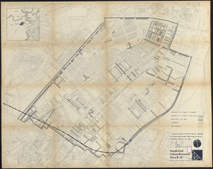
South End urban renewal area R-56 : property map
20.
South End urban renewal area R-56 : property map
21.
South End urban renewal area R-56 : property map
22.
South End urban renewal area R-56 : proposed rights-of-way
23.
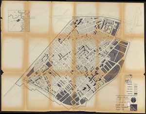
South End urban renewal area R-56 : re-use parcels
24.
South End urban renewal area R-56 : re-use parcels
25.
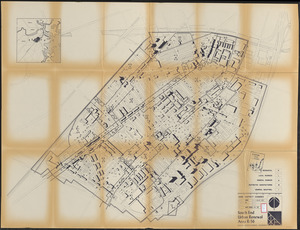
South End urban renewal area R-56 : proposed land use
26.
South End urban renewal area R-56 : zone district changes
27.
South End urban renewal area R-56 : proposed land use
28.
South End urban renewal area R-56 : zone district changes
29.
South End urban renewal area R-56 : proposed land use
30.
South End urban renewal area R-56 : illustrative site plan
31.
South End urban renewal area R-56 : proposed rights-of-way
32.
South End urban renewal area R-56 : proposed treatment areas
33.
South End urban renewal area R-56 : proposed rights-of-way
34.
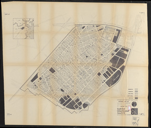
South End urban renewal area R-56 : building deficiencies
35.
South End urban renewal area R-56 : existing land use
36.
South End urban renewal area R-56 : building conditions
37.
South End urban renewal area R-56 : building conditions
38.
South End urban renewal area R-56 : existing zone districts
39.
South End urban renewal area R-56 : existing zone districts
40.
South End urban renewal area R-56 : existing zone districts
41.
Plan accompanying the proposal made to the City of Boston by the Commissioners on Boston Harbor and the Back Bay Octr. 20, 1854...
42.
[Plan of boundary lines in Roxbury and the City of Boston]
43.
Plan of Church St. district, showing estates and buildings : as proposed to be taken by the city of Boston under the Act of the...
44.
Plan of city lands and streets s.w. of Dover St : prepared from new surveys
45.
Plan of estates on Suffolk Street district, belonging to the City of Boston, to be sold at public auction, on Saturday, May 11,...
46.
Plan of house lots & other lands offered for sale by the Boston Water Power Company
47.
Plan of lands belonging to the Boston Water Power Co
48.
Plan of lands belonging to the Boston Water Power Company
49.
Plan of lands belonging to the Boston Water Power Company and the Commonwealth, on the Back Bay, showing part of the city...
50.
[Plan of lots on Falmouth Street, Boston]
51.
Plan of Suffolk Street District : showing estates & buildings as proposed to be taken by the City of Boston under the Act of...
52.
Plan of the estate of the late Warren White : to be sold at public auction on Wednesday March 27th 1872 at 12 o'clock m. on the...
53.
A South Ender's view of the world
54.
View of SoWa food trucks
55.
Washington Street corridor : South Cove to Forest Hills
56.
660 Wakulah St., Roxbury
57.
Allston-Brighton open space plan site inventory
58.
Back Bay Fens master plan
59.
Back Bay park
60.
Berkeley Street community garden
61.
Boston Common - Barry Memorial
62.
Boston Common Brewer Fountain - exist. conditions, demolition plan and site plan for comfort station area
63.
Boylston Street : Fenway to Massachusetts Avenue
64.
Boylston Street improvements
65.
Brighton and Allston urban design strategy
66.
Campus High School urban renewal area Mass. r-129 : property map
67.
Capital Park : Hyde Park ... Boston
68.
Central business district urban renewal area project no. Mass. R-82L site preparation contract T : planting plan and details
69.
Charlestown urban renewal area project no. Mass. R-55 Boston - Suffolk County - Massachusetts delivery parcel plan : parcel...
70.
Charlestown urban renewal project Boston (Suffolk County) Massachusetts Mass. R-55 : topographic map
71.
Charlestown Veterans Memorial, Charlestown, Massachusetts
72.
Circulation plan of parking lot at the corner of VFW Parkway and Spring Street, West Roxbury
73.
Columbia Point development study
74.
Columbia Point updated base maps
75.
Flirtation walk existing conditions plan Charlestown Navy Yard
76.
Flirtation walk schematic planting plan Charlestown Navy Yard
77.
Gate 5 - Chelsea Street modified landscape scheme, Charlestown, MA
78.
Illustrative site plan : Government Center urban renewal area, Massachusetts R-35
79.
Illustrative site plan : Washington Park urban renewal area, Massachusetts R-24
80.
Jamaica Pond master plan
81.
John Hancock office and parking garage complex, Boston, Massachusetts
82.
Landscaping plan of City Hall Plaza, Boston
83.
Little Mystic Channel landscape scheme, Charlestown, MA
84.
Maps from General plan for Boston : preliminary report, December, 1950
85.
[Mill dam survey : Boston, Roxbury, Brookline &c.]
86.
New Congress Street improvements
87.
Olmsted Park master plan
88.
Outline map of Boston
89.
Parcel 22
90.
Plan for the construction of improvements at the Boston Common
91.
Plan of Lafayette Mall (Boston Common)
92.
Plan of land and street layout in Boston, Mass., Hyde Park : prepared for the Stoney Brook Land Trust
93.
Plan of region west of Back Bay Park, Boston, Mass. : proposed improvements
94.
Plan of the parkway between Muddy River gate house and Jamaica Park 1892
95.
Planting beds on Dartmouth Street and Boylston Street in Copley Square
96.
Proposed Charles River Park
97.
Proposed Charles River Park
98.
The Riverway master plan
99.
Ropewalk bldg. Charlestown Navy Yard
100.
Rose F. Kennedy Garden
‹ Prev
Next ›
1
2
3
4
5
…
85
86


![[Plan of boundary lines in Roxbury and the City of Boston]](https://bpldcassets.blob.core.windows.net/derivatives/images/commonwealth:1257bb127/image_thumbnail_300.jpg)


![[Plan of lots on Falmouth Street, Boston]](https://bpldcassets.blob.core.windows.net/derivatives/images/commonwealth:1257bb32q/image_thumbnail_300.jpg)


