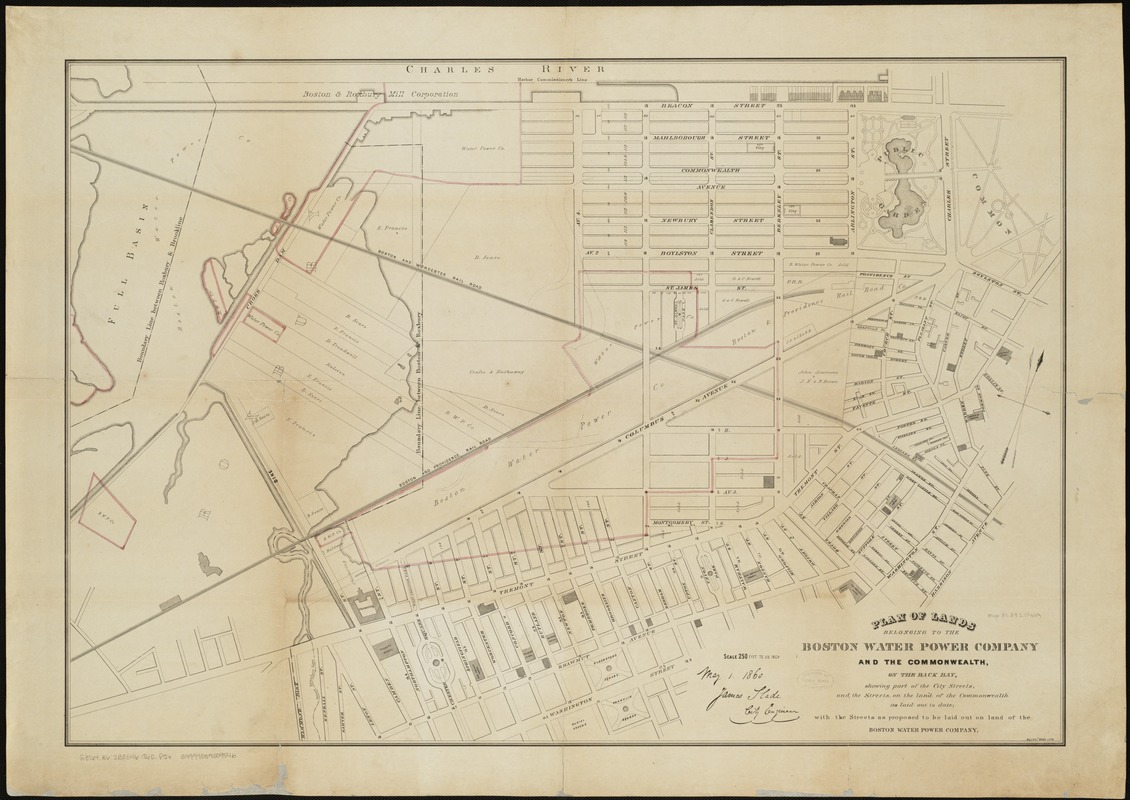
Plan of lands belonging to the Boston Water Power Company and the Commonwealth, on the Back Bay, showing part of the city streets, and the streets, on the land of the Commonwealth as laid out to date : with the streets as proposed to be laid out on the land of the Boston Water Power Company
Item Information
- Title:
- Plan of lands belonging to the Boston Water Power Company and the Commonwealth, on the Back Bay, showing part of the city streets, and the streets, on the land of the Commonwealth as laid out to date : with the streets as proposed to be laid out on the land of the Boston Water Power Company
- Date:
-
[1860]
- Format:
-
Maps/Atlases
- Location:
-
Boston Public Library
Norman B. Leventhal Map & Education Center - Collection (local):
-
Norman B. Leventhal Map & Education Center Collection
- Subjects:
-
Landowners--Massachusetts--Boston--Maps
Real property--Massachusetts--Boston--Back Bay--Maps
Back Bay (Boston, Mass.)--Maps
South End (Boston, Mass.)--Maps
Back Bay (Boston, Mass.)
- Places:
-
MassachusettsSuffolk (county)BostonBack Bay
MassachusettsSuffolk (county)BostonSouth End
- Extent:
- 1 map : col. ; 63 x 92 cm.
- Terms of Use:
-
No known copyright restrictions.
No known restrictions on use.
- Publisher:
-
Boston :
s.n.
- Scale:
-
Scale 1:3,000.
- Language:
-
English
- Notes:
-
Oriented with north toward the upper right.
- Notes (date):
-
This date is inferred.
- Identifier:
-
06_01_005096
- Call #:
-
G3764.B6:2B2G46 1860 .P5x
- Barcode:
-
39999059009546


![[Plan of lots on Falmouth Street, Boston]](https://bpldcassets.blob.core.windows.net/derivatives/images/commonwealth:1257bb32q/image_thumbnail_300.jpg)

