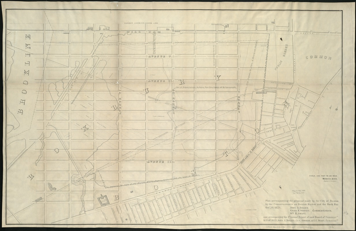
Plan accompanying the proposal made to the City of Boston by the Commissioners on Boston Harbor and the Back Bay Octr. 20, 1854 : and accompanying the 3d Annual report of said Board of Commissioners 16 Feby. 1855
Item Information
- Title:
- Plan accompanying the proposal made to the City of Boston by the Commissioners on Boston Harbor and the Back Bay Octr. 20, 1854 : and accompanying the 3d Annual report of said Board of Commissioners 16 Feby. 1855
- Creator:
- Whitwell & Henck
- Name on Item:
-
Whitwell & Henck, engineers and surveyors.
- Date:
-
[1854]
- Format:
-
Maps/Atlases
- Location:
-
Boston Public Library
Norman B. Leventhal Map & Education Center - Collection (local):
-
Norman B. Leventhal Map & Education Center Collection
- Subjects:
-
Real property--Massachusetts--Boston
Landowners--Massachusetts--Boston--Maps
Back Bay (Boston, Mass.)--Maps
South End (Boston, Mass.)--Maps
- Places:
-
MassachusettsSuffolk (county)BostonBack Bay
MassachusettsSuffolk (county)BostonSouth End
- Extent:
- 1 plan ; 59 x 91 cm.
- Terms of Use:
-
No known copyright restrictions.
No known restrictions on use.
- Publisher:
-
Boston :
s.n.
- Scale:
-
Scale 1:3,000.
- Language:
-
English
- Notes:
-
Oriented with north toward the upper right.
Shows area in the Back Bay and South End from the Charles River, south to Shawmut Avenue.
- Notes (date):
-
This date is inferred.
- Identifier:
-
06_01_005007
- Call #:
-
G3764.B6:2B2G46 1854 .W5
- Barcode:
-
39999059009272
![[Plan of boundary lines in Roxbury and the City of Boston]](https://bpldcassets.blob.core.windows.net/derivatives/images/commonwealth:1257bb127/image_thumbnail_300.jpg)


