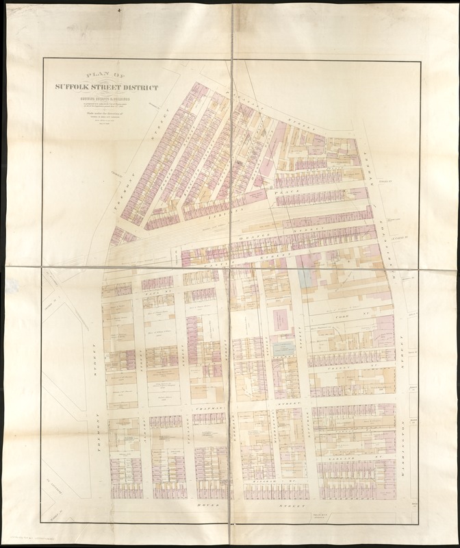
Plan of Suffolk Street District : showing estates & buildings as proposed to be taken by the City of Boston under the Act of the Legislature passed June 4th, 1868
Item Information
- Title:
- Plan of Suffolk Street District : showing estates & buildings as proposed to be taken by the City of Boston under the Act of the Legislature passed June 4th, 1868
- Creator:
- Davis, Thomas W., surveyor
- Name on Item:
-
made under the direction of Thomas W. Davis.
- Date:
-
1869
- Format:
-
Maps/Atlases
- Location:
-
Boston Public Library
Norman B. Leventhal Map & Education Center - Collection (local):
-
Norman B. Leventhal Map & Education Center Collection
- Subjects:
-
Real property--Massachusetts--Boston--South End--Maps
Real property--Massachusetts--Boston--Bay Village--Maps
Boston (Mass.)--Maps
South End (Boston, Mass.)--Maps
Bay Village (Boston, Mass.)--Maps
- Places:
-
MassachusettsSuffolk (county)BostonSouth End
- Extent:
- 1 map : col. ; 147 x 121 cm.
- Terms of Use:
-
No known copyright restrictions.
No known restrictions on use.
- Publisher:
-
Boston :
[s.n.]
- Scale:
-
Scale, 1:360.
- Language:
-
English
- Notes:
-
Shows area of what is now Bay Village and the South End in Boston.
- Identifier:
-
06_01_004317
- Call #:
-
G3764.B6:2S6 1869 .B67
- Barcode:
-
39999059006062


