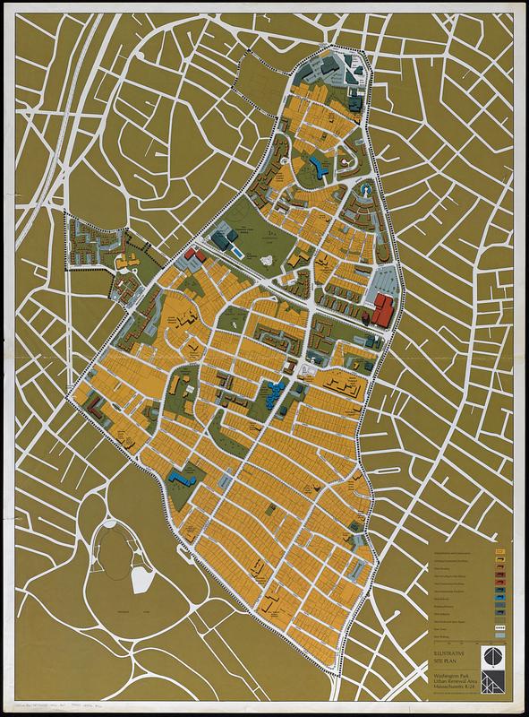
Illustrative site plan : Washington Park urban renewal area, Massachusetts R-24
Item Information
- Title:
- Illustrative site plan : Washington Park urban renewal area, Massachusetts R-24
- Cartographer:
- Boston Redevelopment Authority
- Name on Item:
-
Boston Redevelopment Authority
- Date:
-
[1970]
- Format:
-
Maps/Atlases
- Location:
-
Boston Public Library
Norman B. Leventhal Map & Education Center - Collection (local):
-
Norman B. Leventhal Map & Education Center Collection
- Subjects:
-
Roxbury (Boston, Mass.)--Maps
Urban renewal--Massachusetts--Boston--Maps
Land use--Massachusetts--Boston--Maps
City planning--Massachusetts--Boston--Maps
- Places:
-
MassachusettsSuffolk (county)BostonRoxbury
- Extent:
- 1 map : color ; 120 x 87 cm
- Terms of Use:
-
No known copyright restrictions.
No known restrictions on use.
- Publisher:
-
[Boston] :
Boston Redevelopment Authority
- Scale:
-
Scale approximately 1:2,450
- Language:
-
English
- Notes:
-
Shows new housing, new commercial and community facilities, new schools, parks and open space, new parking, etc.
- Notes (date):
-
This date is inferred.
- Notes (exhibitions):
-
Exhibited: "More or less in common: environment and justice in the human landscape," organized by Leventhal Map & Education Center at the Boston Public Library, 2022.
- Identifier:
-
06_01_017807
- Call #:
-
G3764.B6:2R7G455 1970 .B67
- Barcode:
-
39999085963526


