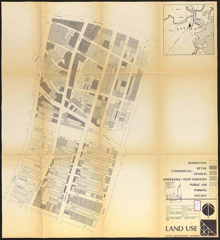
Land use New York streets - South Cove 1953
Item Information
- Title:
- Land use New York streets - South Cove 1953
- Cartographer:
- Boston Redevelopment Authority
- Date:
-
[1963]
- Format:
-
Maps/Atlases
- Location:
-
Boston Public Library
Central Library in Copley Square - Collection (local):
-
Boston Public Library Collection
- Subjects:
-
Land use--Massachusetts--Boston--Maps
South End (Boston, Mass.)--Maps
Chinatown (Boston, Mass.)--Maps
City planning--Massachusetts--Boston--Maps
Tufts-New England Medical Center
- Places:
-
MassachusettsSuffolk (county)BostonSouth End
Suffolk (county)BostonChinatown
- Extent:
- 1 map ; 83 x 76 cm
- Terms of Use:
-
No known copyright restrictions.
No known restrictions on use.
- Publisher:
-
[Boston] :
Boston Redevelopment Authority
- Language:
-
English
- Catalog Record:
-
Accompanying text
- Notes:
-
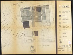
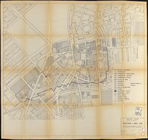
Accompanies the Tufts New England Medical Center development plan for property in downtown Boston's New York Streets/South Cove area adjacent to Chinatown.
Shows residential, commercial retail, commercial general, wholesale - light industry, public use, parking, and vacant.
Inset: [Location map].
- Notes (date):
-
This date is inferred.
- Identifier:
-
06_01_017311a
- Call #:
-
BRA/FOLIO/39 map 1
- Barcode:
-
mq6311062