Toggle navigation
LMEC Home
Exhibitions
Georeferencing
Tools for Teachers
Collections
My Favorites
Sign Up / Log In
Search
Search the map portal
Map Collection
Map Collection
Map Sets
Search
Search
Search for
Search In
All Fields
Creator
Title
Subject
Place
Search All Digital Collections
Advanced Search
377 Results
My Search
Start Over
More Like
commonwealth:hx11z343v
Remove constraint More Like: commonwealth:hx11z343v
Filter your Search
Place
North and Central America
336
United States
210
Canada
103
Essex (county)
23
Louisbourg
21
Saint Lawrence River
19
Fort Edward
16
Suffolk (county)
16
more
Place
»
Topic
United States--History--French and Indian War, 1754-1763--Maps, Manuscript--Early works to 1800
57
Louisbourg (N.S.)--Maps, Manuscript--Early works to 1800
18
Fort Edward (N.Y.)--Maps, Manuscript--Early works to 1800
16
Saint Lawrence River--Maps, Manuscript--Early works to 1800
15
Fort Ticonderoga (N.Y.)--Maps, Manuscript--Early works to 1800
14
Louisbourg (N.S.)--History--Siege, 1745--Maps, Manuscript--Early works to 1800
14
Fortification--New York (State)--Fort Edward--Maps, Manuscript--Early works to 1800
13
Fortification--New York (State)--Maps, Manuscript--Early works to 1800
13
more
Topic
»
Date
Date range begin
–
Date range end
Current results range from
1664
to
1816
View distribution
Creator
Royal United Services Institute for Defence and Security Studies
160
George, III, King of Great Britain, 1738-1820
151
George, IV, King of Great Britain, 1762-1830
150
Amherst, Jeffery Amherst, Baron, 1717-1797
128
Skinner, Monier
28
Skinner, William, 1700-1780
28
Brasier, William
16
Bastide, John Henry, approximately 1700-1770
15
more
Creator
»
Format
Maps/Atlases
360
Manuscripts
150
Drawings/Illustrations
15
Georeferenced
Yes
7
No
370
Collection
British Library Collection
376
American Revolutionary War-Era Maps
353
Boston and New England Maps
21
Urban Maps
5
Maritime Charts and Atlases
2
Library of Congress Collection
1
Available to use
Creative Commons license
377
Search Constraints
Sort by relevance
relevance
title
date (asc)
date (desc)
Number of results to display per page
100 per page
10
per page
20
per page
50
per page
100
per page
View results as:
grid view
map view
Search Results
201.
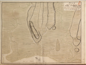
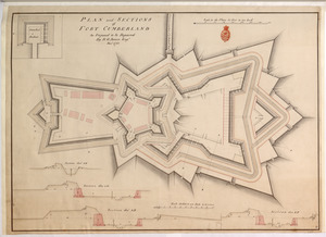
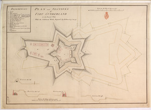
PLAN and SECTIONS of FORT CUMBERLAND As Proposed to be Repaired
202.
PLAN and SECTIONS of FORT CUMBERLAND in its Present State With the Additional Works Proposed
203.
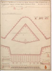
PLAN and SECTIONS of the Front of the Projected Hornwork at FORT CUMBERLAND with CASEMATES Proposed in the Curtain Capable of...
204.
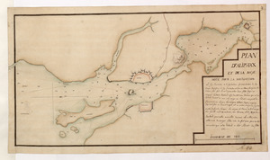
PLAN D'ALIPHAX ET DE LA BAYE
205.
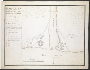
PLAN DE LA RIVIERE ET DES FORTS DE CHVAGEN
206.
PLAN DE LA VILLE DE MONT REAL DEDIER A SON EXCELLENCE M.R LE GENERAL AMHERST COMMANDANT EN CHEF LES FORCES DE SA MAJESTE...
207.
Plan de la ville de Montreal en Canada levé en l'annee 1713
208.
Plan de la ville de Montreal en Canada levé en l'année 1713 et enceinte a Este rectifiée
209.
PLAN DE L'INTENDANCE DE QUE'BEC : Cette Maison Sert aussi de Palais; Elle est Située hors de la Ville, dans le Faubourg de...
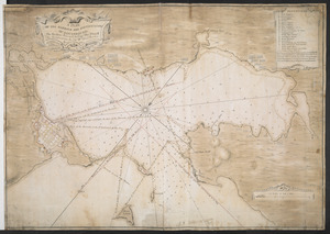
210.
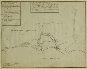
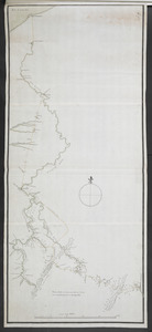
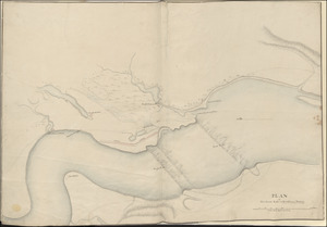
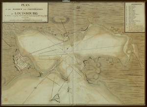
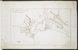
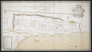
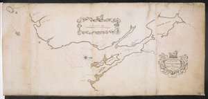
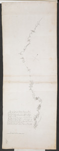
[Plan de Louisburgh, et partie de la baye de Gabarus]
211.
Plan du fort de Chouéghen de la Riviere Et de terrain aux Environs au Sud du Lac Ontario
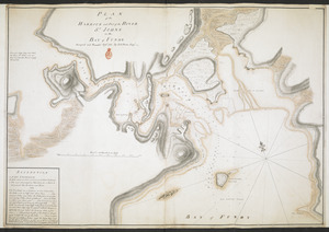
212.
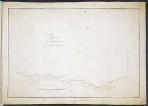
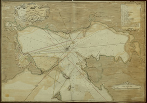
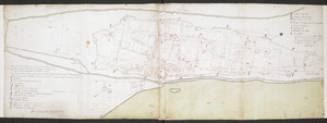
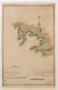
[Plan Du fort Georges appelé par les Anglois William-Henri prie par les francois en 1757 le 9 Aout]
213.
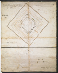
Plan du fort S.t Jean
214.
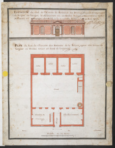
PLAN du Rex de Chausee des Batiments de la Prison, ayant dix Toises de largeur et Treize toises et demi de longeur
215.
Plan dun Fort convenable en quelque endroit ce que soit dune Cote maritime Auquel on a changé la figure reguliere du 1.r...
216.
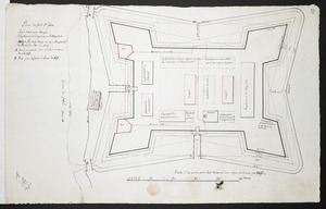
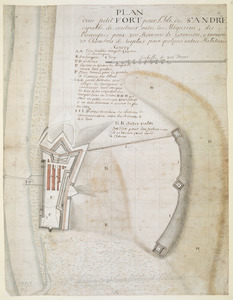
PLAN dun petit FORT pour l'Isle de S.t ANDRE capable de contenir outre les Magazins, des Barraques pour 200 Hommes de Garrison,...
217.
PLAN D'une des Redoutes des Lignes projettee par Mr de PontLeroy ing.r le Chef du Canada sur La plage de Beaupoint pour...
218.
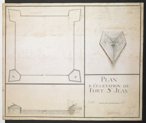
PLAN E L'ELEVATION DU FORT S.T JEAN
219.
Plan Elevation and sections of Blockhouse to be built at Penobscot in the Bay of Funda to contain 100 Men or more if necessary....
220.
PLAN ELEVATION SECTION and PROFILE of ye ROYAL BLOCKHOUSE
221.
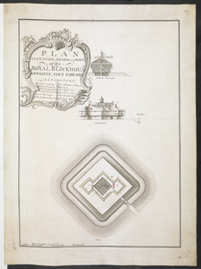
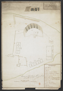
PLAN ELEVATION SECTION and PROFILE of ye ROYAL BLOCKHOUSE OPPOSITE FORT EDWARD
222.
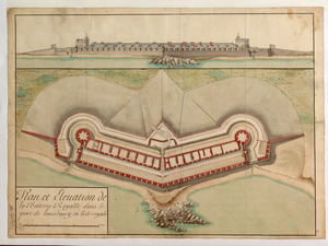
Plan et Elevation de la Batterie Royalle, dans le port de louisbourg, en l'isle royale
223.
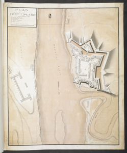
PLAN FORT EDWARD
224.
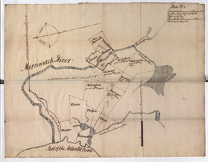
Plan No: 1 : [Eastern New Hampshire and Massachusetts]
225.
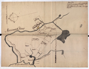
Plan No: 2 : [Eastern New Hampshire and Massachusetts]
226.
Plan No: 2 : [Eastern New Hampshire and Massachusetts]
227.
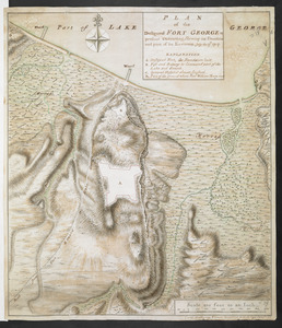
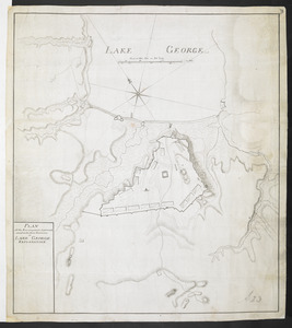
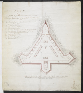
PLAN of a POST for 430 men on the Rocky Ground formerly Retrenched at LAKE GEORGE 1759
228.
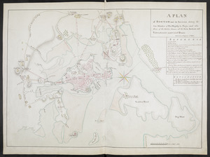
A PLAN of BOSTON and its Environs shewing the true Situation of His Majesty's Troops, and also those of the Rebels; likewise...
229.
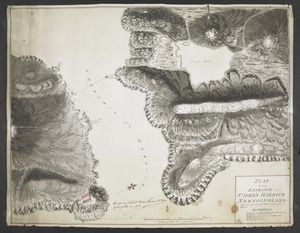
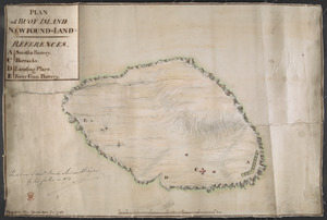
PLAN of BUOY ISLAND NEW FOUND-LAND
230.
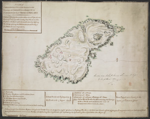
PLAN of CARBONERA ISLAND situated at the Entrance of CARBONERA HARBOUR in CONCEPTION BAY NEWFOUNDLAND
231.
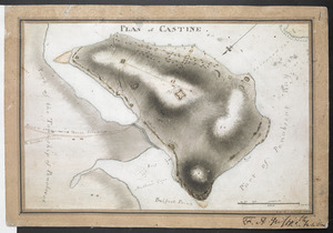
PLAN of CASTINE
232.
Plan of Ferryland Harbour and Capeling Bay In Newfoundland
233.
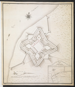
PLAN OF Fort AUGUSTA in the Province OF Pansilvania
234.
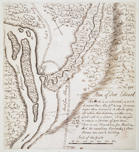
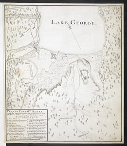
Plan of Fort Edward
235.
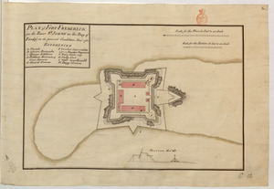
PLAN of FORT FREDERICK at NEWFOUND-LAND as it is now with the new Additions
236.
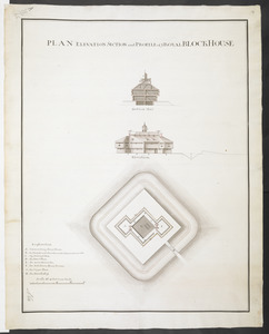
PLAN of FORT FREDERICK (in the River S.T JOHNS in the Bay of Fundy) in its present condition Nov.r 1761
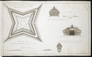
237.
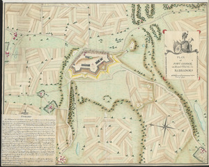
PLAN of FORT GEORGE, on Mount Charity, in BARBADOES
238.
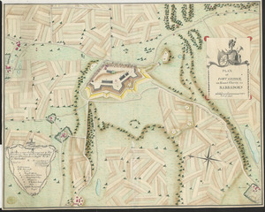
PLAN of FORT GEORGE, on Mount Charity, in BARBADOES
239.
PLAN of FORT LIGONIER
240.
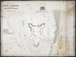
PLAN of FORT LIGONIER with part of the RETRENCHMENT
241.
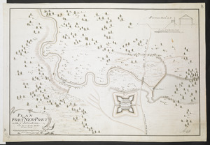
PLAN OF FORT NEW-PORT with ye Situation done by a Scale 100 feet to one Inch
242.
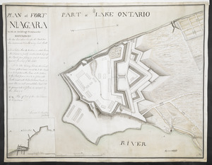
PLAN of FORT NIAGARA With its Buildings & outworks
243.
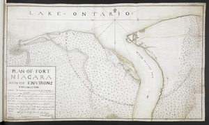
PLAN OF FORT NIAGARA WITH ITS ENVIRONS
244.
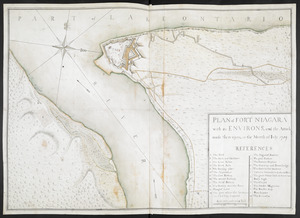
PLAN of FORT NIAGARA with its ENVIRONS, and the Attack made there-upon, in the Month of Iuly 1759
245.
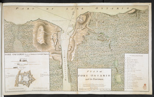
PLAN of FORT ONTARIO and its ENVIRONS
246.
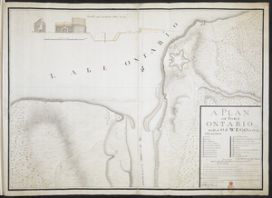
A PLAN OF FORT ONTARIO Built at OSWEGO in 1759
247.
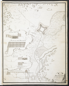
PLAN OF FORT STANWIX AT THE ONNIDE STATION Done by a Scale of 150 Feet to one Inch
248.
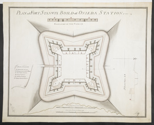
PLAN of FORT STANWIX BUILD at ONIEDA STATION 1758
249.
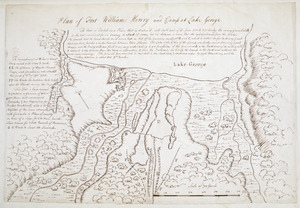
Plan of Fort William Henry and Camp at Lake George
250.
PLAN OF FORT Wm HENRY and the English Camps & Retranchment, with the French different Camps & Attack there upon
251.
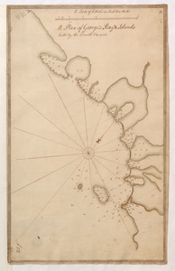
A Plan of George's Bay & Islands Call'd by the French I. du quinto
252.
A PLAN OF HALIFAX HARBOUR IN NOVA SCOTIA 1760
253.
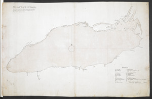
PLAN OF LAKE ONTARIO Copied and inlarged from a French Original, the North Shore corrected in some places, likewise the South...
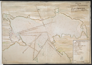
254.
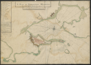
A PLAN OF LOUISBOUGH HARBOUR
255.
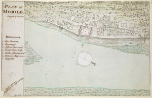
PLAN of MOBILE
256.
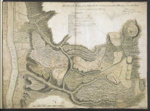
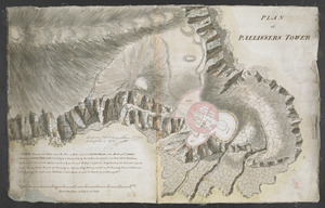
PLAN of PALLISSERS TOWER
257.
Plan of Part of Black River & Part of Otter Creek with the Distances by Computation
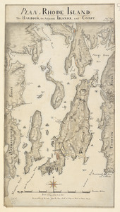
258.
PLAN of part of FORT GEORGE with the BARRACKS &c Erected in the Year 1759
259.
A Plan of Part of the East Coast of the Island of Cape Breton
260.
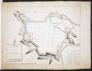
A Plan of Pitts Fort at Pittsburgh. Oct.r 1759
261.
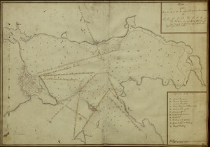
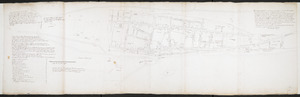
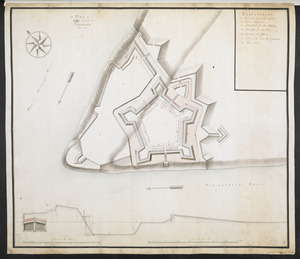
[Plan of proposed Fort Ontario at Oswego]
262.
PLAN of RHODE ISLAND, the HARBOUR, the Adjacent ISLANDS, and COAST
263.
PLAN OF SANDY HOOK 28. Miles from New York
264.
PLAN of the Bastion at Fort George
265.
Plan of the Battery on the South Shore Erected against Fort Levy on the 21. of August 1760
266.
Plan of the Battle fought on the Plains of Abraham, September the 13th 1759
267.
A PLAN OF THE CITY and FORTRESS OF LOUISBOURG
268.
Plan of the City and Fortress of LOUISBOURG Surrendered to his Britanick Majesty by Capitulation the 17 June 1745. to Lieut....
269.
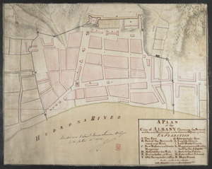
A PLAN of the City of ALBANY Shewing the Several works and Buildings made there in the Year 1756 & 57
270.
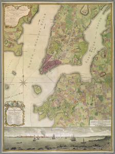
PLAN of the CITY of NEW YORK, in North America : Surveyed in the Years 1766 & 1767
271.
Plan of the communication from Fort Cumberland to Presqu'Isle
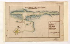
272.
PLAN of the COMMUNICATION from TOWNSHIP No 8 to CATARAQUI as Surveyed by M.r Louis Kott Dep.t Prov.l Surv
273.
PLAN of the Country adjacent to FORT CUMBERLAND Upon the Isthmus of NOVA-SCOTIA Showing the general Situation of that Fort
274.
PLAN of the Designed FORT GEORGE at present executing, Shewing its situation and part of its Environs. July the 17.th 1759
275.
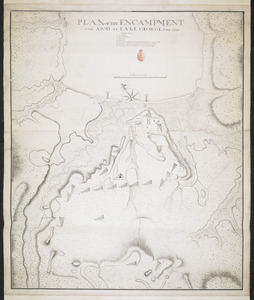
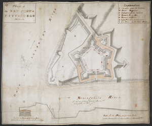
PLAN of the Encampement at Lake George the 27th Iuin 1759
276.
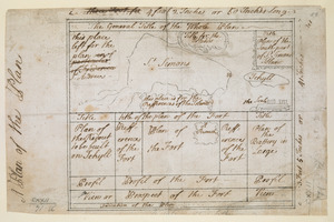
PLAN of the Encampment Intrenchment with thier Environs at LAKE GEORGE
277.
PLAN OF THE ENCAMPMENT OF THE ARMY AT LAKE GEORGE JUNE 1759
278.
PLAN OF THE ENTRANCE OF ST IOHN'S HARBOUR NEWFOUNDLAND Shewing the additional Work's erecting for its defence
279.
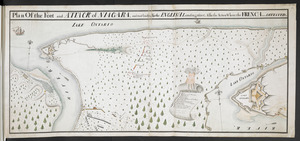
Plan Of the Fort and ATTACK of NIAGARA, and road leading To the ENGLISH Landing place, Also the Action Where the FRENCH were...
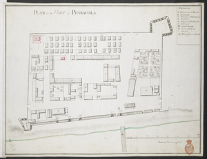
280.
PLAN of the FORT at PENSACOLA
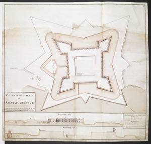
281.
PLAN of the FORT at SAINT AUGUSTINE
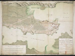
282.
PLAN of the FORTRESS and dependant FORTS at CROWN POINT with their Environs and part of LAKE CHAMPLAIN. 1759
283.
A PLAN of the FORTS MONTGOMERY & CLINTON as taken by his Majesty's Forces under the Command of Gen:l Sir Henry clinton the 6.th...
284.
PLAN of the Great Falls on Hudsons River
285.
A PLAN OF THE HARBOUR AND FORTIFICATIONS OF LOUISBOURG
286.
A PLAN OF THE HARBOUR AND FORTIFICATIONS OF LOUISBOURG
287.
Plan of the HARBOUR and FORTIFICATIONS OF LOUISBOURG
288.
A PLAN OF THE HARBOUR AND FORTIFICATIONS OF LOUISBOURG : The Harbour Survey'd by Cap.t Phi; Durrell The Fortifications by Cap.t...
289.
PLAN of the HARBOUR and FORTIFICATIONS of LOUISBOURG : The Harbour Survey'd by Capt Phill Durell the Town & Fortifications by...
290.
PLAN of the HARBOUR and Part of the RIVER S.T JOHNS in the BAY of FUNDY
291.
PLAN of the HARBOUR and Rivers of PORT LE JOYE in the Island of S.t Iohn
292.
Plan of the Harbour of St John's in the Bay of Fundy= Plan & Section of the Fort as it is Near Finish'd= Plan & Section's of...
293.
Plan of the Incampement at Fort Edward
294.
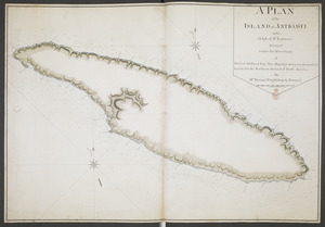
A PLAN of the ISLAND of ANTICOSTI in the Gulph of S.T Lawrence Surveyed under the Directions of Samuel Holland Esq.r His...
295.
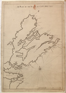
A PLAN OF THE ISLAND OF CAPE BRETON
296.
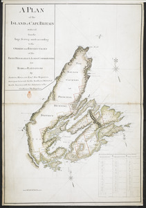
A PLAN of the ISLAND of CAPE BRITAIN reduced from the large Survey made according to the ORDERS and INSTRUCTIONS of the RIGHT...
297.
PLAN of the NEW FORT at PITTSBURGH November 1759
298.
PLAN OF THE PENINSULA OF CHESOPEAK BAY
299.
A Plan of the Plan
300.
PLAN of the Position of the Army under the command of Lieut:t Gen:l Burgoyne near Still Water in which it encamped on ye 20th...
‹ Prev
Next ›
1
2
3
4

![[Plan de Louisburgh, et partie de la baye de Gabarus]](https://bpldcassets.blob.core.windows.net/derivatives/images/commonwealth:hx11z045s/image_thumbnail_300.jpg)
![[Plan Du fort Georges appelé par les Anglois William-Henri prie par les francois en 1757 le 9 Aout]](https://bpldcassets.blob.core.windows.net/derivatives/images/commonwealth:hx11z1913/image_thumbnail_300.jpg)

![[Plan of proposed Fort Ontario at Oswego]](https://bpldcassets.blob.core.windows.net/derivatives/images/commonwealth:hx11z1204/image_thumbnail_300.jpg)