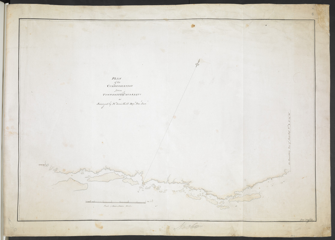
PLAN of the COMMUNICATION from TOWNSHIP No 8 to CATARAQUI as Surveyed by M.r Louis Kott Dep.t Prov.l Surv
This map is also available in American Revolutionary Geographies Online (ARGO), a collections portal especially built for material relating to the American Revolutionary War Era. Visit ARGO to learn more about this item and explore the historical geography of North America in the late eighteenth century.
Item Information
- Title:
- PLAN of the COMMUNICATION from TOWNSHIP No 8 to CATARAQUI as Surveyed by M.r Louis Kott Dep.t Prov.l Surv
- Description:
-
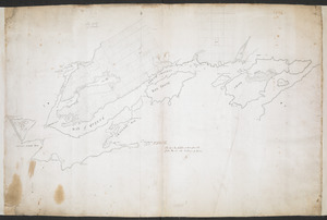
Outline map of the Saint Lawrence River from "Cataraqui" (Fort Cataraqui, present-day Kingston, Ontario) to "The Boundary line of Township No 8 N 24 W" (Township No 8, Elizabethtown, present-day Brockville, Ontario?).
- Surveyor:
- Kott, Louis
- Cartographer:
- Tuffie, Samuel, 1702-1759
- Papermaker:
- Whatman, James
- Associated name:
- Humfrey, Lieutenant
- Former owner:
- Royal United Services Institute for Defence and Security Studies
- Name on Item:
-
Sam Tuffie.
- Date:
-
[1783]
- Format:
-
Maps/Atlases
- Location:
- British Library
- Collection (local):
-
British Library Collection
- Subjects:
-
United Empire loyalists--Maps, Manuscript--Early works to 1800
Saint Lawrence River--Maps, Manuscript--Early works to 1800
- Places:
-
Saint Lawrence River
- Extent:
- 1 map : manuscript pen and ink with watercolour ; 46 x 67 cm
- Terms of Use:
-
No known copyright restrictions.
This work is licensed for use under a Creative Commons Attribution Non-Commercial Share Alike License (CC BY-NC-SA).

- Publisher:
-
[Place of production not identified] :
Sam Tuffie,
- Scale:
-
Scale approximately 1:84,000
- Language:
-
English
- Catalog Record:
-
http://searcharchives.bl.uk/IAMS_VU2:IAMS040-001999737
- Notes:
-
Date attributed based on subject matter - the settling of the United Empire Loyalists.
Shows title centrally on the map.
Shows scale lower left, "Scale of Seven Statue Miles".
Signed at lower left "Sam Tuffie".
Shows an arrow orienting north to the top of the map.
The only toponym given is "Cataraqui".
Copy at Add Ms 57,707.8. Bound in R.U.S.I. Vol LXXII. Shows manuscript addition of "8" in pencil at upper right. Shows "A 28/73" in pencil at lower left and "N2360" at lower centre (crossed through). Laid on archival tissue. Green circular label to verso showing "34". White label to verso showing "DRAWER 28 SECTION 2". Blue label to verso shows "A 28/13". Paper watermarks shows a coat of arms. Paper watermark shows a fleur de lys within a shield and countermark is "J. WHATMAN". Manuscript annotation in ink to verso reads "Presented to the United Service [illegible] by Lieut Humphrey 88 Regt" and an additional title is given, "Plans of the River S.t laurence from Pt au bodel on Lake S.t Francos to Cataraqui".
- Notes (date):
-
9999
This date is inferred.