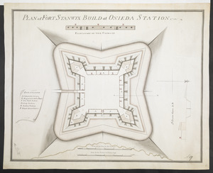
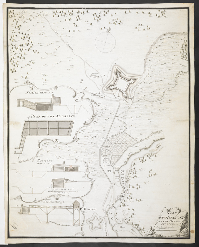
PLAN OF FORT STANWIX AT THE ONNIDE STATION Done by a Scale of 150 Feet to one Inch
This map is also available in American Revolutionary Geographies Online (ARGO), a collections portal especially built for material relating to the American Revolutionary War Era. Visit ARGO to learn more about this item and explore the historical geography of North America in the late eighteenth century.
Item Information
- Title:
- PLAN OF FORT STANWIX AT THE ONNIDE STATION Done by a Scale of 150 Feet to one Inch
- Surveyor:
- Pfister, Francis, 1740-1777
- Former owner:
- Amherst, Jeffery Amherst, Baron, 1717-1797
- Former owner:
- Royal United Services Institute for Defence and Security Studies
- Name on Item:
-
Surveyd by Fran.s Pfister Eng: 1760.
- Date:
-
[1760–1762]
- Format:
-
Maps/Atlases
- Location:
- British Library
- Collection (local):
-
British Library Collection
- Subjects:
-
Fortification--New York (State)--Rome--Maps, Manuscript--Early works to 1800
Military art and science--New York (State)--Rome--Maps, Manuscript--Early works to 1800
Fort Stanwix (Rome, N.Y.)--Maps, Manuscript--Early works to 1800
- Places:
-
Oneida (county)Rome
- Extent:
- 1 map : manuscript pen and ink with wash ; 56 x 44 cm
- Terms of Use:
-
No known copyright restrictions.
This work is licensed for use under a Creative Commons Attribution Non-Commercial Share Alike License (CC BY-NC-SA).

- Publisher:
-
[Place of production not identified] :
Surveyd by Fran.s Pfister Eng:,
- Scale:
-
Scale approximately 1:1,800
- Language:
-
English
- Catalog Record:
-
http://searcharchives.bl.uk/IAMS_VU2:IAMS040-001999743
- Notes:
-
Date range suggested from date of 1760 shown on map and date of 1762 supplied by Boston Public Library.
Relief is shown by shading.
Shows title, incorporating Pfister's name, the 1760 date and scale bar, in a decorative cartouche at lower right.
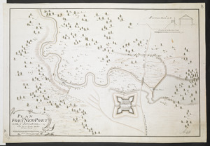
Shows "Road from F.t New Port" and "Road from F.t Harakeman's".
Shows "Artillery's Garden", "Garrison's Garden", "Buying Place" and "Saw mill" on the banks of the Mohawk River.
Shows outline only of "Ft Craven" (had been destroyed in 1756).
Inset at lower left within edcorative, vined boarders are three sections through the fort a a "PLAN OF THE MAGAZINE" with their own scale bar of "Scale 15:th feet to a Inch" (scale approximately 1:180).
Compare another plan of Fort Stanwix (see Add Ms 57,711.12.).
Copy at Add Ms 57,711.11. Bound in R.U.S.I. Vol LXXVI. Shows manuscript addition of "11" in pencil at upper right. Shows "A 49" in pencil at lower left and "A 30/70" at upper right. Laid on archival tissue. Green circular label to verso shows "47". Manuscript annotation in pencil shows "Drawer 30 Section 1". Blue label to verso shows "A 30/70". Paper watermark shows a shield with a diagonal stripe, surmouted by a fleur de lys, with "LVG" beneath. Countermark shows "JW".
- Notes (date):
-
9999
This date is inferred.