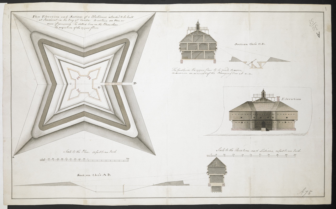
Plan Elevation and sections of Blockhouse to be built at Penobscot in the Bay of Funda to contain 100 Men or more if necessary. The dotted line in the Plans shows the projection of the upper floor
This map is also available in American Revolutionary Geographies Online (ARGO), a collections portal especially built for material relating to the American Revolutionary War Era. Visit ARGO to learn more about this item and explore the historical geography of North America in the late eighteenth century.
Item Information
- Title:
- Plan Elevation and sections of Blockhouse to be built at Penobscot in the Bay of Funda to contain 100 Men or more if necessary. The dotted line in the Plans shows the projection of the upper floor
- Former owner:
- Amherst, Jeffery Amherst, Baron, 1717-1797
- Former owner:
- Royal United Services Institute for Defence and Security Studies
- Date:
-
[1759]
- Format:
-
Maps/Atlases
- Location:
- British Library
- Collection (local):
-
British Library Collection
- Subjects:
-
Fortification--Maine--Fort Pownall--Maps, Manuscript--Early works to 1800
Military art and science--Maine--Fort Pownall--Maps, Manuscript--Early works to 1800
Fort Pownall (Me.)--Maps, Manuscript--Early works to 1800
- Places:
-
Fort Point State Park
- Extent:
- 1 map : manuscript pen and ink with grey wash ; 27 x 44 cm
- Terms of Use:
-
No known copyright restrictions.
This work is licensed for use under a Creative Commons Attribution Non-Commercial Share Alike License (CC BY-NC-SA).

- Publisher:
-
[Place of production not identified] :
[Producer not identified]
- Scale:
-
Scale approximately 1:480
- Language:
-
English
- Catalog Record:
-
http://searcharchives.bl.uk/IAMS_VU2:IAMS040-001999741
- Notes:
-
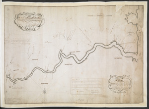
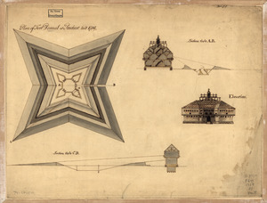
Shows Fort Pownall. Date attributed prior to construction of Fort Pownall in 1759. Shows title at upper left. 4500 shows scale bar at lower left, "Scale to the Plan. 40 foot to an Inch".
Shows two sections through the fort and two elevations with their own scale bar, "Scale to the elebation and Sections. 20 feet to an Inch" (scale approximately 1:240). One section includes a note, "The Cradle in the upper floor to be made to move on occasion on account of the Plunging fire at a.a.".
Compare "Plan of Fort Pownal at Penobscot built 1759" held by the National Library of Congress (CALL NUMBER G3734.F675 1759 .P5 Vault).
Copy at Add Ms 57,711.1. Bound in R.U.S.I. Vol LXXVI. Shows manuscript addition of "1" in pencil at upper right. Shows "A 30/58" in pencil at upper right and "A 75" at lower right. Laid on archival tissue. Green circular label to verso shows "35". White label to verso shows "DRAWER 30 SECTION 1". Blue label to verso shows "A 30/58". Annotation in ink to verso, "To his Excellency Gen Amherst". Paper watermark shows a shield with a diagonal stripe, surmounted by a fleur de lys, with "LVG" beneath. Evidence of old folds.
- Notes (date):
-
9999
This date is inferred.