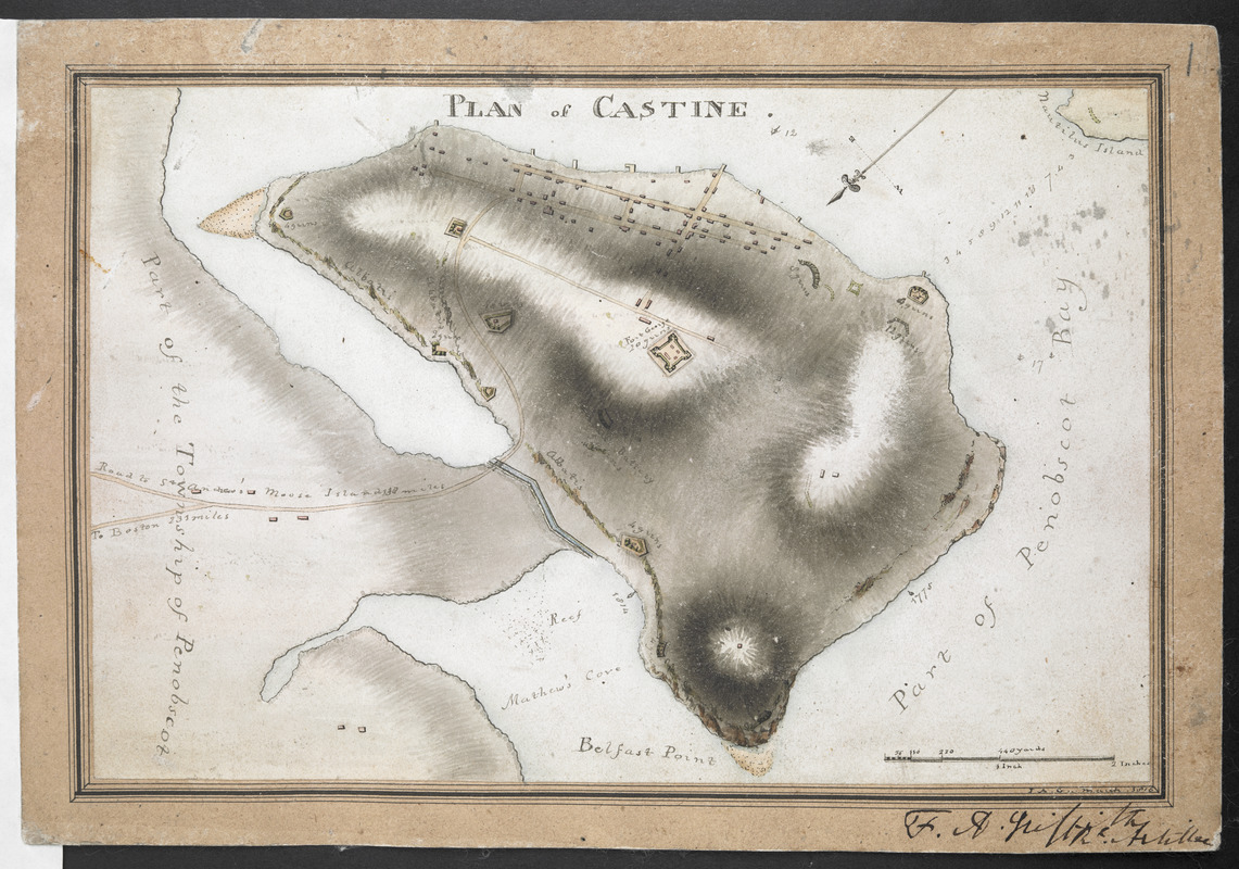
PLAN of CASTINE
This map is also available in American Revolutionary Geographies Online (ARGO), a collections portal especially built for material relating to the American Revolutionary War Era. Visit ARGO to learn more about this item and explore the historical geography of North America in the late eighteenth century.
Item Information
- Title:
- PLAN of CASTINE
- Cartographer:
- Griffiths, F. A. (Frederick Augustus), -1869
- Former owner:
- Royal United Services Institute for Defence and Security Studies
- Name on Item:
-
F. A. G.
- Date:
-
1816
- Format:
-
Maps/Atlases
- Location:
- British Library
- Collection (local):
-
British Library Collection
- Subjects:
-
Fortification--Maine--Castine--Maps, Manuscript
Military art and science--Maine--Castine--Maps, Manuscript
Castine (Me.)--Maps, Manuscript
Fort George (Me. : Fort)--Maps, Manuscript
United States--History--War of 1812--Maps, Manuscript
- Places:
-
Hancock (county)Fort George
Hancock (county)Castine
- Extent:
- 1 map : manuscript pen and ink with watercolour ; 16 x 24 cm
- Terms of Use:
-
No known copyright restrictions.
This work is licensed for use under a Creative Commons Attribution Non-Commercial Share Alike License (CC BY-NC-SA).

- Scale:
-
Scale approximately 1:15,840
- Language:
-
English
- Catalog Record:
-
http://searcharchives.bl.uk/IAMS_VU2:IAMS040-001999748
- Notes:
-
Relief shown by shading.
Sounding depths are given.
Shows "Fort George".
Oriented with north to the lower left of the map.
Shows title at upper centre.
Shows roads with distances.
Shows scale at lower right (440 yards to an inch).
Signed within paper mount at lower right, "F. A. G. March 1816".
Copy at Add Ms 27,715.1. Mounted on an additional sheet of paper. Mount lines ruled in black ink. Mount signed "F. A. Griffith R. Artillert" (?) on mount at lower right. Green circular label to verso showing "7". White label to verso showing "DRAWER 30 SECTION 1". Blue label to the verso shows "A 33/38".


