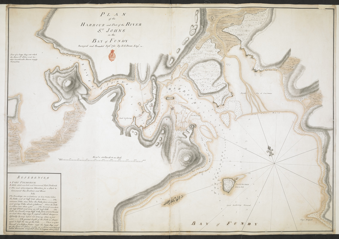
PLAN of the HARBOUR and Part of the RIVER S.T JOHNS in the BAY of FUNDY
This map is also available in American Revolutionary Geographies Online (ARGO), a collections portal especially built for material relating to the American Revolutionary War Era. Visit ARGO to learn more about this item and explore the historical geography of North America in the late eighteenth century.
Item Information
- Title:
- PLAN of the HARBOUR and Part of the RIVER S.T JOHNS in the BAY of FUNDY
- Surveyor:
- Bruce, Robert George
- Former owner:
- Amherst, Jeffery Amherst, Baron, 1717-1797
- Former owner:
- Royal United Services Institute for Defence and Security Studies
- Name on Item:
-
Surveyed and Sounded Sept.r 1761. By R. G. Bruce Eng.r.
- Date:
-
1761
- Format:
-
Maps/Atlases
- Location:
- British Library
- Collection (local):
-
British Library Collection
- Subjects:
-
Fortification--New Brunswick--Saint John--Maps, Manuscript--Early works to 1800
Military art and science--New Brunswick--Saint John--Maps, Manuscript--Early works to 1800
Saint John (N.B.)--Maps, Manuscript--Early works to 1800
Saint John River (Me. and N.B.)--Maps, Manuscript--Early works to 1800
- Places:
-
CanadaSaint John
Saint John River
- Extent:
- 1 map on 2 sheets : joined, laid on linen, manuscript pen and ink with watercolour ; 72 x 105 cm
- Terms of Use:
-
No known copyright restrictions.
This work is licensed for use under a Creative Commons Attribution Non-Commercial Share Alike License (CC BY-NC-SA).

- Publisher:
-
[Fort Frederick?] :
Surveyed and Sounded Sept.r 1761. By R. G. Bruce Eng.r.,
- Scale:
-
Scale approximately 1:10,800
- Language:
-
English
- Catalog Record:
-
http://searcharchives.bl.uk/IAMS_VU2:IAMS040-001999733
- Notes:
-
Relief shown by shading.
Sounding depths are given.
shows title to left of upper centre with red stamp of R.U.S.I. beneath.
Shows "Scale 300 Yards to an inch" near lower left.
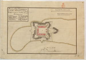
Shows a lettered key (A-C) at lower left with notes regarding soundings beneath. The key highlights the situation of Fort Frederick and an alternative "most advantageous Situation for a Fort to command this Harbour and River" (perhaps between present-day Queen Square and Rainbow Square on the opposite side of the river).
Shows overland portages .
Copy at Add Ms 57,703.5. In a R.U.S.I. solander box numbered Vol LXVII. Map comprises 2 sheets joined and laid on linen. Laid on linen. Manuscript addition of "C 11" in pencil to verso. Linen shows stamp of "ADD. MS. 57,703 (5)" in black ink. Green circular label to verso shows "14". White label to verso shows "DRAWER 28 SECTION 2". Additional annotation in pencil repeats shelfmark "57703-5". Paper watermark shows a fleur de lys within a shield with "LVG" beneath.
- Notes (date):
-
9999


![[A map showing the post route between the River St. Lawrence and the Bay of Fundy]](https://bpldcassets.blob.core.windows.net/derivatives/images/commonwealth:hx11z4963/image_thumbnail_300.jpg)
