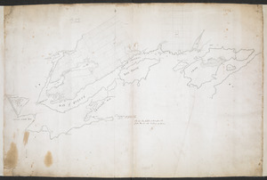
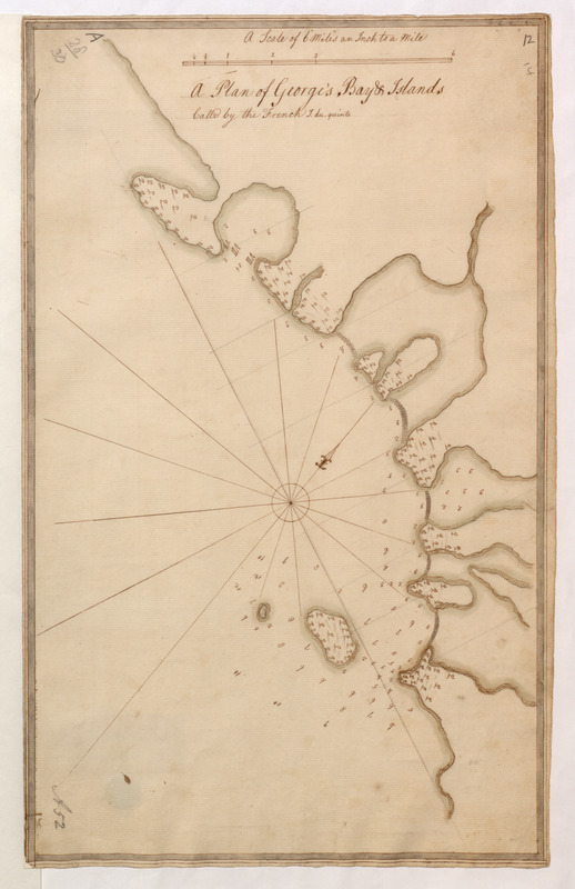
A Plan of George's Bay & Islands Call'd by the French I. du quinto
This map is also available in American Revolutionary Geographies Online (ARGO), a collections portal especially built for material relating to the American Revolutionary War Era. Visit ARGO to learn more about this item and explore the historical geography of North America in the late eighteenth century.
Item Information
- Title:
- A Plan of George's Bay & Islands Call'd by the French I. du quinto
- Former owner:
- Amherst, Jeffery Amherst, Baron, 1717-1797
- Former owner:
- Royal United Services Institute for Defence and Security Studies
- Date:
-
[ca. 1755]
- Format:
-
Maps/Atlases
- Location:
- British Library
- Collection (local):
-
British Library Collection
- Subjects:
-
Quinte, Bay of (Ont.)--Maps, Manuscript--Early works to 1800
- Places:
-
CanadaQuinte, Bay of
- Extent:
- 1 map : manuscript pen and ink, over pencil ; 47 x 29 cm
- Terms of Use:
-
No known copyright restrictions.
This work is licensed for use under a Creative Commons Attribution Non-Commercial Share Alike License (CC BY-NC-SA).

- Publisher:
-
[Place of production not identified] :
[producer not identified]
- Scale:
-
Scale approximately 1:63,360
- Language:
-
English
- Catalog Record:
-
http://searcharchives.bl.uk/IAMS_VU2:IAMS040-001999737
- Notes:
-
Sounding depths are given.
Depicts Bay of Quinte (but precise location not identified).
A decorative compass rose orients north to the upper right of the map.
Shows title at upper centre with scale above, "A Scale of 6 Miles an inch to a Mile".
Copy at Add Ms 57,707.11. Bound in R.U.S.I. Vol LXXII. Shows manuscript addition of "12" (and "14") in pencil at upper right. Shows "A 28/30" in pencil at upper left and "A 52" at lower left. Laid on archival tissue. Green circular label to verso showing "5". White label to verso showing "DRAWER 28 SECTION 2". Manuscript additions to verso in pencil show "14" and 29".
- Notes (date):
-
9999