Toggle navigation
LMEC Home
Exhibitions
Georeferencing
Tools for Teachers
Collections
My Favorites
Sign Up / Log In
Search
Search the map portal
Map Collection
Map Collection
Map Sets
Search
Search
Search for
Search In
All Fields
Creator
Title
Subject
Place
Search All Digital Collections
Advanced Search
438 Results
My Search
Start Over
More Like
commonwealth:hq37vv90w
Remove constraint More Like: commonwealth:hq37vv90w
Filter your Search
Place
North and Central America
393
Massachusetts
176
United States
150
New England
133
Rhode Island
51
Suffolk (county)
49
Boston
48
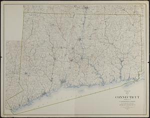
Connecticut
42
more
Place
»
Topic
Massachusetts--Maps
218
New England--Maps
120
Boston (Mass.)--Maps
50
Railroads--New England--Maps
50
Rhode Island--Maps
46
Connecticut--Maps
39
Railroads--Massachusetts--Maps
32
New York (State)--Maps
25
more
Topic
»
Date
Date range begin
–
Date range end
Current results range from
1482
to
2020
View distribution
Creator
Geo. H. Walker & Co
16
MassGIS (Office : Mass.)
10
Massachusetts. Executive Office of Environmental Affairs
10
Walling, Henry Francis, 1825-1888
10
Boston Public Library. Norman B. Leventhal Map and Education Center
9
Geological Survey (U.S.)
9
Carey, Mathew, 1760-1839
8
Geo. H. Walker & Co.
7
more
Creator
»
Format
Maps/Atlases
436
Manuscripts
5
Books
1
Ephemera
1
Prints
1
Georeferenced
Yes
88
No
350
Collection
Norman B. Leventhal Map Center Collection
306
Boston and New England Maps
241
Sidney R. Knafel Map Collection at Phillips Academy
87
American Revolutionary War-Era Maps
67
David Judkins Weaver Papers
22
American Antiquarian Society Collection
18
William L. Clements Library Collection
14
Urban Maps
12
more
Collection
»
Available to use
No known restrictions
298
Creative Commons license
15
Search Constraints
Sort by relevance
relevance
title
date (asc)
date (desc)
Number of results to display per page
100 per page
10
per page
20
per page
50
per page
100
per page
View results as:
grid view
map view
Search Results
1.
The city of New York as laid out by the Commissioners with the surrounding country
2.
Map of Massachusetts, Connecticut and Rhode Island constructed from the latest authorities
3.
A map of Massachusetts, Connecticut and Rhodeisland
4.
Map of Massachusetts, Rhode-Island & Connecticut : compiled from the latest authorities
5.
Massachusetts, Rhode-Island and Connecticut
6.
The National Publishing Company's railroad, post office, township and county map of Massachusetts, Rhode Island and Connecticut...
7.
Sketch of the states of Massachusetts, Connecticut, and Rhode Island, and parts of New Hampshire & New York exhibiting the...
8.
Sketch of the states of Massachusetts, Connecticut, and Rhode Island, and parts of New Hampshire & New York exhibiting the...
9.
Johnson's Massachusetts Connecticut and Rhode Island
10.
Map of Massachusetts, Connecticut and Rhode Island constructed from the latest authorities
11.
Map of Massachusetts, Connecticut and Rhode Island constructed from the latest authorities
12.
Map of Massachusetts, Rhode-Island & Connecticut : compiled from the latest authorities
13.
A map of the colony of Rhode Island : with the adjacent parts of Connecticut, Massachusetts Bay, &c.
14.
Massachusetts with Connecticut and Rhode Island
15.
Post route map of the states of Massachusetts, Rhode Island, Connecticut showing post offices with the intermediate distances...
16.
States of Massachusetts, Rhode Island and Connecticut : shaded relief
17.
States of Massachusetts, Rhode Island and Connecticut : base map with highways and contours
18.
States of Massachusetts, Rhode Island and Connecticut : base map with highways and contours
19.
Massachusetts and Rhode Island
20.
Connecticut with portions of New York & Rhode Island
21.
Manuscript maps of U.S. states
22.
A Map of Connecticut and Rhode Island, with Long Island Sound, &c
23.
A new and accurate map of Connecticut and Rhode Island from the best authorities
24.
Colton's Massachusetts and Rhode Island
25.
Hammond's new road map of Rhode Island and southeastern Massachusetts
26.
Map of Massachusetts and Rhode Island
27.
Massachusetts and Rhode Island
28.
National topographic map of Massachusetts and Rhode Island : showing counties, townships, cities, villages and post offices ......
29.
New York, New Haven & Hartford Railroad : Old Colony system
30.
Route of the proposed Providence & Worcester rail-road
31.
Route of the Providence and Worcester rail road
32.
Topographic map of Massachusetts and Rhode Island
33.
Tri-state trolley map showing Boston & Northern and Old Colony Street Railway Companies' systems and connecting lines
34.
G. Woolworth Colton's railroad, township & distance map of New England with adjacent portions of New York, Canada & New Brunswick
35.
Map of the country copied from Hale's map of N. E. with railroad route from Boston to Lake Champlain : through Keene, N. H
36.
Map of the rail road from Boston to Stanstead
37.
Map of the northern part of New England : compiled for Pres't. Dwight's travels
38.
Old Colony & Newport railway and its connections
39.
Sketch A showing the progress of the survey in section no. 1 from 1844 to 1881
40.
Geological map of Massachusetts
41.
Map of Massachusetts, from the best authorities
42.
Massachusetts
43.
Massachusetts
44.
Massachusetts
45.
The state of Massachusetts
46.
The Commonwealth of Connecticut
47.
Connecticut
48.
Connecticut
49.
Connecticut
50.
Connecticut
51.
Connecticut, from actual survey
52.
Connecticut from the best authorities
53.
Connecticut from the best authorities
54.
Connecticut from the best authorities
55.
Manuscript maps of U.S. states, possibly drawn by a schoolchild
56.
Map of Connecticut
57.
Map of Connecticut
58.
A new and correct map of Connecticut : one of the United States of North America
59.
Open space map of Connecticut, lands dedicated as open space, and selected undeveloped land, lands managed but not dedicated as...
60.
A particular discription of that part of the coast of Connecticut extending from Byram River to Stratford Point : these...
61.
Preliminary geological map of Connecticut
62.
The state of New York with part of the adjacent states
63.
Geographical, statistical, and historical map of Rhode Island
64.
A map of the State of Rhode Island
65.
Map of the State of Rhode Island and Providence Plantations
66.
Map of the State of Rhode Island, and Providence Plantations
67.
Partie de l'état de Rhode-Island et position des armées Américaine et Britannique au siege de Newport et à l'affaire du 29 Août...
68.
Rhode Island
69.
Rhode Island
70.
Rhode Island
71.
The State of Rhode Island, : from the latest surveys. 1796
72.
The state of Rhode Island
73.
The state of Rhode Island : compiled from the surveys and observations of Caleb Harris
74.
Topographical map of the state of Rhode Island and Providence plantations
75.
A topographical map of the state of Rhode-Island and Providence Plantations
76.
ABC pathfinder railway guide map : eastern division
77.
Automobile map of New England showing the ideal tour
78.
Black in New England 1840
79.
Boston Clinton Fitchburg and Mansfield Framingham Lowell Railroads, and connections
80.
The Boston Globe ski map of northern New England and Canada
81.
A canoeist's guide to New England's rivers
82.
Carte de la Nouvelle Angleterre, Nouvelle Yorck, et Pensilvanie. : Pour servir à l'Histoire générale des voyages
83.
C.H. Guild & Co.'s newspaper map of New England
84.
Commercial map of New England
85.
Ensign, Bridgman & Fanning's rail road map of the United States, showing the depots & stations
86.
E.P. Dutton & Co.'s railroad, steam boat & stage route map of New England, New-York and Canada
87.
An Exact map of New England, New York, Pensylvania & New Jersey, : from the latest surveys
88.
An Exact map of the province of Quebec with part of New York & New England from the latest surveys
89.
Fishing grounds out of Boston : NLSECO marine diesel oil engines ; built by New London Ship & Engine Co., Groton, Conn
90.
G. Woolworth Colton's railroad, township & distance map of New England : with adjacent portions of New York, Canada & New...
91.
The heart of New England
92.
Hodgman's new map showing location and classification golf and country clubs of New England with automobile roads and distances
93.
Industrial map of New England
94.
L'Isle de Terre-Neuve, l'Acadie, ou la Nouvelle Ecosse, : l'Isle St. Jean et la partie orientale du Canada
95.
Kaart van Nieuw Nederland : behoorende tot de door het Provinciaal Utrechtsch genootschap bekroonde verhandeling
96.
Limited edition, 500 only of a pictorial map covering the New England States U.S.A
97.
Lloyd's railroad, telegraph & express map of the Eastern States to accompany Lloyd's railroad, telegraph & express map of the...
98.
Map exhibiting the rail road, canal, lake and river routes from New York and Boston to the west, via Ogdensburgh, Buffalo and...
99.
Map exhibiting the rail road routes leading from Boston, to Ogdensburg and Buffalo, N.Y
100.
Map first division railway mail service
‹ Prev
Next ›
1
2
3
4
5