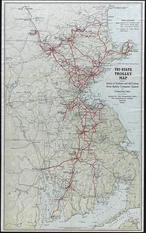
Tri-state trolley map showing Boston & Northern and Old Colony Street Railway Companies' systems and connecting lines
Item Information
- Title:
- Tri-state trolley map showing Boston & Northern and Old Colony Street Railway Companies' systems and connecting lines
- Issuing body:
- Old Colony Railroad Company. Passenger Department
- Issuing body:
- Boston and Northern Street Railway Co.
- Engraver:
- C.J. Peters & Son
- Name on Item:
-
issued by the Passenger Dept. ; engraved by C.J. Peters & Son Co.
- Date:
-
1907
- Format:
-
Maps/Atlases
- Location:
-
Boston Public Library
Norman B. Leventhal Map & Education Center - Collection (local):
-
Norman B. Leventhal Map & Education Center Collection
- Subjects:
-
Massachusetts--Maps
New Hampshire--Maps
Rhode Island--Maps
Street-railroads--Massachusetts--Maps
Street-railroads--New Hampshire--Maps
Street-railroads--Rhode Island--Maps
Old Colony Railroad Company
Boston and Northern Street Railway Co.
- Places:
-
Massachusetts
New Hampshire
Rhode Island
- Extent:
- 1 map : color ; 59 x 36 cm, on sheet 61 x 38 cm, folded to 20 x 11 cm + text (24 pages ; 21 cm)
- Terms of Use:
-
No known copyright restrictions.
No known restrictions on use.
- Publisher:
-
Boston :
Boston & Northern Street Railway Co. ; Old Colony Street Railway Co.
- Scale:
-
Scale approximately 1:290,000
- Language:
-
English
- Notes:
-
Shows Boston & Northern and Old Colony Street Railway Companies routes and routes of other street railways.
Relief shown by shading.
Accompanied by text title Trolley trips (24 pages ; 21 cm).
"Copyright, 1907, by Boston & Northern and Old Colony Street Railway Companies."
Advertisement for The trolley wayfinder stamped on verso.
- Identifier:
-
06_01_017389
- Call #:
-
G3721.P3 1907 .T75
- Barcode:
-
39999085965679


