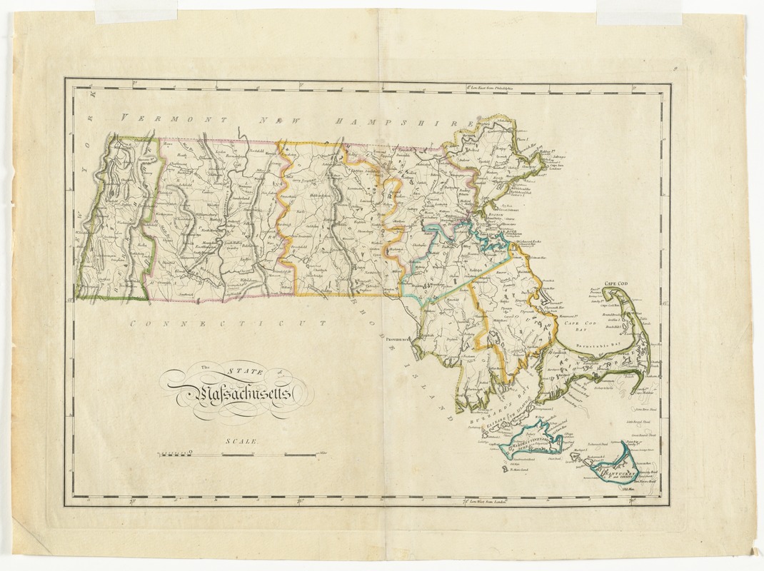
The state of Massachusetts
Item Information
- Title:
- The state of Massachusetts
- Creator:
- Carey, Mathew, 1760-1839
- Date:
-
[1814]
- Format:
-
Maps/Atlases
- Location:
- Phillips Academy
- Collection (local):
-
Sidney R. Knafel Map Collection at Phillips Academy, Andover MA
- Subjects:
-
Massachusetts--Maps
- Places:
-
Massachusetts
- Extent:
- 1 map : hand colored ; 30 x 44 cm.
- Terms of Use:
-
Rights status not evaluated.
Contact host institution for more information.
- Publisher:
-
[Philadelphia] :
[M. Carey]
- Scale:
-
Scale [ca. 1:700,000]
- Language:
-
English
- Notes:
-
Relief shown by hachures.
Prime meridians: London and Philadelphia.
In upper right: 9.
From Carey's general atlas.
- Notes (date):
-
This date is inferred.
- Identifier:
-
1329


