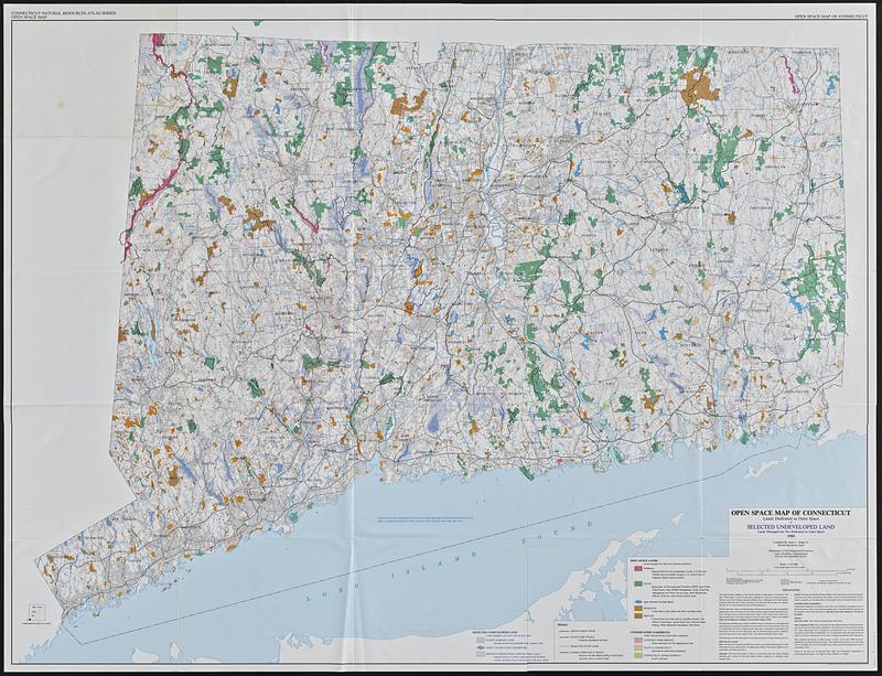
Open space map of Connecticut, lands dedicated as open space, and selected undeveloped land, lands managed but not dedicated as open space
Item Information
- Title:
- Open space map of Connecticut, lands dedicated as open space, and selected undeveloped land, lands managed but not dedicated as open space
- Title (alt.):
-
Selected undeveloped land, lands managed but not dedicated as open space
- Cartographer:
- Bogar, James C.
- Contributor:
- Connecticut. Natural Resources Center
- Name on Item:
-
compiled by James C. Bogar Jr., Natural Resources Center
- Date:
-
1990
- Format:
-
Maps/Atlases
- Location:
-
Boston Public Library
Norman B. Leventhal Map & Education Center - Collection (local):
-
David Judkins Weaver Papers
- Subjects:
-
Connecticut--Maps
Open spaces--Connecticut--Maps
Trails--Connecticut--Maps
Recreation areas--Connecticut--Maps
Public lands--Connecticut--Maps
- Places:
-
Connecticut
- Extent:
- 1 map : color ; 103 x 137 cm
- Terms of Use:
-
No known copyright restrictions.
No known restrictions on use.
- Publisher:
-
[Hartford], Connecticut||Capitol Heights, Md. :
Department of Environmental Protection||Williams & Heintz Map Corporation
- Scale:
-
Scale 1:125,000. 1 inch equals approximately 2 miles
- Language:
-
English
- Notes:
-
Relief shown by contours and spot heights.
"Contour interval 50 ft, national geodetic vertical datum of 1929."
"Base map prepared by Natural Resources Center, DEP, modified from USGS 1:125,000 scale base map of Connecticut, 1965 revised 1974."
- Identifier:
-
06_01_018831
- Call #:
-
Weaver folder 17 no. 8