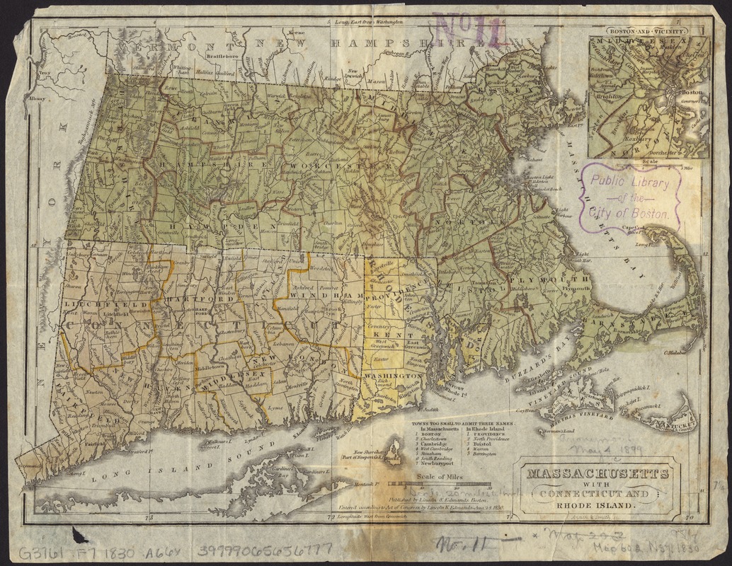
Massachusetts with Connecticut and Rhode Island
Item Information
- Title:
- Massachusetts with Connecticut and Rhode Island
- Creator:
- Annin & Smith
- Name on Item:
-
Annin & Smith sc.
- Date:
-
1830
- Format:
-
Maps/Atlases
- Location:
-
Boston Public Library
Norman B. Leventhal Map & Education Center - Collection (local):
-
Norman B. Leventhal Map & Education Center Collection
- Subjects:
-
Counties--Connecticut--Maps
Cities and towns--Connecticut--Maps
Counties--Massachusetts--Maps
Cities and towns--Massachusetts--Maps
Counties--Rhode Island--Maps
Cities and towns--Rhode Island--Maps
Massachusetts--Maps
Connecticut--Maps
Rhode Island--Maps
- Places:
-
Massachusetts
Rhode Island
Connecticut
- Extent:
- 1 map : hand col. ; 19 x 27 cm.
- Terms of Use:
-
No known copyright restrictions.
No known restrictions on use.
- Publisher:
-
Boston :
Lincoln & Edmands
- Scale:
-
Scale [ca. 1:1,260,000]
- Language:
-
English
- Notes:
-
Relief shown pictorially.
Prime meridians: Washington and Greenwich.
Inset: Boston and vicinity.
- Identifier:
-
06_01_008697
- Call #:
-
G3761.F7 1830 .A66x
- Barcode:
-
39999065656777


