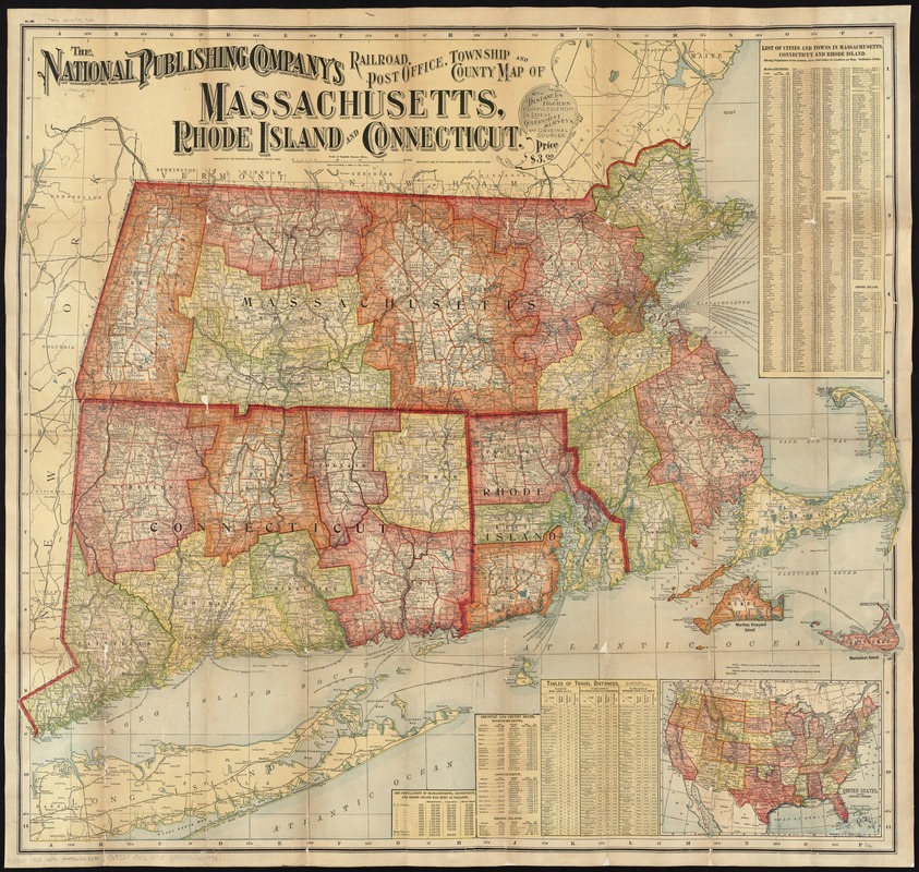
The National Publishing Company's railroad, post office, township and county map of Massachusetts, Rhode Island and Connecticut : with distances in figures compiled from the latest government surveys and original sources
Item Information
- Title:
- The National Publishing Company's railroad, post office, township and county map of Massachusetts, Rhode Island and Connecticut : with distances in figures compiled from the latest government surveys and original sources
- Title (alt.):
-
Railroad, post office, township and county map of Massachusetts, Rhode Island and Connecticut
- Creator:
- National Publishing Company (Boston, Mass.)
- Date:
-
[ca. 1902]
- Format:
-
Maps/Atlases
- Location:
-
Boston Public Library
Norman B. Leventhal Map & Education Center - Collection (local):
-
Norman B. Leventhal Map & Education Center Collection
- Subjects:
-
Railroads--Connecticut--Maps
Railroads--Massachusetts--Maps
Railroads--Rhode Island--Maps
New England--Maps
Rhode Island--Maps
Connecticut--Maps
Massachusetts--Maps
- Places:
-
Massachusetts
New England (area)
Rhode Island
Connecticut
- Extent:
- 1 map : col. ; 86 x 94 cm.
- Terms of Use:
-
No known copyright restrictions.
No known restrictions on use.
- Publisher:
-
Boston, Mass :
National Publishing Co.
- Scale:
-
Scale [ca. 1:316,800]
- Language:
-
English
- Notes:
-
Relief shown by hachures and spot heights.
Inset: United States, showing political divisions.
Includes list of cities and towns, counties and county seats, tables of travel distances, and population statistics.
- Identifier:
-
06_01_009721
- Call #:
-
G3720 1902 .N38
- Barcode:
-
39999065663351


