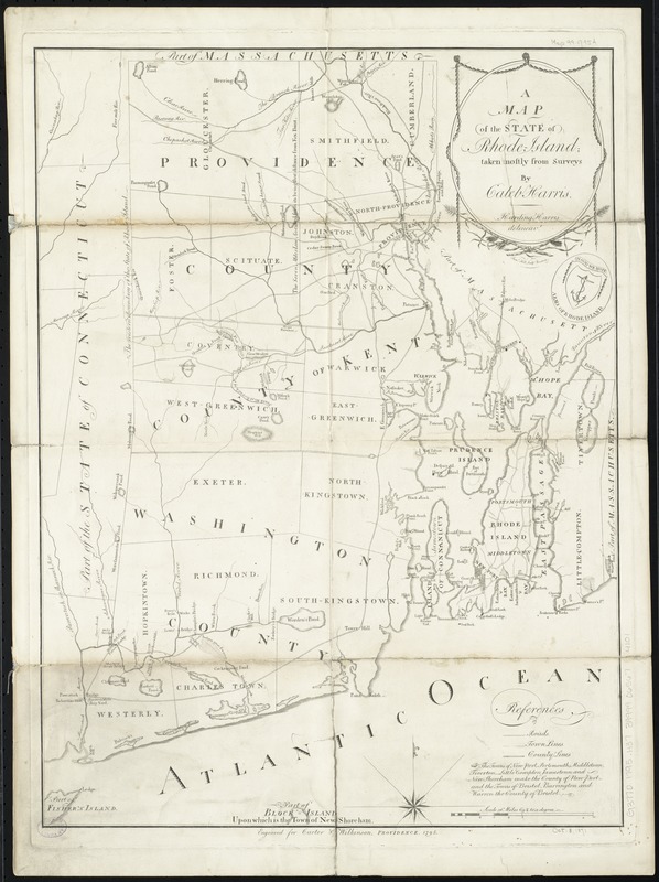
A map of the State of Rhode Island
This map is also available in American Revolutionary Geographies Online (ARGO), a collections portal especially built for material relating to the American Revolutionary War Era. Visit ARGO to learn more about this item and explore the historical geography of North America in the late eighteenth century.
Item Information
- Title:
- A map of the State of Rhode Island
- Creator:
- Harris, Harding.
- Name on Item:
-
taken mainly from surveys by Caleb Harris ; Saml. Hill, sculpt.
- Date:
-
1795
- Format:
-
Maps/Atlases
- Location:
-
Boston Public Library
Norman B. Leventhal Map & Education Center - Collection (local):
-
Norman B. Leventhal Map & Education Center Collection
- Subjects:
-
Rhode Island--Maps
- Places:
-
Rhode Island
- Extent:
- 1 map ; 54 x 40 cm.
- Terms of Use:
-
No known copyright restrictions.
No known restrictions on use.
- Publisher:
-
Providence :
Carter & Wilkinson
- Scale:
-
Scale [ca. 1:163,000]
- Language:
-
English
- Notes:
-
Relief shown by hachures.
- Identifier:
-
06_01_010541
- Call #:
-
G3770 1795 .H37
- Barcode:
-
39999065674101


