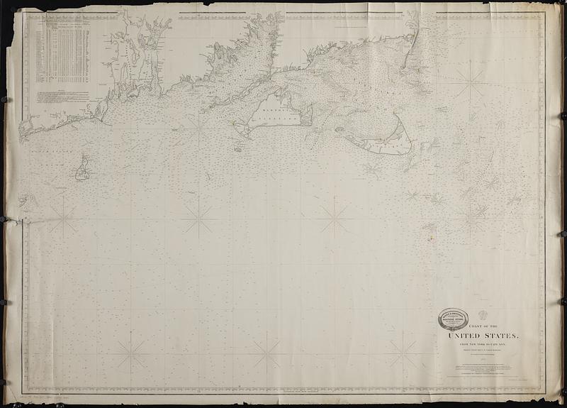
Coast of the United States, from New York to Cape Ann : drawn from the U.S. Coast Surveys
Item Information
- Title:
- Coast of the United States, from New York to Cape Ann : drawn from the U.S. Coast Surveys
- Title (alt.):
-
Montauk to Chatham
- Cartographer:
- Copley, Charles
- Publisher:
- Chas. Copley & Sons
- Name on Item:
-
by Charles Copley, hydrographer
- Date:
-
1865
- Format:
-
Maps/Atlases
- Genre:
-
Nautical charts
- Location:
-
Boston Public Library
Norman B. Leventhal Map & Education Center - Collection (local):
-
Norman B. Leventhal Map & Education Center Collection
- Subjects:
-
Massachusetts--Maps
Rhode Island--Maps
Coasts--Massachusetts--Maps
Coasts--Rhode Island--Maps
Navigation--Massachusetts
Navigation--Rhode Island
Navigation--Rhode Island--Block Island Sound
Navigation--Massachusetts--Buzzards Bay
Navigation--Massachusetts--Vineyard Sound
Navigation--Massachusetts--Nantucket Sound
- Places:
-
Massachusetts
Rhode Island
Block Island Sound (bay)
MassachusettsBuzzards Bay
MassachusettsDukes (county)Nantucket Sound (bay)
Vineyard Sound
- Extent:
- 1 map on 2 sheets ; sheets 93 x 129 cm
- Terms of Use:
-
No known copyright restrictions.
No known restrictions on use.
- Publisher:
-
New York :
Published by Charles Copley & Sons
- Scale:
-
Scale approximately 1:180,000
- Language:
-
English
- Notes:
-
Boston Public Library copy imperfect: lacking north sheet showing Cape Cod to Cape Ann.
Depths shown by gradients, soundings, and isolines.
Includes tide table and buoys note.
"Entered according to Act of Congress in the year 1856 by C.J & F.S. Copley, in the Clerks office, of the district court, of the Southern district of New York."
Logo at head of title: Hydrographic Office, New York.
Advertisement for Riggs & Brother pasted above title.
Publisher's advertisement pasted on verso, labeling chart Montauk to Chatham.
- Identifier:
-
06_01_018844
- Call #:
-
G3721.P5 1865 .C67
- Barcode:
-
39999085969184


