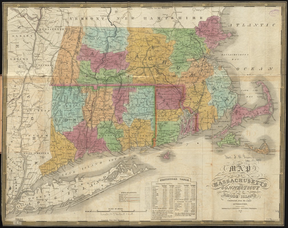
Map of Massachusetts, Connecticut and Rhode Island constructed from the latest authorities
Item Information
- Title:
- Map of Massachusetts, Connecticut and Rhode Island constructed from the latest authorities
- Description:
-
One of the earliest county and township maps to show proposed railroads in New England. Indicates rail line between Schenectady and Albany, N.Y.
- Creator:
- Young, J. H. (James Hamilton)
- Name on Item:
-
J. H. Young sc.
- Date:
-
1831
- Format:
-
Maps/Atlases
- Location:
-
Boston Public Library
Norman B. Leventhal Map & Education Center - Collection (local):
-
Norman B. Leventhal Map & Education Center Collection
- Subjects:
-
New England--Maps
Connecticut--Maps
Massachusetts--Maps
Rhode Island--Maps
- Places:
-
Massachusetts
New England (area)
Rhode Island
Connecticut
- Extent:
- 1 map : hand col. ; 42 x 53 cm.
- Terms of Use:
-
No known copyright restrictions.
No known restrictions on use.
- Publisher:
-
Philadelphia :
S. Augustus Mitchell
- Scale:
-
Scale [ca. 1:685,000]
- Language:
-
English
- Notes:
-
Relief shown pictorially.
Includes statistical table.
- Identifier:
-
06_01_009779
- Call #:
-
G3720 1831 .Y68
- Barcode:
-
39999065709550
- LCCN:
-
98688372


