Toggle navigation
LMEC Home
Exhibitions
Georeferencing
Tools for Teachers
Collections
My Favorites
Sign Up / Log In
Search
Search the map portal
Map Collection
Map Collection
Map Sets
Search
Search
Search for
Search In
All Fields
Creator
Title
Subject
Place
Search All Digital Collections
Advanced Search
8778 Results
My Search
Start Over
More Like
commonwealth:1257bz77s
Remove constraint More Like: commonwealth:1257bz77s
Filter your Search
Place
North and Central America
6,073
United States
4,995
Massachusetts
2,108
Europe
1,359
Suffolk (county)
1,258
Boston
1,231
Canada
448
Asia
422
more
Place
»
Topic
Boston (Mass.)--Maps
741
United States--Maps
273
Real property--Massachusetts--Boston--Maps
252
City planning--Massachusetts--Boston--Maps
191
Landowners--Massachusetts--Boston--Maps
169
Massachusetts--Maps
163
North America--Maps--Early works to 1800
103
New England--Maps
101
more
Topic
»
Date
Date range begin
–
Date range end
Current results range from
1482
to
2023
View distribution
Creator
United States. Hydrographic Office
594
Boston Redevelopment Authority
193
O.H. Bailey & Co
148
Des Barres, Joseph F. W. (Joseph Frederick Wallet), 1722-1824
124
United States. Post Office Dept
120
Ptolemy, 2nd cent
100
Walling, Henry Francis, 1825-1888
94
Geological Survey (U.S.)
87
more
Creator
»
Format
Maps/Atlases
8,719
Manuscripts
215
Prints
56
Books
36
Objects/Artifacts
10
Drawings/Illustrations
8
Posters
4
Georeferenced
Yes
885
No
7,893
Collection
Norman B. Leventhal Map & Education Center Collection
8,576
Boston and New England Maps
2,364
Urban Maps
2,093
Maritime Charts and Atlases
1,081
American Revolutionary War-Era Maps
638
Boston Redevelopment Authority Collection
229
Massachusetts Real Estate Atlases
38
Mapping Boston Collection
20
more
Collection
»
Available to use
No known restrictions
8,556
Creative Commons license
69
Search Constraints
Sort by date (desc)
relevance
title
date (asc)
date (desc)
Number of results to display per page
100 per page
10
per page
20
per page
50
per page
100
per page
View results as:
grid view
map view
Search Results
401.
North Harvard project area : locality map
402.
Dominican Republic road map 1:250,000
403.
Historic Massachusetts : a travel map to help you feel at home in the Bay State
404.
Metropolitan Transit Authority system route map
405.
Charlestown renewal area : location map
406.
South End renewal area : location map
407.
South End renewal area : blighted areas
408.
Charlestown renewal area : blighted areas
409.
City of Boston topographic and planimetric survey : [Downtown and North End]
410.
Civil War centennial
411.
Navajoland, U.S.A.
412.
Daily weather map : Tuesday, September 29, 1959
413.
Land ownership maps for land in the Government Center urban renewal project area
414.
Metropolitan Transit Authority system route map
415.
A nation of immigrants
416.
Panoramic view of Boston showing golden semicircle
417.
Ward boundaries 1959
418.
Wards & precincts, city of Boston - 1890
419.
Cape Cod and the islands
420.
March 17-21 ; March 22-26
421.
The United States, the land and the people = Les états-Unis, le pays et ses habitants = De Verenigde Staten, het land en het volk
422.
Oil in America : a pictorial story of the petroleum industry in the United States
423.
Sportsmen's fishing map of the United States and neighboring waters
424.
Atlas of town of Weymouth Massachusetts
425.
Dublin
426.
Makers of the U.S.A. : a friendship map
427.
Metropolitan Transit Authority system route map
428.
A two-way street between the Americas
429.
Metropolitan Transit Authority system route map
430.
Town of Belmont Massachusetts
431.
The town of Dedham, Massachusetts : a pictorial map
432.
United States, including territories and insular possessions : showing the extent of public surveys, national parks, national...
433.
Ward lines and voting precincts 1954
434.
Pashtunistan
435.
Map of the Boston Metropolitan District showing park reservations and holdings of the Metropolitan District Commission and...
436.
Maps with a moral
437.
Metropolitan Transit Authority system route map
438.
Eastern Mediterranean
439.
A pictorial stamp map of navigation and exploration
440.
Portugal is not a small country
441.
USAF cloth chart, Western Mediterranean
442.
Armour food source map
443.
The Chevron trail through the scenic west
444.
Development of the Calfpasture, Boston, Massachusetts
445.
Illustrierte karte der Vereinigten Staaten von Amerika : mit darstellung der regionalen bodenschätze, produkte und...
446.
Maps from General plan for Boston : preliminary report, December, 1950
447.
Metropolitan Transit Authority system route map
448.
A Scott-Map of Boston, Massachusetts
449.
World freedom : a factual & pictorial map
450.
Atlas of town of Weymouth Massachusetts
451.
Gay days around America : a pleasure map of festivals, pageants, and special events best reached by Greyhound ... the...
452.
A map of the West Indies and the Spanish Main
453.
The pictorial map, United States stamps
454.
Storrow Memorial Embankment : plan of additions and changes under the requirements of Chapter 262, Acts of 1949
455.
A Texan's map of the United States [of Texas]
456.
These United States : products & industries
457.
United States inlay puzzle
458.
The 100th anniversary map of Abraham Lincoln's visit to Massachusetts, September 11-23, 1848
459.
Ask Shell!
460.
The Boston Globe ski map of northern New England and Canada
461.
Election map of the United States with 49 novel diagrams
462.
Map of the City of Boston, Massachusetts
463.
Map of the island of Tangerina and Wild Island
464.
Metropolitan Transit Authority system route map
465.
Nouveau Paris monumental : itinéraire pratique de l'etranger dans Paris
466.
The pictorial map, a world of stamps
467.
The pictorial map, stamps of America
468.
The pictorial map, stamps of the U.S.A.
469.
Plan de Paris divisé en 20 arrondissements et 80 quartiers
470.
Aaron Bohrod's America, its history
471.
Atlas of the city of Newton Massachusetts : assessors block system
472.
Boston Elevated Railway system route map
473.
Boston Elevated Railway track lengths of surface lines and subway
474.
Catholic America : a pictorial map portraying the contribution of Catholics in the development of the United States of America...
475.
Paul Sample's America, its soil
476.
Shíjú tú
477.
William Gropper's America, its folklore
478.
Bataan
479.
Camarines Sur : (western part)
480.
Cavite
481.
China, south coast, principal ethnic groups and dialects
482.
Climate zones for Eastern Asia
483.
Germany, western border regions, agricultural areas (north of the Main and west of the Rhine Rivers)
484.
Germany western border regions rail traffic volume (excluding inter-Ruhr traffic) summer 1939
485.
Ilocos Sur : northern portion
486.
Java and Madoera : Indonesian ethnic groups, elementary education, and Christian missions
487.
Java and Madoera principal estate regions showing major products
488.
Lesser Sunda Islands, distribution of population
489.
Lesser Sunda Islands Indonesian Ethnic groups and Christian missions
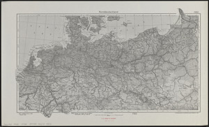
490.
Norddeutschland
491.
Pampanga
492.
Philippine Islands : [outline map]
493.
A pictorial map of North America
494.
Pictorial map of the American continent : featuring the Pan American Highway and showing some of the natural resources, scenic...
495.
Süddeutschland, Österreich, Schweiz und östliches Frankreich
496.
Sumatra wegenkaart
497.
Tayabas (northern part)
498.
Tayabas (southern part)
499.
Uprooted people of the U.S.A.
500.
Ward lines and voting precincts circa 1945
‹ Prev
Next ›
1
2
3
4
5
6
7
8
9
…
87
88