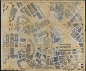
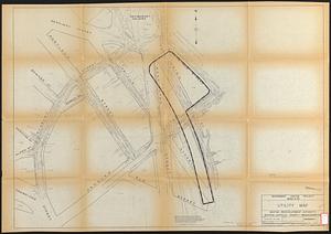
Land ownership maps for land in the Government Center urban renewal project area

Item Information
- Title:
- Land ownership maps for land in the Government Center urban renewal project area
- Contributor:
- Nyman H. Kolodny and Associates
- Cartographer:
- Blake, James
- Cartographer:
- Bonner, John, approximately 1643-1726
- Date:
-
[ca. 1959]
- Format:
-
Maps/Atlases
- Location:
-
Boston Public Library
Central Library in Copley Square - Collection (local):
-
Boston Public Library Collection
- Subjects:
-
Government Center (Boston, Mass.)--Maps
Land tenure--Massachusetts--Boston--Maps
Real property--Massachusetts--Boston--Maps
Urban renewal--Massachusetts--Boston--Maps
- Places:
-
Suffolk (county)Boston
Government Center
- Extent:
- 5 maps : photocopies ; sheets 46 x 60 cm
- Terms of Use:
-
No known copyright restrictions.
No known restrictions on use.
- Place of origin:
-
[Boston]
- Language:
-
English
- Table of Contents:
-
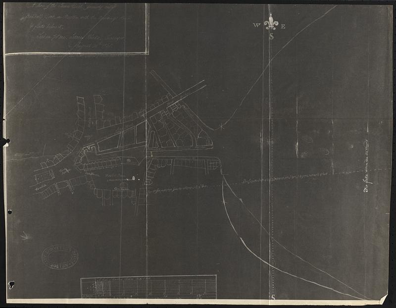
A plan of the town dock, formerly called Bendall's Dock, in Boston, with the buildings round & flatts before it / taken [by?] me, James Blake, surveyor, August 26th, 1738 ; copied from an old plan in the possession of Charles Shaw esq., Jany. 1817
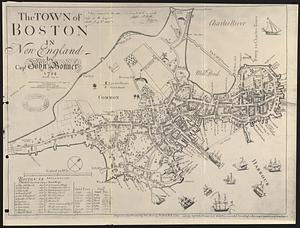
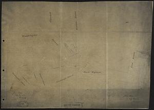
The town of Boston in New England / by Capt. John Bonner 1722
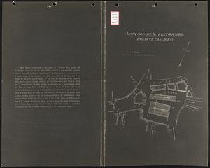
Dock Square, Market Square, Roebuck Passage &c.
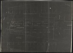
[Plan of the area around Exchange St. between Dock Sq. and State St., ca. 1925]
[Washington St. and Brattle St.] ; [Dock Square] / James Slade, city engineer, Feb. 25 1856
- Catalog Record:
-
Accompanying text
- Notes:
-
Accompanies a report providing ownership information for certain land in the Government Center urban renewal project in Downtown Boston, researching ownership of these areas back to colonial times and taking into consideration the law of tidelands as affecting Dock Square.
Maps are reproduced for 1722, 1738, 1804, 1852 and 1925.
- Identifier:
-
06_01_017362a
06_01_017362b
06_01_017362c
06_01_017362d
06_01_017362e
- Call #:
-
BRA/1242
- Barcode:
-
39999063151722