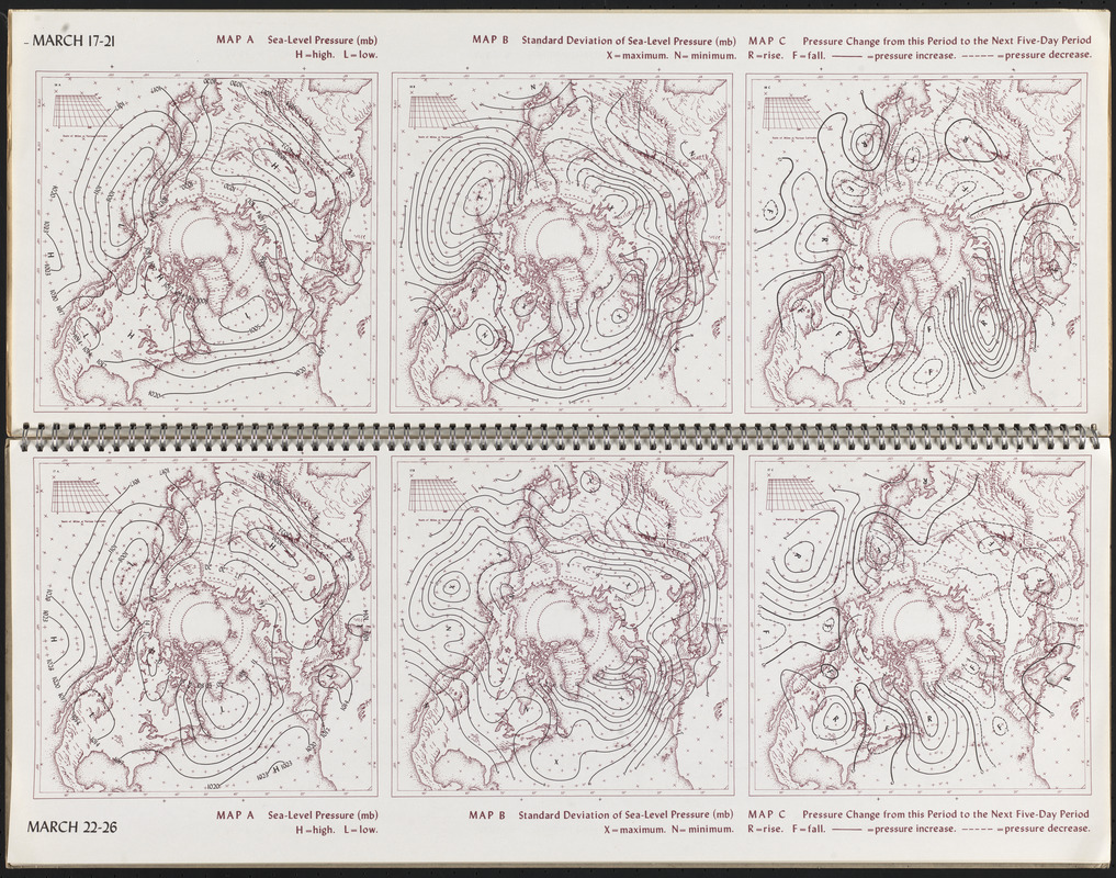
March 17-21 ; March 22-26
Item Information
- Title:
- March 17-21 ; March 22-26
- Description:
-
Atmospheric pressure, or the weight of air above any given point, was first measured using a barometer in the 17th century, and is one of the main elements that combine to make weather along with temperature and precipitation. Sea-level pressure is the atmospheric pressure at sea level for any given location. This mid-20th-century nautical atlas made on behalf of the U.S. Air Force, with a viewpoint from the North Pole, presents sea-level pressure readings in the northern hemisphere. The solid and dashed lines, known as isobars, represent areas of equal pressure. Variations in pressure can be analyzed by meteorologists to see high or low pressure areas.
- Cartographer:
- Lahey, James F. (James Frederick), 1921-
- Date:
-
1958
- Format:
-
Maps/Atlases
- Location:
-
Boston Public Library
Norman B. Leventhal Map & Education Center - Collection (local):
-
Norman B. Leventhal Map & Education Center Collection
- Subjects:
-
Atmospheric pressure--Maps
North Atlantic Ocean--Maps
- Places:
-
Atlantic Ocean
- Extent:
- 6 maps on 2 pages : color ; 48 x 62 cm
- Terms of Use:
-
Copyright University of Wisconsin Press.
All rights reserved.
- Publisher:
-
Madison :
University of Wisconsin Press
- Language:
-
English
- Notes:
-
In the Atlas of Five-Day Normal Sea-Level Pressure Charts for the Northern Hemisphere.
- Notes (exhibitions):
-
Exhibited: "Regions and Seasons: Mapping Climate through History" organized by the Norman B. Leventhal Map Center at the Boston Public Library, 2017.
- Identifier:
-
06_01_015939
- Call #:
-
QC1 .U53 No 57-226 FOLIO
- Barcode:
-
39999065645895