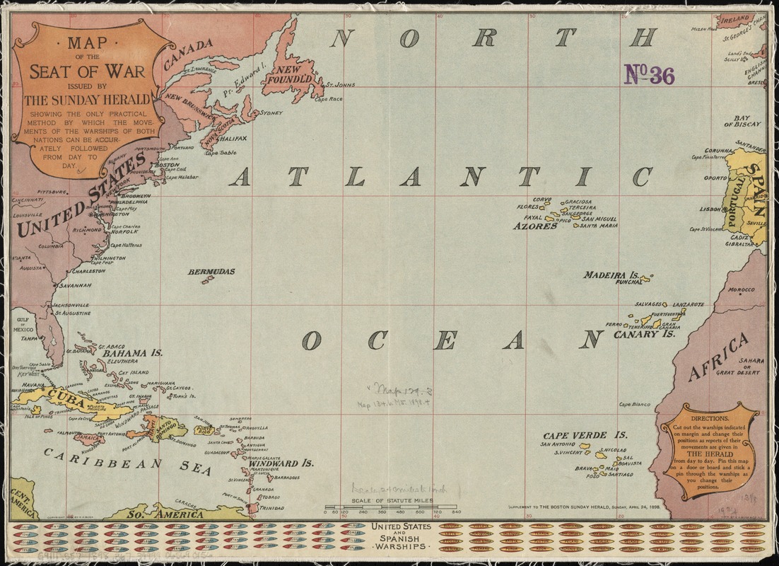
Map of the seat of war : showing the only practical method by which the movements of the warships of both nations can be accurately followed from day to day
Item Information
- Title:
- Map of the seat of war : showing the only practical method by which the movements of the warships of both nations can be accurately followed from day to day
- Title (uniform):
-
Boston herald
- Name on Item:
-
issued by the Sunday Herald.
- Date:
-
1898
- Format:
-
Maps/Atlases
- Location:
-
Boston Public Library
Norman B. Leventhal Map & Education Center - Collection (local):
-
Norman B. Leventhal Map & Education Center Collection
- Subjects:
-
Spanish-American War, 1898--Maps
West Indies--Maps
North Atlantic Ocean--Maps
- Places:
-
West Indies
Atlantic Ocean
- Extent:
- 1 map : color ; 34 x 50 cm
- Terms of Use:
-
No known copyright restrictions.
No known restrictions on use.
- Publisher:
-
[Boston] :
Sunday Herald,
- Scale:
-
Scale approximately 1:15,540,000
- Language:
-
English
- Notes:
-
Covers the North Atlantic Ocean between Spain and the United States.
Includes markers with names of United States and Spanish warships in the bottom margin. Ships are intended to be cut out and used to follow their positions.
"Supplement to the Boston Sunday Herald, Sunday, April 24, 1898."
- Identifier:
-
06_01_011897
- Call #:
-
G9111.S57 1898 .B67
- Barcode:
-
39999065690156


