The Evening Post map of the West Indies
Item Information
- Title:
- The Evening Post map of the West Indies
- Description:
-
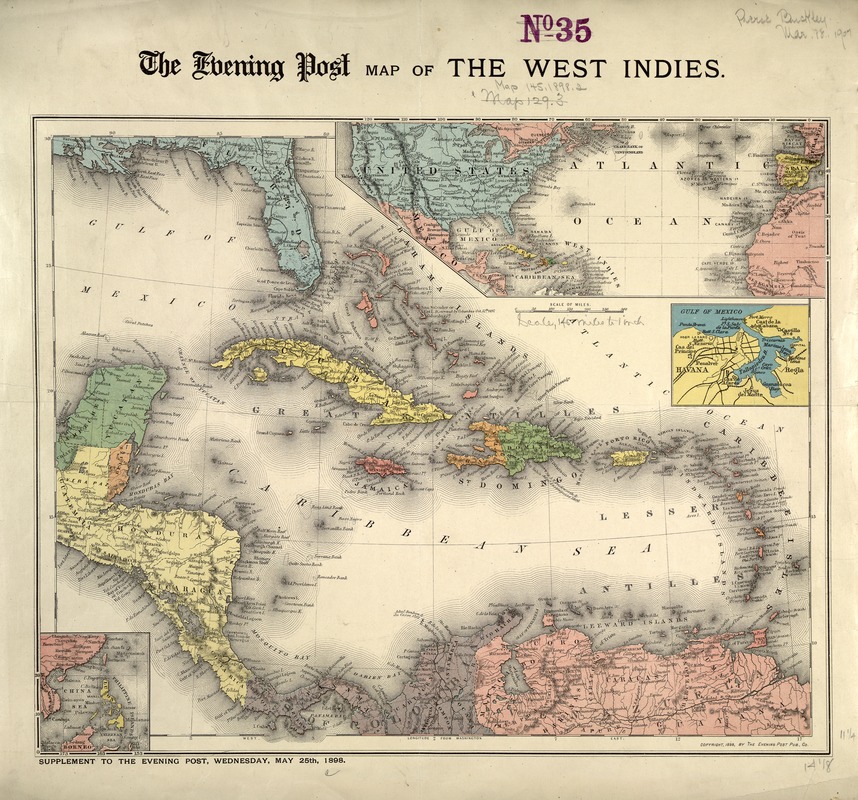
Printed during the Spanish-American War as a supplement to The Evening Post, this map is good example of journalistic cartography. Its purpose was to educate the newspapers readers and help them follow the course of the war just as modern newspapers publish maps and inserts to illustrate events of national and international interest. The insets of Havana and the Philippines may seem out of place, but are in fact quite timely; in May 1898, the United States was simultaneously sending troops to the Philippines and preparing for war with Cuba, both under Spanish control. With the United States undertaking territorial expansion in several parts of the world in 1898, this map would have been an indispensable guide for the American public to keep track of international developments.
- Date:
-
1898
- Format:
-
Maps/Atlases
- Location:
-
Boston Public Library
Norman B. Leventhal Map & Education Center - Collection (local):
-
Norman B. Leventhal Map & Education Center Collection
- Subjects:
-
Spanish-American War, 1898--Maps
West Indies--Maps
Caribbean Area--Maps
- Places:
-
West Indies
Caribbean Sea
- Extent:
- 1 map : col. ; 39 x 30 cm.
- Terms of Use:
-
No known copyright restrictions.
No known restrictions on use.
- Publisher:
-
New York :
Evening Post Publishing Co.
- Scale:
-
Scale [ca. 1:9,500,000].
- Language:
-
English
- Notes:
-
Relief shown by hachures.
Includes insets of the Atlantic Ocean, Havana Harbor and the Philippines.
"Supplement to the Evening Post, Wednesday, may 25th, 1898."
Featured in the Faces & Places Exhibit, Krvais Center, Palm Beach, FL, since 2005. MB (BRL)
- Identifier:
-
05_04_000125
- Call #:
-
G4900 1898 .E9
- Barcode:
-
39999052509732


