Daily weather map : Tuesday, September 29, 1959
Item Information
- Title:
- Daily weather map : Tuesday, September 29, 1959
- Title (uniform):
-
Daily weather map (District of Columbia, Maryland, Virginia, Delaware ed.)
- Description:
-
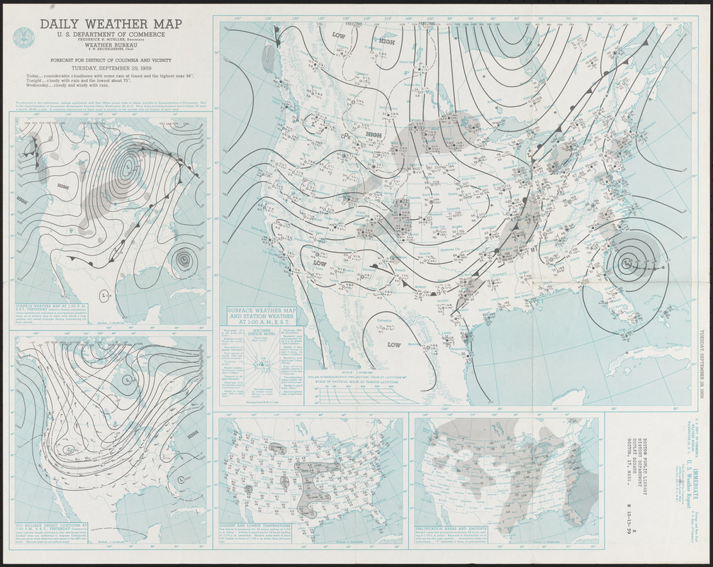
Regions and Seasons: Early 19th-century weather observers often looked to the damage left in the wake of a hurricane to determine how the storm functioned. However, with the advent of aircraft and radar in the 1940s, meteorologists could observe hurricanes from above. This daily weather map – issued by the U.S. Weather Bureau – illustrates a hurricane that threatened South Carolina on September 29, 1959. The concentric rings with an "L" in the center indicate the low pressure system of Hurricane Gracie, which lasted ten days. These weather maps have documented the basic atmospheric elements of temperature, pressure, precipitation, humidity and a forecast since the late 19th century.
- Creator:
- United States. Weather Bureau
- Name on Item:
-
U.S. Department of Commerce, Weather Bureau
- Date:
-
1959
- Format:
-
Maps/Atlases
- Location:
-
Boston Public Library
Norman B. Leventhal Map & Education Center - Collection (local):
-
Norman B. Leventhal Map & Education Center Collection
- Subjects:
-
Weather--Maps
United States--Climate--Maps
- Places:
-
United States
- Extent:
- 5 maps on 1 sheet ; 48 x 60 cm.
- Terms of Use:
-
No known copyright restrictions.
No known restrictions on use.
- Publisher:
-
Washington, D.C. :
The Bureau
- Scale:
-
Scales differ
- Language:
-
English
- Notes:
-
Large surface map of the United States, southern Canada, northern Mexico, and Cuba prepared from weather observations taken at 1:30 a.m.
Insets: Weather map for 1:30 p.m.--700-millibar constant pressure chart--Highest and lowest temperatures--Precipitation areas and amounts.
- Notes (exhibitions):
-
Exhibited: "Regions and Seasons: Mapping Climate through History" organized by the Norman B. Leventhal Map Center at the Boston Public Library, 2017.
- Identifier:
-
06_01_015944
- Call #:
-
QC983 .U52 1959 Sep 29
- Barcode:
-
39999085942058


