Development of the Calfpasture, Boston, Massachusetts

Item Information
- Title:
- Development of the Calfpasture, Boston, Massachusetts
- Cartographer:
- Glaser and Gray
- Name on Item:
-
Glaser and Gray
- Date:
-
1950
- Format:
-
Maps/Atlases
- Location:
-
Boston Public Library
Central Library in Copley Square - Collection (local):
-
Boston Public Library Collection
- Subjects:
-
Columbia Point (Boston, Mass.)--Maps
Dorchester (Boston, Mass.)--Maps
Housing--Massachusetts--Boston--Maps
City planning--Massachusetts--Boston--Maps
Urban renewal--Massachusetts--Boston--Maps
- Places:
-
Suffolk (county)BostonDorchester
Suffolk (county)Columbia Point (cape)
- Extent:
- 7 sheets : maps, illustrations ; sheets 36 x 46 cm
- Terms of Use:
-
No known copyright restrictions.
No known restrictions on use.
- Publisher:
-
Boston :
Glaser and Gray
- Language:
-
English
- Table of Contents:
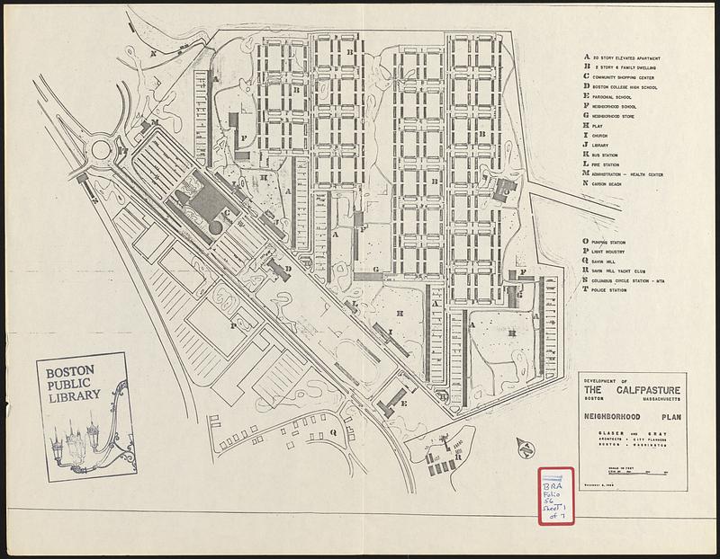
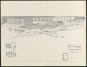
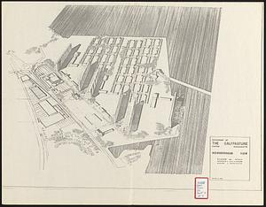
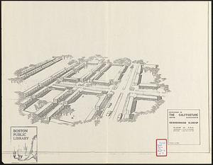
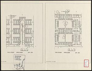
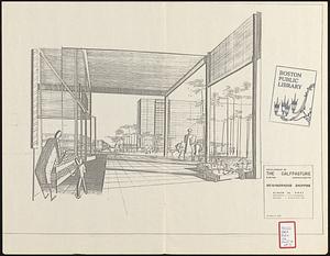
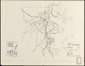
-
Neighborhood plan
Columbia Circle approach
Neighborhood view
Neighborhood close-up
Two-story dwelling plot plan
Neighborhood shopping
Location of site
- Catalog Record:
-
Accompanying text
- Notes:
-
Part of a report prepared for the Boston Housing Authority concerning the development of Calf Pasture in Boston's Dorchester neighborhood into affordable housing.
- Identifier:
-
06_01_017305a
06_01_017305b
06_01_017305c
06_01_017305d
06_01_017305e
06_01_017305f
06_01_017305g
- Call #:
-
BRA/FOLIO/56
- Barcode:
-
mq6311511


