Toggle navigation
LMEC Home
Exhibitions
Georeferencing
Tools for Teachers
Collections
My Favorites
Sign Up / Log In
Search
Search the map portal
Map Collection
Map Collection
Map Sets
Search
Search
Search for
Search In
All Fields
Creator
Title
Subject
Place
Search All Digital Collections
Advanced Search
98 Results
My Search
Start Over
g1105
Remove constraint g1105
Filter your Search
Place
North and Central America
68
United States
27
Canada
14
North America
6
Québec
6
Atlantic Ocean
4
French Guiana
4
New England
4
more
Place
»
Topic
North America--Maps--Early works to 1800
6
America--Discovery and Exploration--Maps--Early works to 1800
5
Québec (Québec)--Maps--Early works to 1800
5
Tactics--Maps--Early works to 1800
5
Braddock's Campaign, 1755--Maps
4
New England--Maps--Early works to 1800
4
United States--History--French and Indian War, 1754-1763--Maps
4
United States--History--French and Indian War, 1754-1763--Maps--Early works to 1800
4
more
Topic
»
Date
Date range begin
–
Date range end
Current results range from
1511
to
1777
View distribution
Creator
Jefferys, Thomas, -1771
76
Sayer, Robert, 1725-1794
66
Celi, Francisco Mathias
8
Le Rouge, Georges-Louis.
7
Green, John, -1757
6
Orme, Robert, -1781
6
Bellin, Jacques Nicolas, 1703-1772
2
Bully, le sieur
2
more
Creator
»
Format
Maps/Atlases
98
Georeferenced
Yes
1
No
97
Collection
Norman B. Leventhal Map Center Collection
98
American Revolutionary War-Era Maps
68
Maritime Charts and Atlases
20
Boston and New England Maps
4
Urban Maps
2
Available to use
No known restrictions
98
Search Constraints
Sort by title
relevance
title
date (asc)
date (desc)
Number of results to display per page
100 per page
10
per page
20
per page
50
per page
100
per page
View results as:
grid view
map view
Search Results
1.
An accurate map of His Majesty's province of New-Hampshire in New England : taken from actual surveys of all the inhabited...
2.
An accurate map of North America : describing and distinguishing the British, Spanish and French dominions on this great...
3.
Antigoa
4.
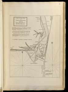
An authentic plan of the River St. Laurence from Sillery to the fall of Montmorenci, with the operations of the siege of Quebec...
5.
An authentic plan of the town and harbour of Cap-François in the isle of St. Domingo
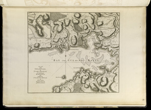
6.
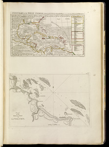
The Caribbee Islands and Guayana
7.
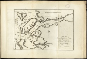
Carte des bayes, rades, et port de Plaisance dans l'isle de Terre-Neuve
8.
Carte d'une partie de l'Amérique Septentrionale : pour servir à l'intellegence du mémoire sur les prétentions des Anglois...
9.
Charles-town, capitale de la Caroline
10.
Chart comprizing Greenland with the countries and islands about Baffin's and Hudson's Bays
11.
Chart containing part of the Icy Sea with the adjacent coast of Asia and America
12.
Chart containing the coasts of California, New Albion, and Russian discoveries to the north : with the peninsula of Kamchatka,...
13.
Chart containing the greater part of the South Sea to the south of the line, with islands dispersed thro' the same
14.
Chart of South America, comprehending the West Indies, with the adjacent islands, in the Southern Ocean, and South Sea
15.
Chart of the Atlantic Ocean, with the British, French, & Spanish settlements in North America, and the West Indies : as also on...
16.
Chart of the Atlantic Ocean, with the British, French, & Spanish settlements in North America, and the West Indies : as also on...
17.
A chart of the harbour of Halifax in Nova Scotia : with Jebucto Bay and Cape Sambro also the islands, ledges of rocks, shoals &...
18.
A correct map of the coast of New England
19.
A correct plan of the environs of Quebec, and of the battle fought on the 13th September, 1759 : together with a particular...
20.
Dominica
21.
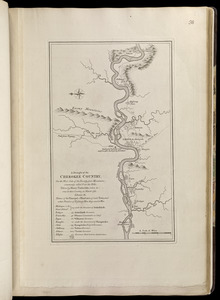
A draught of the Cherokee Country, on the west side of the Twenty Four Mountains, commonly called Over the Hills
22.
The Dutch colony of Surinam, as laid down by L: Colonel Spiering, Chief Engineer at Surinam
23.
Florida from the latest authorities
24.
A general map of the middle British colonies in America : viz. Virginia, Maryland, Delaware, Pensilvania, New-Jersey, New-York,...
25.
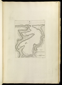
The grand bay of Nipe on the north side of Cuba from Spanish draughts ; Plan of Puerto de Baracoa
26.
Guadaloupe, one of the Caribbee Islands subject to France in the West Indies
27.
The island and colony of Cayenne subject to the French, on the continent of South America
28.
The island of Hispaniola called by the French St. Domingo : subject to France & Spain
29.
Jamaica
30.
Kingston, capitale de la Jamaique : bâtie par les Anglois en 1692
31.
A large and particular plan of Shegnekto Bay, and the circumjacent country, with the forts and settlements of the French 'till...
32.
A map of Canada and the north part of Louisiana with the adjacent countrys
33.
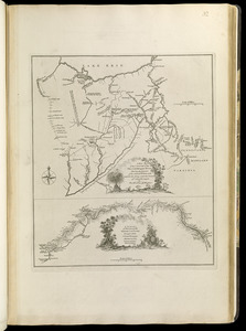
A map of South Carolina and a part of Georgia : containing the whole sea-coast; all the islands, inlets, rivers, creeks,...
34.
A map of the country between Will's Creek & Monongahela River shewing the rout and encampments of the English army in 1755
35.
A map of the country on the Ohio and Muskingum Rivers : shewing the situation of the Indian towns with respect to the army...
36.
A map of the discoveries made by the Russians on the North West coast of America
37.
A map of the island of Guadaloupe
38.
A map of the isle of Cuba : with the Bahama Islands, Gulf of Florida, and Windward Passage ; drawn from English and Spanish...
39.
A map of the most inhabited part of New England : containing the provinces of Massachusets Bay and New Hampshire, with the...
40.
A map of the most inhabited part of Virginia containing the whole province of Maryland with part of Pensilvania, New Jersey and...
41.
A map of the n.e. part of Asia, and n.w. parts of America, shewing their situations with respect to Japan
42.
A map of the several dispositions of the English Fleet & Army on the River St. Laurence to the taking of Quebec
43.
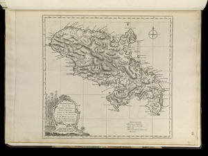
Martinico, one of the Caribbee Islands in the West Indies : subject to the French
44.
A new and exact plan of Cape Fear River, from the bar to Brunswick
45.
A new chart of the West Indies, drawn from the best Spanish maps, and regulated by astronomical observations ; Plan of the road...
46.
A new map of Nova Scotia, and Cape Britain : with the adjacent parts of New England and Canada, composed from a great number of...
47.
North America : from the French of Mr. d'Anville, improved with the back settlements of Virginia and course of Ohio,...
48.
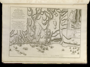
North view of Pensacola, on the island of Santa Rosa ; Plan of the harbour and settlement of Pensacola
49.
Païs cedés, sheet IId, containing the Peninsula & Gulf of Florida, with the Bahama Islands
50.
Païs cedés, sheet Ist, containing the coast of Louisiana and Florida
51.
[Plan d'Amboy : vues de la rade de Charles-Town et de Fort Sulivan, mai 1780]
52.
Plan de Boston
53.
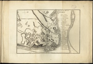
Plan de la ville de Quebec
54.
Plan de l'isle de la Grenade : ou sont marqués dans leur juste position, les ports et mouillages, les ville et bourgs, les...
55.
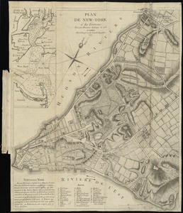
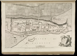
Plan de New-York et des environs
56.
Plan de Puerto de Mariel
57.
Plan of Bahía Honda ; Plan of Puerto de Cavañas
58.
Plan of Bahia Xagua on the south side of Cuba ; Plan of the Colorado Rocks, near the west end of Cuba
59.
Plan of Fort le Quesne, built by the French at the fork of the Ohio and Monongahela in 1754
60.
Plan of Guantanimo, called by the English Cumberland Harbor ; Plan of the city and harbour of St. Jago de Cuba
61.
Plan of La Vera Cruz, from Spanish draughts ; Plan of Port Royal Laguna, commonly called Logwood Creeks
62.
Plan of New Orleans the capital of Louisiana : with the disposition of its quarters and canals as they have been traced by Mr....
63.
Plan of Puerto Cavello, on the coast of the Caracas ; Plan of Puerto de La Guaira on the coast of the Caracas
64.
A plan of Quebec the capital of New France or Canada
65.
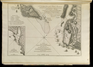
Plan of the attack against Basseterre on the island of Guadeloupe by a squadron of his Majesty's ships of war commanded by...
66.
Plan of the attack against Fort Louis now Fort George, at Point à Pitre on the island of Guadaloupe : by a squadron of His...
67.
Plan of the battle near Bushy Run, gained by Colonel Bouquet over the Delawares, Shawanese, Mingoes, Wyandots, Mohikons,...
68.
A plan of the city, and fortifications, of Louisburg : from a survey made by Richard Gridley, Lieut. Coll. of the Train of...
69.
Plan of the city and harbour of the Havana ; Plan of Bahia de Matanzas
70.
Plan of the city and suburbs of Carthagena ; Plan of the bay & town of Sta. Martha, on the coast of Tierra Firma
71.
Plan of the city of San Domingo
72.
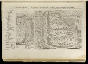
A plan of the disposition of the advanced party consisting of 400 men : to defend the workers in making the road
73.
A plan of the encampment of the detachment from the little Meadows
74.
A plan of the field of battle and disposition of the troops, as they were on the march at the time of the attack on the 9th of...
75.
Plan of the harbour of San Fernando de Omoa ; A map of the Isthmus of Panama, drawn from Spanish surveys
76.
A plan of the line of march of the detachment from the little Meadows
77.
A plan of the line of march with the whole baggage
78.
Plan of the town and citadel of Fort Royal, the capital of Martinico : with the Bay of Cul de Sac Royal
79.
Plan of the town and fort of Grenada
80.
Plan of the town and fortifications of Montreal or Ville Marie in Canada
81.
Plan of the town and harbour of San Juan de Puerto Rico ; Plan of the Aguada Nueva de Puerto Rico
82.
Plan of the town of Basse Terre the capital of Guadaloupe from an authentic survey
83.
Plan of the town of Cayenne and Fort St. Michael
84.
Plan of the town, road, and harbour of Chagre ; Plan of Porto Belo
85.
Plan of Zisapata Bay ; Plan of the harbour of Carthagena
86.
Port Royal appellé aujourd. par les Anglois Annapolis Royal
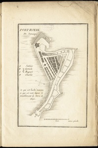
87.
Port-Royal de Jamaique
88.
A prospective view of the battle fought near Lake George, on the 8th of Sepr. 1755, between 2000 English, with 250 Mohawks,...
89.
The provinces of New York, and New Jersey; with part of Pensilvania, and the governments of Trois Rivieres, and Montreal
90.
Sault du Niagara de 135 pieds de haut
91.
St. Christophers
92.
A survey of the coast about Cape Lookout in North Carolina, taken the 29th. of June 1756
93.
Tertia Asiae tabula
94.
To the Honourable Thomas Penn and Richard Penn, Esqrs., true & absolute proprietaries & Governours of the Province of...
95.
Tobago
96.
Vera-Cruz dans le Golfe du Méxique [and] Isle St. Juan, Fort de St. Jean d'Ulloa
97.
Vue de Quebec, capitale du Canada
98.
The West Indies exhibiting the English, French, Spanish, Dutch & Danish settlements


![Vera-Cruz dans le Golfe du Méxique [and] Isle St. Juan, Fort de St. Jean d'Ulloa](https://bpldcassets.blob.core.windows.net/derivatives/images/commonwealth:cj82kx24p/image_thumbnail_300.jpg)

