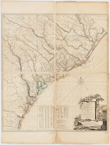
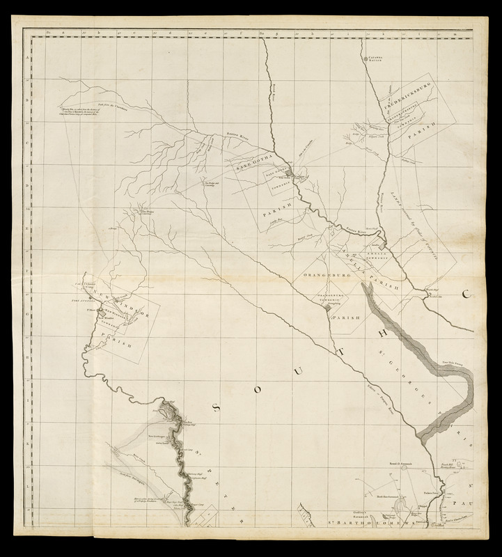
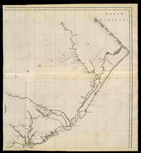
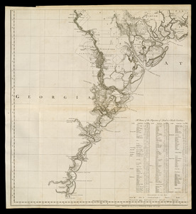
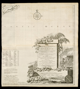
A map of South Carolina and a part of Georgia : containing the whole sea-coast; all the islands, inlets, rivers, creeks, parishes, townships, boroughs, roads, and bridges; as also, several plantations, with their proper boundary-lines, their names, and the names of their proprietors

This map is also available in American Revolutionary Geographies Online (ARGO), a collections portal especially built for material relating to the American Revolutionary War Era. Visit ARGO to learn more about this item and explore the historical geography of North America in the late eighteenth century.
Item Information
- Title:
- A map of South Carolina and a part of Georgia : containing the whole sea-coast; all the islands, inlets, rivers, creeks, parishes, townships, boroughs, roads, and bridges; as also, several plantations, with their proper boundary-lines, their names, and the names of their proprietors
- Cartographer:
- De Brahm, John Gerar William, 1717-approximately 1799
- Surveyor:
- Bull, William, 1710-1791
- Publisher:
- Sayer, Robert, 1725-1794
- Engraver:
- Jefferys, Thomas, -1771
- Name on Item:
-
composed from surveys taken by the Hon. William Bull, Esq., Lieutenant Governor, Captain Gascoign, Hugh Bryan, Esq; and the author William De Brahm ; engraved by Thomas Jefferys
- Date:
-
[1768]
- Format:
-
Maps/Atlases
- Location:
-
Boston Public Library
Norman B. Leventhal Map & Education Center - Collection (local):
-
Norman B. Leventhal Map & Education Center Collection
- Subjects:
-
Real property--South Carolina--Maps--Early works to 1800
Real property--Georgia--Maps--Early works to 1800
South Carolina--Maps--Early works to 1800
Georgia--Maps--Early works to 1800
- Places:
-
South Carolina
Georgia
- Extent:
- 1 map on 4 sheets ; 135 x 122 cm., on sheets 65 x 70 cm.
- Terms of Use:
-
No known copyright restrictions.
No known restrictions on use.
- Publisher:
-
London :
T. Jefferys
- Scale:
-
Scale [ca. 1:315,000]
- Language:
-
English
- Notes:
-
Relief shown by hachures.
Also shows parishes and land plots.
Includes notes, geologic cross-section, and index to landowners.
"To the Right Honourable George Dunk, Earl of Halifax ... "
Appears in Jefferys' General topography of North America and the West Indies. London: Printed for Robert Sayer, ... and Thomas Jefferys, 1768.
- Notes (date):
-
This date is inferred.
- Notes (citation):
-
LC Maps of North America, 1750-1789, 1517
Cumming, W.P. Southeast in early maps, 310
- Identifier:
-
4000137_0071r
4000137_0072r
4000137_0073r
4000137_0074r
- Call #:
-
G1105 .J4 1768
- Barcode:
-
30000003254685