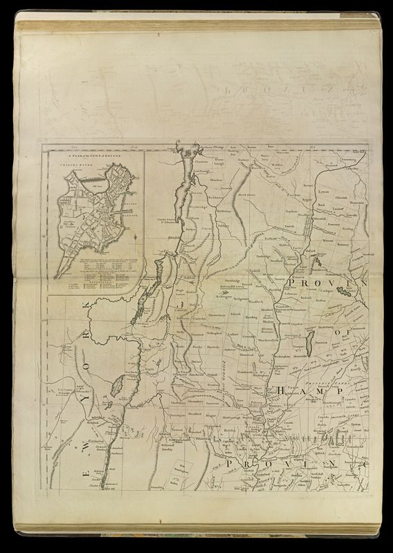
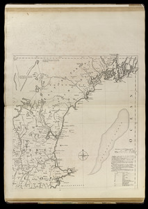
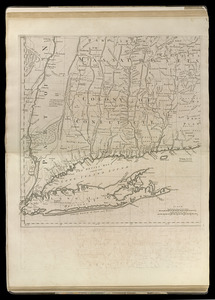
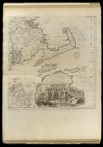
A map of the most inhabited part of New England : containing the provinces of Massachusets Bay and New Hampshire, with the colonies of Conecticut and Rhode Island, divided into counties and townships : the whole composed from actual surveys and its situation adjusted by astronomical observations

This map is also available in American Revolutionary Geographies Online (ARGO), a collections portal especially built for material relating to the American Revolutionary War Era. Visit ARGO to learn more about this item and explore the historical geography of North America in the late eighteenth century.
Item Information
- Title:
- A map of the most inhabited part of New England : containing the provinces of Massachusets Bay and New Hampshire, with the colonies of Conecticut and Rhode Island, divided into counties and townships : the whole composed from actual surveys and its situation adjusted by astronomical observations
- Cartographer:
- Jefferys, Thomas, -1771
- Date:
-
[1763?]
- Format:
-
Maps/Atlases
- Location:
-
Boston Public Library
Norman B. Leventhal Map & Education Center - Collection (local):
-
Norman B. Leventhal Map & Education Center Collection
- Subjects:
-
New England--Maps--Early works to 1800
Boston Harbor (Mass.)--Maps--Early works to 1800
Boston (Mass.)--Maps--Early works to 1800
- Places:
-
New England (area)
MassachusettsBoston Harbor
MassachusettsSuffolk (county)Boston
- Extent:
- 1 map : hand col. ; 103 x 99 cm.
- Terms of Use:
-
No known copyright restrictions.
No known restrictions on use.
- Publisher:
-
[London] :
Thos. Jefferys
- Scale:
-
Scale [ca. 1:440,000]
- Language:
-
English
- Notes:
-
2nd edition, 1st issue (Stevens & Tree).
2nd state (LC).
Prime meridians: London and Ferro.
Relief shown pictorially.
Insets: A plan of the town of Boston -- A plan of Boston Harbor from an accurate survey [ca. 1:150,000].
Imprint November 29th 1755 but published ca. 1763.
- Notes (citation):
-
Stevens & Tree. Comparative cartography, 33c
LC Maps of North America, 1750-1789, 798
McCorkle, B. New England in early printed maps, 755.19
- Identifier:
-
4000137_0038r
4000137_0039r
4000137_0040r
4000137_0041r
- Call #:
-
G1105 .J4 1768
- Barcode:
-
30000002833573


