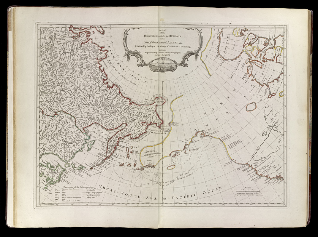
A map of the discoveries made by the Russians on the North West coast of America
Item Information
- Title:
- A map of the discoveries made by the Russians on the North West coast of America
- Creator:
- Jefferys, Thomas, -1771
- Name on Item:
-
published by the Royal Academy of Sciences at Petersburg ; republished by Thomas Jefferys
- Date:
-
[1768]
- Format:
-
Maps/Atlases
- Location:
-
Boston Public Library
Norman B. Leventhal Map & Education Center - Collection (local):
-
Norman B. Leventhal Map & Education Center Collection
- Subjects:
-
North America--Maps--Early works to 1800
Russia--Maps--Early works to 1800
North Pacific Ocean--Maps--Early works to 1800
- Places:
-
North America (area)
Russia
North Pacific
- Extent:
- 1 map : outline col. ; 44 x 61 cm.
- Terms of Use:
-
No known copyright restrictions.
No known restrictions on use.
- Publisher:
-
London :
T. Jefferys
- Scale:
-
Scale [ca. 1:16,000,000]
- Language:
-
English
- Notes:
-
Relief shown pictorially.
Includes nautical exploration routes, historical text, and explanation of Russian names.
Appears in Jefferys' General topography of North America and the West Indies. London: Printed for Robert Sayer, 1768. (G1105 .J4 1768).
- Notes (date):
-
This date is inferred.
- Identifier:
-
4000137_0019
- Call #:
-
G1105 .J4 1768
- Barcode:
-
30000003761306

![Regni Sueciae tabula generalis, divisa in Sueciae, Gotiaeq[ue] regna Finniae ducatum Lapponiam, Livoniam Ingrianq[ue] et in omnes subiacentes provincias](https://bpldcassets.blob.core.windows.net/derivatives/images/commonwealth:cj82kt14t/image_thumbnail_300.jpg)
