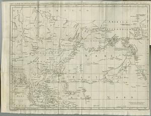
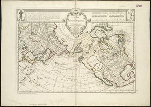
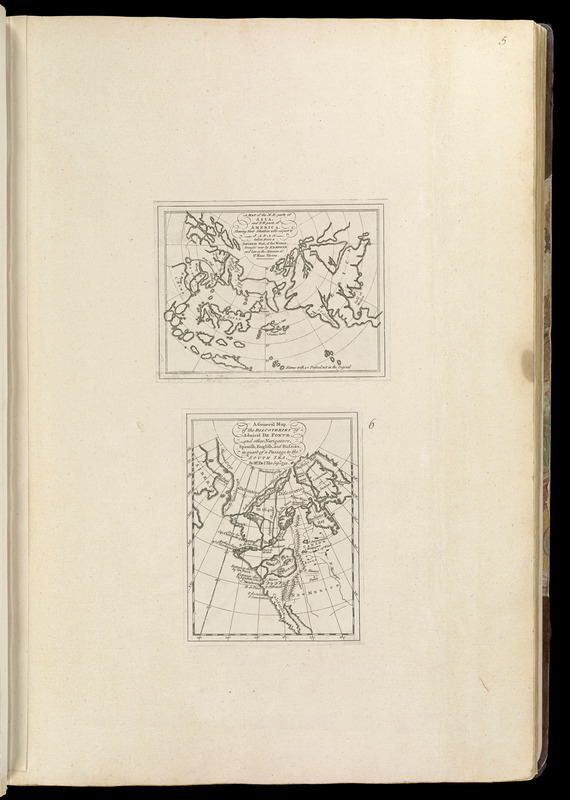
A map of the n.e. part of Asia, and n.w. parts of America, shewing their situations with respect to Japan
Item Information
- Title:
- A map of the n.e. part of Asia, and n.w. parts of America, shewing their situations with respect to Japan
- Cartographer:
- Jefferys, Thomas, -1771
- Name on Item:
-
taken from a Japanese map, of the world brought over by Kemper and late in the musaum of Sr. Hans Sloane
- Date:
-
[1768]
- Format:
-
Maps/Atlases
- Location:
-
Boston Public Library
Norman B. Leventhal Map & Education Center - Collection (local):
-
Norman B. Leventhal Map & Education Center Collection
- Subjects:
-
Northern Hemisphere--Maps--Early works to 1800
Asia--Maps--Early works to 1800
North America--Maps--Early works to 1800
- Places:
-
North America (area)
Asia
Asia
- Extent:
- 1 map ; 12 x 16 cm., on sheet 56 x 37 cm.
- Terms of Use:
-
No known copyright restrictions.
No known restrictions on use.
- Publisher:
-
London :
Printed for Robert Sayer, ... and Thomas Jefferys
- Scale:
-
Scale [ca. 1:100,000,000]
- Language:
-
English
- Notes:
-
Appears in Jefferys' General topography of North America and the West Indies. London: Printed for Robert Sayer, ... and Thomas Jefferys, 1768.
On sheet with: A general map of the discoveries of Admiral De Fonte and other navigators.
- Notes (date):
-
This date is inferred.
- Notes (citation):
-
Phillips, 1196
- Identifier:
-
4000137_0020
- Call #:
-
G1105 .J4 1768
- Barcode:
-
30000003253431