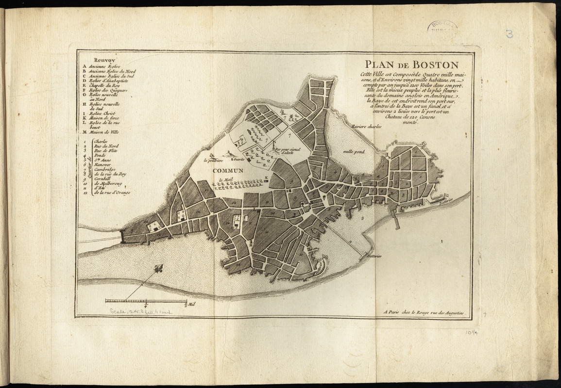
Plan de Boston
This map is also available in American Revolutionary Geographies Online (ARGO), a collections portal especially built for material relating to the American Revolutionary War Era. Visit ARGO to learn more about this item and explore the historical geography of North America in the late eighteenth century.
Item Information
- Title:
- Plan de Boston
- Creator:
- Le Rouge, Georges-Louis
- Date:
-
[1755]
- Format:
-
Maps/Atlases
- Location:
-
Boston Public Library
Norman B. Leventhal Map & Education Center - Collection (local):
-
Norman B. Leventhal Map & Education Center Collection
- Subjects:
-
Boston (Mass.)--Maps--Early works to 1800
- Places:
-
MassachusettsSuffolk (county)Boston
- Extent:
- 1 map ; 18 x 26 cm.
- Terms of Use:
-
No known copyright restrictions.
No known restrictions on use.
- Publisher:
-
Paris :
chez le Rouge
- Scale:
-
Scale [ca. 1:15,000]
- Language:
-
French
- Notes:
-
Relief shown pictorially.
Oriented with north towards the upper right.
Includes text and references.
Appears in Le Rouge's Recueil des plans de l'Amerique Septentrionale.
A reduced, French edition of state 7 of the Bonner plan.
- Notes (date):
-
This date is inferred.
- Identifier:
-
06_01_009933
- Call #:
-
G1105 .L47 1777
- Barcode:
-
3000003816189x


