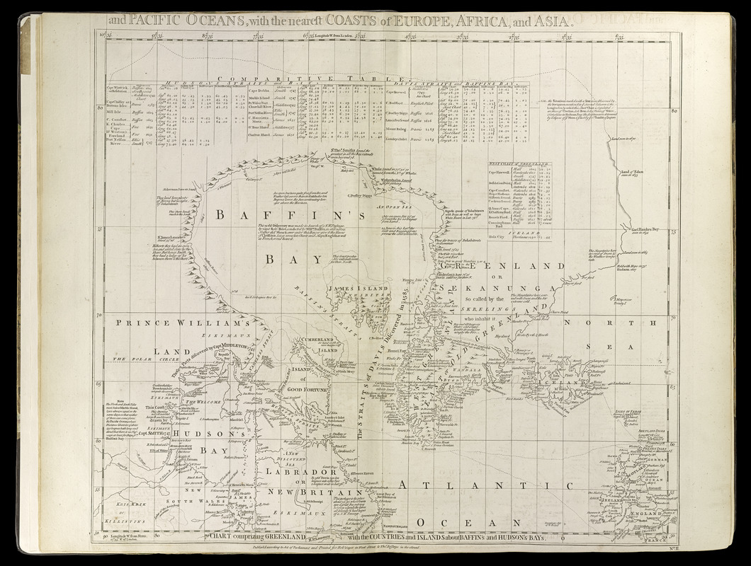
Chart comprizing Greenland with the countries and islands about Baffin's and Hudson's Bays
Item Information
- Title:
- Chart comprizing Greenland with the countries and islands about Baffin's and Hudson's Bays
- Title (alt.):
-
A chart of North and South America, including the Atlantic and Pacific Oceans, with the nearest coasts of Europe, Africa and Asia
- Cartographer:
- Green, John, -1757
- Publisher:
- Jefferys, Thomas, -1771
- Publisher:
- Sayer, Robert, 1725-1794
- Date:
-
[1768?]
- Format:
-
Maps/Atlases
- Location:
-
Boston Public Library
Norman B. Leventhal Map & Education Center - Collection (local):
-
Norman B. Leventhal Map & Education Center Collection
- Subjects:
-
America--Discovery and Exploration--Maps--Early works to 1800
Baffin Bay--Maps--Early works to 1800
Greenland--Maps--Early works to 1800
North Atlantic Ocean--Maps--Early works to 1800
- Places:
-
Greenland (territory)
Baffin Bay
Atlantic Ocean
- Extent:
- 1 map ; 52 x 61 cm
- Terms of Use:
-
No known copyright restrictions.
No known restrictions on use.
- Publisher:
-
[London] :
Printed for Robert Sayer in Fleet Street and Thomas Jefferys in the Strand
- Scale:
-
Scale approximately 1:10,000,000
- Language:
-
English
- Notes:
-
Appears in Thomas Jefferys' A general topography of North America and the West Indies. London: Printed for Robert Sayer, 1768.
Prime meridians: London and Ferro.
Relief shown pictorially.
Shows nautical exploration routes.
Includes text, historical and geographical notes, and tables of comparative astronomical observations.
- Identifier:
-
4000137_0009
- Call #:
-
G1105 .J4 1768
- Barcode:
-
30000003761123