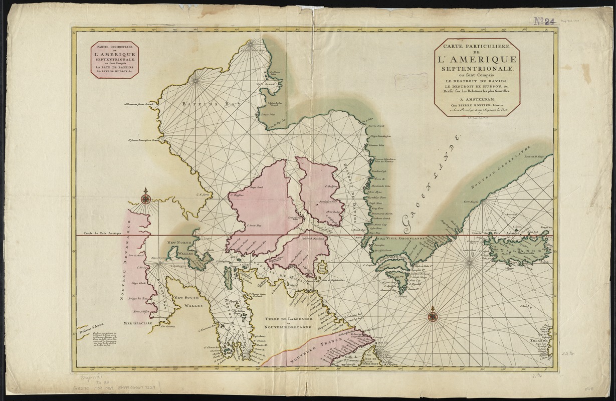
Carte particuliere de l'Amerique septentrionale ou sont compris le Destroit de Davids, le Destroit de Hudson, &c
Item Information
- Title:
- Carte particuliere de l'Amerique septentrionale ou sont compris le Destroit de Davids, le Destroit de Hudson, &c
- Title on left half :
- Partie occidentale de l'Amerique septentrionale : ou sont compris la Baye de Baffins, la Baye de Hudson, &c
- Creator:
- Mortier, Pierre.
- Name on Item:
-
dressé sur les relations les plus nouvelles.
- Date:
-
[1708]
- Format:
-
Maps/Atlases
- Location:
-
Boston Public Library
Norman B. Leventhal Map & Education Center - Collection (local):
-
Norman B. Leventhal Map & Education Center Collection
- Subjects:
-
Arctic regions--Maps--Early works to 1800
Canada, Eastern--Maps--Early works to 1800
Canada, Northern--Maps--Early works to 1800
Greenland--Maps--Early works to 1800
- Places:
-
Arctic (area)
Greenland (territory)
Canada
- Extent:
- 1 map : hand col. ; 57 x 82 cm.
- Terms of Use:
-
No known copyright restrictions.
No known restrictions on use.
- Publisher:
-
À Amsterdam :
Chez Pierre Mortier, Libraire
- Scale:
-
Scale [ca. 1:6,650,000]
- Language:
-
French
- Notes:
-
Shows Greenland, Iceland, and the eastern part of Canada.
Prime meridian: Ferro.
"Avec privilege de nos Seigneurs les Etats"."
Appears in Mortier's Atlas nouveau.
- Notes (date):
-
This date is inferred.
- Identifier:
-
06_01_010765
- Call #:
-
G3270 1708 .M67
- Barcode:
-
39999065677229