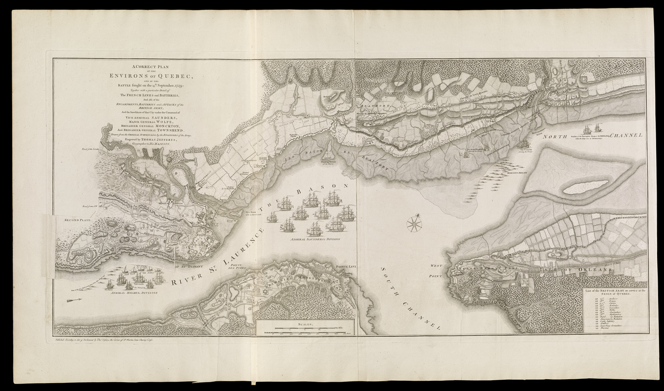
A correct plan of the environs of Quebec, and of the battle fought on the 13th September, 1759 : together with a particular detail of the French lines and batteries, and also of the encampments, batteries and attacks of the British army, and the investiture of that city under the command of Vice Admiral Saunders, Major General Wolfe, Brigadier General Monckton, and Brigadier General Townshend ; drawn from the original surveys taken by the engineers of the army

This map is also available in American Revolutionary Geographies Online (ARGO), a collections portal especially built for material relating to the American Revolutionary War Era. Visit ARGO to learn more about this item and explore the historical geography of North America in the late eighteenth century.
Item Information
- Title:
- A correct plan of the environs of Quebec, and of the battle fought on the 13th September, 1759 : together with a particular detail of the French lines and batteries, and also of the encampments, batteries and attacks of the British army, and the investiture of that city under the command of Vice Admiral Saunders, Major General Wolfe, Brigadier General Monckton, and Brigadier General Townshend ; drawn from the original surveys taken by the engineers of the army
- Cartographer:
- Jefferys, Thomas, -1771
- Date:
-
[1768]
- Format:
-
Maps/Atlases
- Location:
-
Boston Public Library
Norman B. Leventhal Map & Education Center - Collection (local):
-
Norman B. Leventhal Map & Education Center Collection
- Subjects:
-
Québec Campaign, Québec, 1759--Maps--Early works to 1800
Québec (Québec)--Maps--Early works to 1800
United States--History--French and Indian War, 1754-1763--Maps--Early works to 1800
- Places:
-
CanadaQuebec (province)Québec
- Extent:
- 1 map ; 41 x 89 cm.
- Terms of Use:
-
No known copyright restrictions.
No known restrictions on use.
- Publisher:
-
[London] :
Thos. Jefferys, the corner of St. Martins Lane Charing Cross
- Scale:
-
Scale [ca. 1:18,200]
- Language:
-
English
- Notes:
-
Shows details of British and French positions during the siege of Québec. References identifies British military units.
Oriented with north to the upper right.
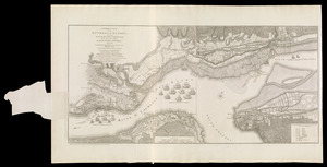
Overlay, titled second plate, provides details of changed position of British troops at the battle of September 13, 1759.
Appears in Jefferys' General topography of North America and the West Indies. London: Printed for Robert Sayer, ... and Thomas Jefferys, 1768.
- Notes (date):
-
This date is inferred.
- Notes (citation):
-
Kershaw, K. Early printed maps of Canada, vol. 4, no. 1015
Phillips, 1196
- Identifier:
-
4000137_0029
4000137_0030
- Call #:
-
G1105 .J4 1768
- Barcode:
-
30000003253858


