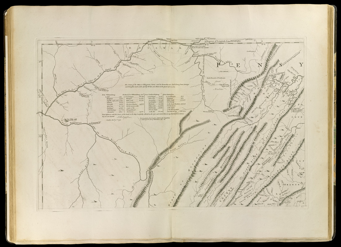
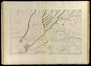
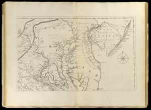
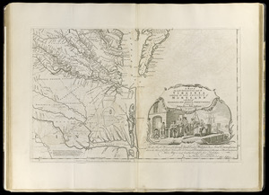
A map of the most inhabited part of Virginia containing the whole province of Maryland with part of Pensilvania, New Jersey and North Carolina

This map is also available in American Revolutionary Geographies Online (ARGO), a collections portal especially built for material relating to the American Revolutionary War Era. Visit ARGO to learn more about this item and explore the historical geography of North America in the late eighteenth century.
Item Information
- Title:
- A map of the most inhabited part of Virginia containing the whole province of Maryland with part of Pensilvania, New Jersey and North Carolina
- Cartographer:
- Fry, Joshua, approximately 1700-1754
- Cartographer:
- Jefferson, Peter, 1708-1757
- Publisher:
- Sayer, Robert, 1725-1794
- Publisher:
- Jefferys, Thomas, -1771
- Name on Item:
-
drawn by Joshua Fry & Peter Jefferson in 1751
- Date:
-
[1768]
- Format:
-
Maps/Atlases
- Location:
-
Boston Public Library
Norman B. Leventhal Map & Education Center - Collection (local):
-
Norman B. Leventhal Map & Education Center Collection
- Subjects:
-
Indians of North America--Middle Atlantic States--Maps--Early works to 1800
Virginia--Maps--Early works to 1800
Maryland--Maps--Early works to 1800
Middle Atlantic States--Maps--Early works to 1800
- Places:
-
Virginia
Maryland
Middle Atlantic (area)
- Extent:
- 1 map on 4 sheets ; 76 x 123 cm., on sheets 55 x 73 cm.
- Terms of Use:
-
No known copyright restrictions.
No known restrictions on use.
- Publisher:
-
London :
Printed for Robt. Sayer ... & Thos. Jefferys
- Scale:
-
Scale [ca. 1:650,000]
- Language:
-
English
- Notes:
-
Prime meridians: Philadelphia, Curratuck Inlet, and London.
Relief shown pictorially.
"To the Right Honourable, George Dunk Earl of Halifax ... [by] Thos. Jefferys."
Includes notes and distance chart.
Appears in Jefferys' General topography of North America and the West Indies. London: Printed for Robert Sayer, ... and Thomas Jefferys, 1768.
- Notes (date):
-
This date is inferred.
- Notes (citation):
-
LC Maps of North America, 1750-1789, 1429
Stevens & Tree. Comparative cartography, 87e
- Identifier:
-
4000137_0066
4000137_0067
4000137_0068
4000137_0069
- Call #:
-
G1105 .J4 1768
- Barcode:
-
30000002835727


