Toggle navigation
LMEC Home
Exhibitions
Georeferencing
Tools for Teachers
Collections
My Favorites
Sign Up / Log In
Search
Search the map portal
Map Collection
Map Collection
Map Sets
Search
Search
Search for
Search In
All Fields
Creator
Title
Subject
Place
Search All Digital Collections
Advanced Search
337 Results
My Search
Start Over
More Like
commonwealth:z603vv407
Remove constraint More Like: commonwealth:z603vv407
Filter your Search
Place
North and Central America
270
United States
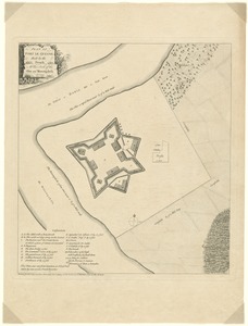
208
Suffolk (county)
72
Boston
70
Massachusetts
38
New York
32
Canada
28
North America
27
more
Place
»
Topic
Boston (Mass.)--Maps--Early works to 1800
46
Boston Harbor (Mass.)--Maps--Early works to 1800
21
Boston (Mass.)--History--Revolution, 1775-1783--Maps--Early works to 1800
19
North America--Maps--Early works to 1800
18
New England--Maps--Early works to 1800
11
United States--History--Revolution, 1775-1783--Maps--Early works to 1800
11
Vues d'optique
10
Fortification--Massachusetts--Boston--Maps--Early works to 1800
9
more
Topic
»
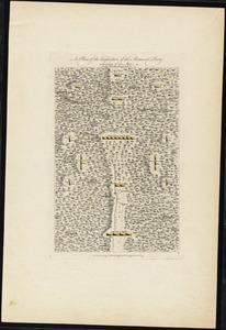
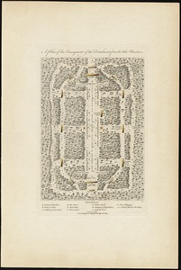
Date
Date range begin
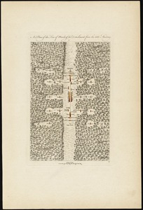
–
Date range end
Current results range from
1694
to
1879
View distribution
Creator
Faden, William, 1749-1836
33
Jefferys, Thomas, -1771
30
Le Rouge, Georges-Louis
24
Des Barres, Joseph F. W. (Joseph Frederick Wallet), 1722-1824
22
Sayer, Robert, 1725-1794
19
Korn, Christoph Heinrich, 1726-1783
11
Raspe, Gabriel Nicolaus, 1712-1785
11
Simcoe, John Graves, 1752-1806
10
more
Creator
»
Format
Maps/Atlases
294
Prints
32
Manuscripts
25
Drawings/Illustrations
9
Books
2
Georeferenced
Yes
18
No
319
Collection
American Revolutionary War-Era Maps
327
Richard H. Brown Revolutionary War Map Collection at Mount Vernon
293
Boston and New England Maps
41
Norman B. Leventhal Map & Education Center Collection
38
Urban Maps
25
Mapping Boston Collection
8
Maritime Charts and Atlases
6
Library of Congress Collection
3
more
Collection
»
Available to use
Creative Commons license
305
No known restrictions
32
Search Constraints
Sort by date (asc)
relevance
title
date (asc)
date (desc)
Number of results to display per page
100 per page
10
per page
20
per page
50
per page
100
per page
View results as:
grid view
map view
Search Results
1.
A draught of Boston Harbor by Capt. Cyprian Southake
2.
The town of Boston in New England
3.
A New Plan of ye Great Town of BOSTON in New England in AMERICA with the many Additionall Buildings & New Streets to the Year,...
4.
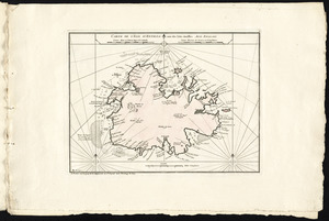
Carte de l'isle d'Antigoa une de Isles Antilles
5.
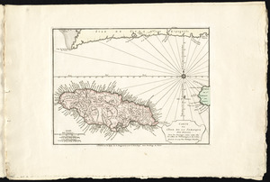
Carte de l'isle de la Jamaique
6.
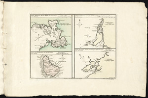
Port, baye cul de sac Royal dans la Martinique -- Isle des Barbades une des Isles Antilles -- Cartagene située sur le Côte de...
7.
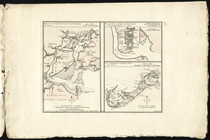
Port de St. Augustin -- Port de la Providence -- La Havane dans l'isle de Cuba -- Baye de Sn. Iago dans l'isle de Cuba -- Port...
8.
Ports de la Nouvelle York et de Pertamboy -- Plan de la ville et du port de Charles Town dans la Caroline Méridionale -- I. de...
9.
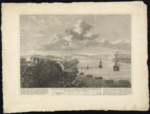
Rade et port de Plaisance -- Le Port d'Anapolis dans l'Acadie -- Port de Boston dans la Nouvlle. Angleterre
10.
A new plan of ye great town of Boston in New England in America, with the many additionall buildings & new streets to the year...
11.
Carte d'une partie du Nord Amerique dans la quelle se trouvent les isles et les provinces suivantes : l'Isle de la Terre-Neuve...
12.
Particular draughts and plans of some of the principal towns and harbours belonging to the English, French, and Spaniards, in...
13.
To the rt. honble. the Earl of Halifax, first lord commissioner of trade & plantations, &c &c this chart of Chibucto Harbour,...
14.
Chart comprizing Greenland with the countries and islands about Baffin's and Hudson's Bays
15.
Chart containing the coasts of California, New Albion, and Russian discoveries to the north : with the peninsula of Kamchatka,...
16.
Chart containing the greater part of the South Sea to the south of the line, with islands dispersed thro' the same
17.
A chart of North and South America, including the Atlantic and Pacific Oceans, with the nearest coasts of Europe, Africa and Asia
18.
Chart of South America, comprehending the West Indies, with the adjacent islands, in the Southern Ocean, and South Sea
19.
Chart of the Atlantic Ocean, with the British, French, & Spanish settlements in North America, and the West Indies : as also on...
20.
Map of the western parts of the colony of Virginia, as far as the Mississipi
21.
A general map of the middle British colonies, in America : viz Virginia, Màriland, Dèlaware, Pensilvania, New-Jersey,...
22.
L'isthme de l'Acadie, Baye du Beaubassin, en Anglois Shegnekto, environs du Fort Beausejour
23.
A large and particular plan of Shegnekto Bay, and the circumjacent country, with the forts and settlements of the French 'till...
24.
A map of the British and French dominions in North America with the roads, distances, limits, and extent of the settlements,...
25.
A new and accurate map of the English empire in North America : representing their rightful claim as confirmed by charters, and...
26.
North America from the French of Mr. D'Anville, improved with the back settlements of Virginia and course of Ohio, illustrated...
27.
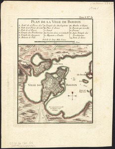
Plan de Boston
28.
Plan de Boston
29.
Theatrum belli in America Septentrionali
30.
Amérique septentrionale avec les routes, distances en miles, limites et etablissements françois et anglois
31.
Baye et port de Boston
32.
A map of South Carolina and a part of Georgia : containing the whole sea-coast; all the islands, inlets, rivers, creeks,...
33.
Plan de la ville de Boston et ses environs
34.
Carte topographique du port et de la ville de Louisbourg, assiegé par les Anglais pendant les mois de Juin, Juillet 1758
35.
[Ein grund-riss von der Festung Duquessne wie sie ausgesehen hat, ehe sie die Frankosen zerstoren aben, und zum theil noch...
36.
Grundriss von der Stadt Boston und ihren Gegenden
37.
Grundriss von der stadt Boston und ihren gegenden
38.
Plan de la ville de Louisbourg avec les ouvrages d'attaque des Anglais pour sa reddition, ainsi que ceux des assiegés pr. la...
39.
Plan du port et de la ville de Louisbourg en l'Isle Royale, et des attaques faites par les Anglois pendant le siége dépuis le...
40.
Lauff des flusses St. Laurentzi von Quebec bis an den See Ontario : 2. bladt
41.
[Map of Florida, Carolina, and the Gulf Coast]
42.
[Map of the Allegheny and Ohio Rivers] ; Franzosische see kusten von Provence zwischen Marseille und Toulon = : Cotes maritimes...
43.
Plan der gegend des Ohio Flusses, wo ohnweit da von am 9 July 1755, zwischen denen Franzofichen u. Engl trouppen ein hiziges...
44.
Plan des jenigen treffen welches am 8. Sept 1755. zwischen dem Engl. Gen. Johnson, und dem Franz. Gen. Diesckau welcher dabey...
45.
Plan du fort et ville de Louisbourg dans l'Isle Roale
46.
A view of the landing place above the town of Quebec, describing the assault of the enemys post, on the banks of the River St....
47.
An accurate map of His Majesty's province of New-Hampshire in New England : taken from actual surveys of all the inhabited...
48.
Karte von dem Ostlichen-Stucke von Neu Franckreich oder Canada in America : besonders aber Acadia und Neu Schottland
49.
A general map of North America : in which is express'd the several new roads, forts, engagements, &c, taken from actual surveys...
50.
A map of the most inhabited part of New England : containing the provinces of Massachusets Bay and New Hampshire, with the...
51.
A map of the most inhabited part of New England : containing the provinces of Massachusets Bay and New Hampshire, with the...
52.
A new map of North America wherein the British Dominions in the continent of North America : and on the islands of the West...
53.
A south east view of the city of New York, in North America = Vue de sud est de la ville de New York, dans l'Amerique...
54.
A south west view of the city of New York, in North America = Vue de sud ouest de la ville de New York, dans l'Amerique...
55.
Theodolite's pattern, shewing the provinces in North America which were in the respective possessions of England, France &...
56.
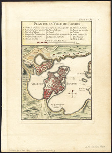
Plan de la ville de Boston
57.
Plan de la ville de Boston
58.
Plan de la ville de Boston
59.
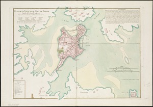
Plan de la ville et du port de Boston : capitale de la Nouvelle Angleterre
60.
Plan de la ville et du port de Boston : capitale de la Nouvelle Angleterre : erigée prémierement en 1630, et en 1735 elle fut...
61.
Plan de la ville et du port de Boston : capitale de la Nouvelle Angleterre
62.
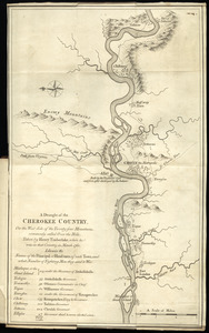
A draught of the Cherokee Country : on the west side of the Twenty Four Mountains, commonly called Over the Hills
63.
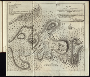
Plan of the battle near Bushy-Run gained by His Majesty's troops commanded by Colonel Henry Bouquet over the Delawares,...
64.
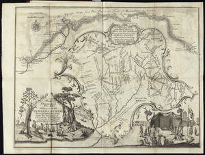
A topographical plan of that part of the Indian-country through which Colonel Bouquet marched in the year, 1764
65.
To the right honourable, the Earl of Shelbourne, His Majesty's principal Secretary of State for the Southern Department : this...
66.
Map of Nova Scotia, or Acadia : with the islands of Cape Breton and St. John's, from actual surveys
67.
A map of the country between Will's Creek & Monongahela River shewing the rout and encampments of the English army in 1755
68.
A map of the most inhabited part of Virginia containing the whole province of Maryland with part of Pensilvania, New Jersey and...
69.
A new map of Nova Scotia, and Cape Britain : with the adjacent parts of New England and Canada, composed from a great number of...
70.
Plan of Fort le Quesne, built by the French at the fork of the Ohio and Monongahela in 1754
71.
A plan of the disposition of the advanced party consisting of 400 men : to defend the workers in making the road
72.
A plan of the encampment of the detachment from the little Meadows
73.
A plan of the field of battle and disposition of the troops, as they were on the march at the time of the attack on the 9th of...
74.
A plan of the line of march of the detachment from the little Meadows
75.
A plan of the line of march with the whole baggage
76.
A prospective view of the battle fought near Lake George, on the 8th of Sepr. 1755, between 2000 English, with 250 Mohawks,...
77.
A view of Miramichi, a French settlement in the Gulf of St. Laurence, destroyed by Brigadier Murray detached by General Wolfe...
78.
A view of the city of Quebec, the capital of Canada, taken partly from the Pointe des Peres, and partly on board the Vanguard...
79.
A new plan of ye great town of Boston in New England in America, with the many additionall [sic] buildings, & new streets, to...
80.
To His Excellency Sr. Henry Moore, Bart., captain general and governour in chief in & over the province of New York & the...
81.
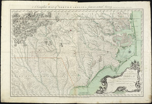
A compleat map of North-Carolina from an actual survey
82.
[A map of part of Pennsylvania & Maryland intended to shew, at one view, the several places proposed for opening a...
83.
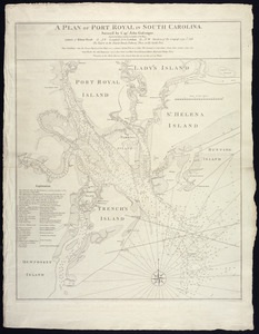
A plan of Port Royal in South Carolina
84.
A chart of the coast of New England, from Beverly to Scituate harbour, including the ports of Boston and Salem
85.
A map of the most inhabited part of New England : containing the provinces of Massachusets Bay and New Hampshire, with the...
86.
A new and accurate plan of the town of Boston in New England : A new plan of Boston Harbor from an actual survey
87.
[Boston Neck, with the British lines and John Hancock's house]
88.
[Cambridge with Washington's headquarters]
89.
[Charlestown Promontory, the ruins of the town after the Battle of Bunker Hill and General Howe's encampment]
90.
A chart of the harbour of Boston
91.
A chart of the harbour of Boston
92.
A chart of the harbour of Boston
93.
[Dorchester Neck]
94.
Exact plan of General Gage's lines on Boston Neck in America
95.
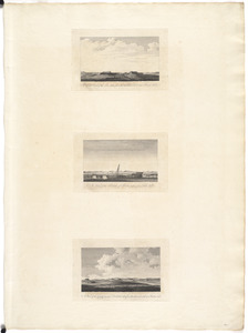
A front view of the lines taken from the advanced post near Browns house : A view of the harbour of Boston taken from Fort Hill...
96.
A map of 100 miles round Boston
97.
[Map of Boston]
98.
A Map of forty miles north, thirty miles west, and twentyfive miles south of Boston : including an accurate draft of the...
99.
Map of the environs of Boston
100.
A new and correct plan of the town of Boston
‹ Prev
Next ›
1
2
3
4


![[Ein grund-riss von der Festung Duquessne wie sie ausgesehen hat, ehe sie die Frankosen zerstoren aben, und zum theil noch aussiehet]](https://bpldcassets.blob.core.windows.net/derivatives/images/commonwealth:z603vv49q/image_thumbnail_300.jpg)


![[Map of Florida, Carolina, and the Gulf Coast]](https://bpldcassets.blob.core.windows.net/derivatives/images/commonwealth:z603vr379/image_thumbnail_300.jpg)
![[Map of the Allegheny and Ohio Rivers] ; Franzosische see kusten von Provence zwischen Marseille und Toulon =](https://bpldcassets.blob.core.windows.net/derivatives/images/commonwealth:z603vr31n/image_thumbnail_300.jpg)


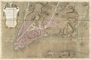
![A new plan of ye great town of Boston in New England in America, with the many additionall [sic] buildings, & new streets, to the year, 1769](https://bpldcassets.blob.core.windows.net/derivatives/images/commonwealth:3f462v50z/image_thumbnail_300.jpg)
![[A map of part of Pennsylvania & Maryland intended to shew, at one view, the several places proposed for opening a communication between the waters of the Delaware & Chesopeak Bays]](https://bpldcassets.blob.core.windows.net/derivatives/images/commonwealth:z603vt12v/image_thumbnail_300.jpg)


![[Boston Neck, with the British lines and John Hancock's house]](https://bpldcassets.blob.core.windows.net/derivatives/images/commonwealth:dz010v61c/image_thumbnail_300.jpg)
![[Cambridge with Washington's headquarters]](https://bpldcassets.blob.core.windows.net/derivatives/images/commonwealth:dz010v63x/image_thumbnail_300.jpg)
![[Charlestown Promontory, the ruins of the town after the Battle of Bunker Hill and General Howe's encampment]](https://bpldcassets.blob.core.windows.net/derivatives/images/commonwealth:dz010v65g/image_thumbnail_300.jpg)


![[Dorchester Neck]](https://bpldcassets.blob.core.windows.net/derivatives/images/commonwealth:dz010v59b/image_thumbnail_300.jpg)


![[Map of Boston]](https://bpldcassets.blob.core.windows.net/derivatives/images/commonwealth:z603vw17n/image_thumbnail_300.jpg)


