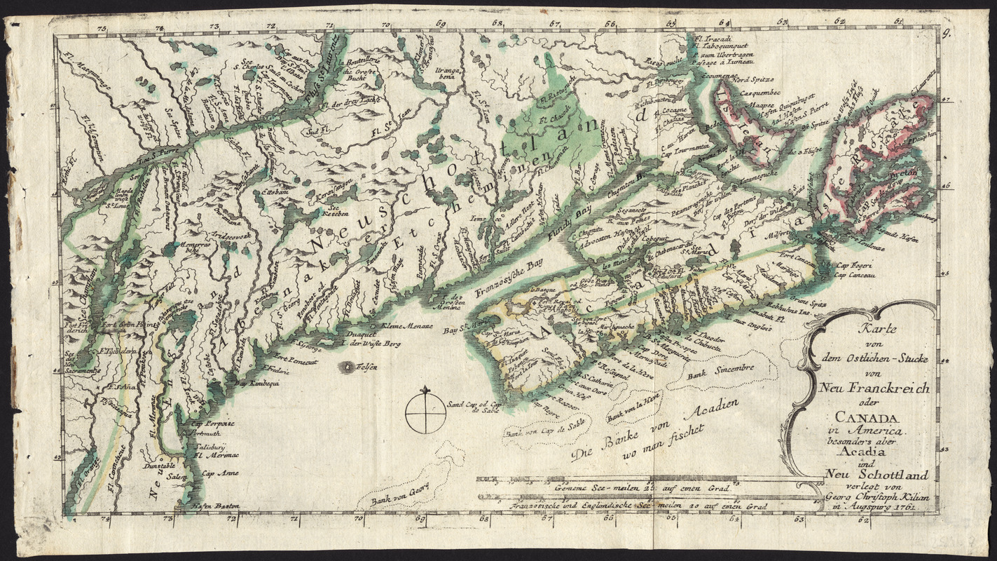
Karte von dem Ostlichen-Stucke von Neu Franckreich oder Canada in America : besonders aber Acadia und Neu Schottland
This map is also available in American Revolutionary Geographies Online (ARGO), a collections portal especially built for material relating to the American Revolutionary War Era. Visit ARGO to learn more about this item and explore the historical geography of North America in the late eighteenth century.
Item Information
- Title:
- Karte von dem Ostlichen-Stucke von Neu Franckreich oder Canada in America : besonders aber Acadia und Neu Schottland
- Creator:
- Kilian, Georg Christoph, 1709-1781
- Name on Item:
-
verlegt von Georg Christoph Kilian.
- Date:
-
1761
- Format:
-
Maps/Atlases
- Location:
- George Washington's Mount Vernon
- Collection (local):
-
Richard H. Brown Revolutionary War Map Collection at Mount Vernon
- Subjects:
-
Acadia--Maps--Early works to 1800
Maritime Provinces--Maps--Early works to 1800
New England--Maps--Early works to 1800
Québec (Province)--Maps--Early works to 1800
- Places:
-
New England (area)
CanadaNova Scotia (province)
- Extent:
- 1 map : hand col. ; 18 x 32 cm.
- Terms of Use:
-
No known copyright restrictions.
This work is licensed for use under a Creative Commons Attribution Non-Commercial Share Alike License (CC BY-NC-SA).

- Publisher:
-
Augspurg :
[Christian Friedrich von der Heiden]
- Scale:
-
Scale [ca. 1:1,200,000]
- Language:
-
German
- Catalog Record:
-
MVLA record
- Notes:
-
Relief shown pictorially.
From von der Heiden's Americanische urquelle.
In upper right: 9.
In German.
- Identifier:
-
06_01_009538


