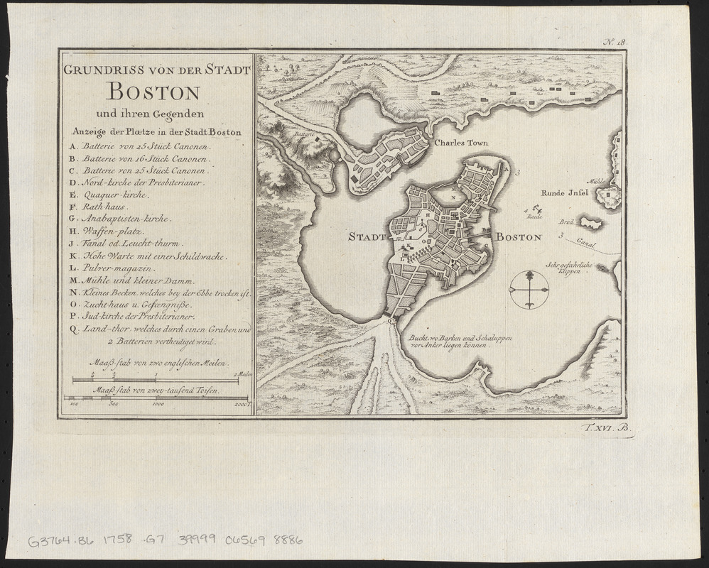
Grundriss von der stadt Boston und ihren gegenden
This map is also available in American Revolutionary Geographies Online (ARGO), a collections portal especially built for material relating to the American Revolutionary War Era. Visit ARGO to learn more about this item and explore the historical geography of North America in the late eighteenth century.
Item Information
- Title:
- Grundriss von der stadt Boston und ihren gegenden
- Date:
-
[1758]
- Format:
-
Maps/Atlases
- Location:
-
Boston Public Library
Norman B. Leventhal Map & Education Center - Collection (local):
-
Norman B. Leventhal Map & Education Center Collection
- Subjects:
-
Boston (Mass.)--Maps--Early works to 1800
- Places:
-
MassachusettsSuffolk (county)Boston
- Extent:
- 1 map ; 16 x 25 cm
- Terms of Use:
-
No known copyright restrictions.
No known restrictions on use.
- Publisher:
-
[Leipzig] :
[Arkstee & Merkus]
- Scale:
-
Scale approximately 1:44,500
- Language:
-
German
- Notes:
-
Relief shown by hachures.
Plate "No. 18."
"T. XVI. B."
From Allgemeine Historie der Reisen zu Wasser und Lande. 1758.
Indexed.
- Notes (date):
-
This date is inferred.
- Notes (citation):
-
LC Maps of North America, 1750-1789, 884
Boston Engineering Department. List of map of Boston, page 20
- Identifier:
-
06_01_012683
- Call #:
-
G3764.B6 1758 .G7
- Barcode:
-
39999065698886


